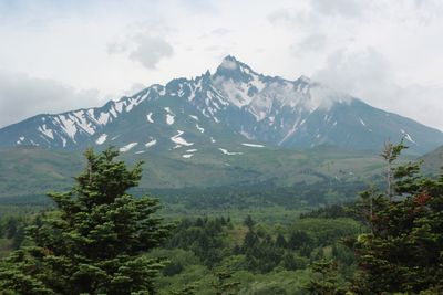
Mount Rishiri, Stratovolcano on Rishiri Island, Japan
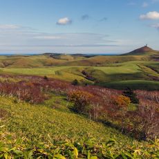
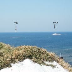
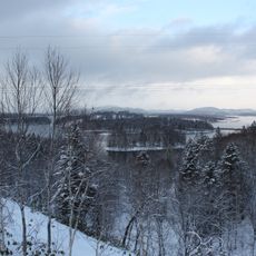
Mount Rishiri is a stratovolcano that rises 1721 meters directly from the waters of the Sea of Japan, creating a near-perfect cone that shapes the entire profile of Rishiri Island. The slopes climb steeply from the coastline to the summit, with rocky terrain and alpine vegetation marking the upper sections.
The volcano formed during the Late Pleistocene around 130,000 years ago, gradually building the island through repeated eruptions. Its last eruption occurred around 5830 BC, and since then it has remained dormant.
The mountain holds special recognition in Japanese geography as part of multiple prestigious lists, including the 100 Famous Japanese Mountains and Hokkaido's 100 Famous Mountains.
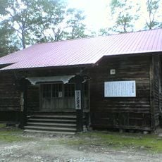
Two main trails reach the summit: the Oshidomari Trail from the north and the Kutsugata Trail from the west, both equipped with emergency shelters along the way. The ascent requires stamina and alpine experience, as the terrain becomes steep and rocky in the upper sections.
The Kanro Spring is the only natural water source along the hiking trails, located just past the Rishiri Hokuroku Campground. Hikers regularly fill their bottles there before beginning the waterless climb to the summit.
Location: Rishiri
Location: Rishirifuji
Elevation above the sea: 1,721 m
Part of: 100 Famous Japanese Mountains, New 100 Famous Japanese Mountains, Hana no Hyaku Meizan, New 100 Famous Flower Mountains, Hokkaidō Hyaku Meizan, Hokkaidō no Hyaku-meizan
GPS coordinates: 45.18043,141.24138
Latest update: December 5, 2025 22:27
Lake Shumarinai
122.7 km
Benten-jima
65.5 km
Moneron Island
119.5 km
Wakkanai Breakwater Dome
43.5 km
Soya Hills
58.2 km
Wakkanai Park
42.7 km
ゴメ島
136.2 km
Hokumon Shrine
42.9 km
Wakkanai Fukkō Ichiba
42.5 km
Wakkanai Noshappu Aquarium
43.5 km
Sōyamisaki Lighthouse
66.3 km
Wakkanai Lighthouse
43.5 km
Lake Ōnuma
46.3 km
Wakkanai Centennial Memorial Tower / Hoppō Memorial Museum
42.2 km
Kōken-ji
123 km
Nayoro City Museum
134.6 km
Nayoro Municipal Observatory Kitasubaru
133 km
Itsukushima-jinja
149.1 km
Hirashima
65.6 km
稚內市役所
42.8 km
North Okhotsk Prefectural Natural Park
88.6 km
Sōya Fureai Park
46.8 km
Soshin-no-matsu
140.7 km
Okhotsk Museum Esashi
107.9 km
Wakkanai Karafuto Museum
42.5 km
Shosanbetsu observatory
80.5 km
Shumarinai Prefectural Natural Park
122.3 km
Mashike Lighthouse
149.3 kmVisited this place? Tap the stars to rate it and share your experience / photos with the community! Try now! You can cancel it anytime.
Discover hidden gems everywhere you go!
From secret cafés to breathtaking viewpoints, skip the crowded tourist spots and find places that match your style. Our app makes it easy with voice search, smart filtering, route optimization, and insider tips from travelers worldwide. Download now for the complete mobile experience.
A unique approach to discovering new places❞
— Le Figaro
All the places worth exploring❞
— France Info
A tailor-made excursion in just a few clicks❞
— 20 Minutes