Defence Line of Amsterdam
Defence Line of Amsterdam, Military fortification system in North Holland, Netherlands.
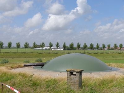
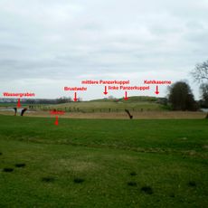
The Defence Line of Amsterdam is a network of military structures and water barriers designed to encircle the Dutch capital in a protective ring. The system integrates numerous fortified positions with dikes and water control mechanisms spread across the surrounding landscape.
The system was built in the late 1800s and early 1900s as a military response to changing warfare tactics. Its construction marked a significant shift in how countries approached the defense of large urban areas.
The fortification ring reflects how the Dutch have historically used water as both weapon and shield. Visitors can see this philosophy embodied in the landscape itself, where nature and human design work as one defensive system.
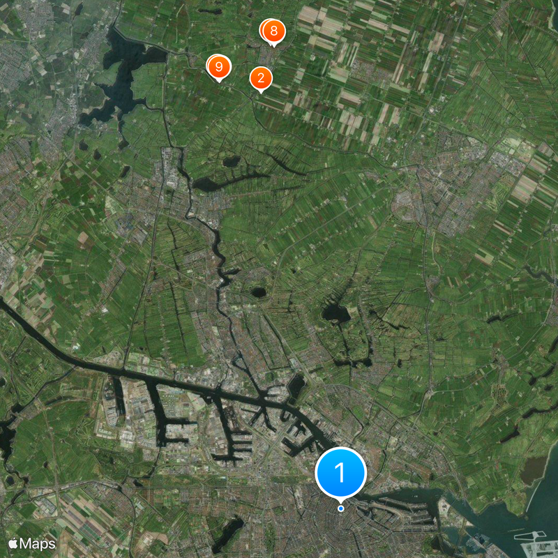
Several forts along the line now operate as museums, galleries, or cafes that welcome visitors. The best way to experience the entire system is by bicycle or on foot, as the landscape is relatively flat and accessible.
The system's defense relied on flooding the terrain to exact water depths that made passage impossible for boats and soldiers. This approach was innovative because it turned the Dutch landscape itself into an impenetrable barrier.
Location: North Holland
Location: Utrecht
Part of: Dutch Water Defence Lines
Website: http://stelling-amsterdam.nl
GPS coordinates: 52.37444,4.89306
Latest update: December 7, 2025 10:02
Fort Spijkerboor
18.8 km
Hervormde Kerk, Oost-Graftdijk
19.7 km
Doopsgezinde vermaning
19.8 km
Grote Dam 5, De Rijp
20.8 km
Jan Boonplein 4, De Rijp
20.7 km
Kerkstraat 26, De Rijp
20.9 km
Grote Dam 3, De Rijp
20.8 km
Hooihuis
19.7 km
Langebrugspad 4, De Rijp
20.9 km
Kerkstraat 11, De Rijp
20.8 km
Kerkstraat 28, De Rijp
20.9 km
Volgerweg 1, Middenbeemster
19 km
Kerkstraat 24, De Rijp
20.8 km
Woonhuis behorend tot het hooihuisboerderij-complex
19.7 km
Schuur
19.7 km
Het Heerenhuis, polderhuis van de Starnmeer en Kamerhop. Tegen de dijk gebouwd rechthoekig huis met schilddak, tevens uitspanning
18.8 km
Kerkstraat 12, De Rijp
20.8 km
Huis met gepleisterde voorgevel en fraaie achtertopgevel boven een gepleisterde onderbouw
20.8 km
Kerkstraat 1, De Rijp
20.8 km
Venbuurt 7, De Rijp
20.8 km
Vlaander 8, De Rijp
20.8 km
Zuideinde 3, De Rijp
20.7 km
Houten woonhuis onder met pannen gedekt zadeldak
20.7 km
Grote Dam 4, De Rijp
20.8 km
Grote Dam 7, De Rijp
20.8 km
Jan Boonplein 8, De Rijp
20.7 km
Jan Boonplein 2, De Rijp
20.8 km
Jan Boonplein 1, De Rijp
20.8 kmVisited this place? Tap the stars to rate it and share your experience / photos with the community! Try now! You can cancel it anytime.
Discover hidden gems everywhere you go!
From secret cafés to breathtaking viewpoints, skip the crowded tourist spots and find places that match your style. Our app makes it easy with voice search, smart filtering, route optimization, and insider tips from travelers worldwide. Download now for the complete mobile experience.
A unique approach to discovering new places❞
— Le Figaro
All the places worth exploring❞
— France Info
A tailor-made excursion in just a few clicks❞
— 20 Minutes