Enable Location

We need your location to show you interesting places around you

Discover nearby places

Find interesting locations and hidden gems around you

Precise directions

Get accurate directions and distances to places

Your location is never shared with other users. It's only used when you tap the location button.

Log in to your account

Start exploring — it's free

Trusted by 62,331 travelers worldwide

Continue with Google
Continue with Apple
or

We will send you a code to connect

By continuing, you accept our Terms and Conditions and our Privacy Policy

Check your inbox

We've sent a pincode in your inbox. Please enter the code below.

Witterveld, protected area in Kingdom of the Netherlands

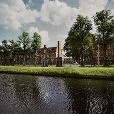
Witterveld is a protected nature reserve southwest of Assen covering about 500 hectares, featuring wetland heathlands, raised bogs, bog forests, and several small lakes. The landscape displays diverse habitats side by side, ranging from wet peat areas with sphagnum moss to dry heathlands and birch forests on boggy ground.

The area was once part of the vast Smildigervenen that covered northwestern Drenthe before peat extraction and drainage destroyed most of it from the 16th century onward. Witterveld escaped major destruction because military use as a training ground since the late 1800s prevented the large-scale interventions that affected surrounding lands.

The area reflects a landscape that once covered much of northwestern Drenthe before human activity reshaped most of it. Visitors today encounter a patchwork of bog forests, wetlands, and open heathlands that have remained largely untouched by development.

The area is not freely accessible due to its military training use, but a cycling path on the western side offers good views of the various landscape types. The best spot for observation is the strip along the western edge, where you can see the diversity of forest, heathland, and bog areas.

The area supports rare raised bog forest vegetation with natural birch trees that grow only on wet peat and feature a unique understory of sphagnum moss and dwarf shrubs. These specialized bog forests develop naturally only under extreme conditions, making Witterveld an exceptional example of these fragile ecosystems.

The community of curious travelers

AroundUs brings together thousands of curated places, local tips, and hidden gems, enriched daily by 60,000 contributors worldwide.

Start exploring
Inception
2009
GPS coordinates
52.96420,6.50860
Latest update
February 9, 2026 07:45
« Witterveld - protected area in Kingdom of the Netherlands » is provided by Around Us (aroundus.com). Images and texts are derived from Wikimedia project under a Creative Commons license. You are allowed to copy, distribute, and modify copies of this page, under the conditions set by the license, as long as this note is clearly visible.

Discover hidden gems everywhere you go!

From secret cafés to breathtaking viewpoints, skip the crowded tourist spots and find places that match your style. Our app makes it easy with voice search, smart filtering, route optimization, and insider tips from travelers worldwide. Download now for the complete mobile experience.

Around Us App Screenshot

A unique approach to discovering new places

Le Figaro

All the places worth exploring

France Info

A tailor-made excursion in just a few clicks

20 Minutes

Around Us
Travel Guide & Maps
Download

Send to your phone

QR Code
1

Open the camera app on your mobile.

2

Point at the QR code with your camera. A notification will appear.

3

Tap the notification to open the link.