Mandaluyong, Commercial city in Metro Manila, Philippines.
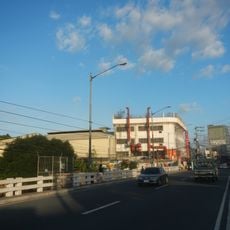
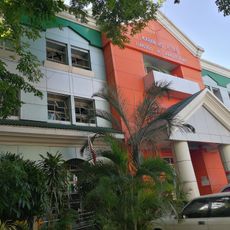
Mandaluyong is a city in central Metro Manila, Philippines, where residential areas sit alongside business districts. The urban area extends across several major roads linking office towers, shopping complexes and densely populated neighborhoods.
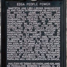
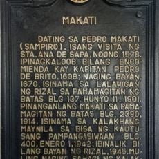
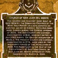
The area emerged from a district of Santa Ana de Sapa and became an independent municipality in the 19th century. Later, during the 1970s, it joined the newly formed Metro Manila region.
The name Mandaluyong comes from a Tagalog word for a tree that once grew in the area. Residents today gather in public parks along main avenues and visit local markets offering fresh produce and street food.
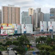
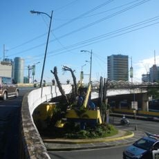
The Ortigas Center area in the eastern section provides access to numerous shopping options and connects well to the public transport network. Walkways between larger complexes are often covered or linked by pedestrian bridges, making movement easier during rain.
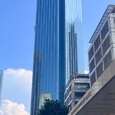
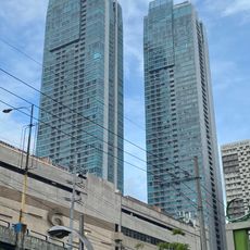
Several large companies have their headquarters here, including international financial institutions and well-known Philippine firms. This concentration of office buildings draws thousands of commuters daily from across the metropolitan area.
Inception: 1841
Elevation above the sea: 32 m
Reference: 1380500000
Shares border with: San Juan, Quezon City, Pasig, Makati, Manila
Website: https://mandaluyong.gov.ph
GPS coordinates: 14.58333,121.03333
Latest update: December 16, 2025 02:35
EDSA Shrine
2.9 kmPeople Power Monument
3.4 km
BDO Corporate Center
2.8 km
Robinsons Cybergate
2.2 km
Skycity
2.9 km
Guadalupe Bridge
2.1 km
Wack Wack Golf and Country Club
2 km
The St. Francis Shangri-La Place
2.5 kmSt. Francis Square
2.7 km
San Juan River Bridge
2.5 km6underground
2.9 km
Makati–Mandaluyong Bridge
1.6 km
Sevilla Bridge
1.4 km
EDSA People Power historical marker
3.4 km
Tomas Earnshaw historical marker
1.6 km
Makati historical marker
1.7 km
Felipe Agoncillo and Marcela Mariño Agoncillo historical marker
1.7 km
San Miguel Brewery Inc. historical marker
2.8 km
National Center for Mental Health historical marker
1 km
José P. Laurel residence historical marker
1.4 kmSummit One Tower
1.4 km
Jose Rizal University historical marker
1.2 km
Kaban ng Hiyas
597 m
Church of San Juan del Monte historical marker
1.7 km
Bridge of San Juan historical marker
2.5 km
Vicente Fabella y Fernandez historical marker
1.2 km
Jose P. Laurel historical marker
2.6 kmWack Wack Golf and Country Club
2.1 kmVisited this place? Tap the stars to rate it and share your experience / photos with the community! Try now! You can cancel it anytime.
Discover hidden gems everywhere you go!
From secret cafés to breathtaking viewpoints, skip the crowded tourist spots and find places that match your style. Our app makes it easy with voice search, smart filtering, route optimization, and insider tips from travelers worldwide. Download now for the complete mobile experience.
A unique approach to discovering new places❞
— Le Figaro
All the places worth exploring❞
— France Info
A tailor-made excursion in just a few clicks❞
— 20 Minutes