
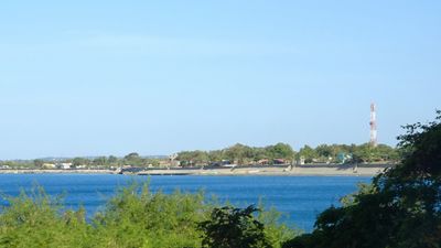
Santa, municipality of the Philippines in the province of Ilocos Sur
Location: Ilocos Sur
Elevation above the sea: 72 m
Shares border with: Vigan, Caoayan, San Quintin
Website: http://lgusanta.org
GPS coordinates: 17.48604,120.43444
Latest update: March 25, 2025 13:17
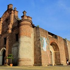
Santa Maria Church
14.3 km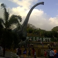
Baluarte Zoo
9.5 km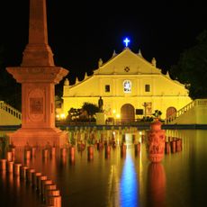
Vigan Cathedral
11 km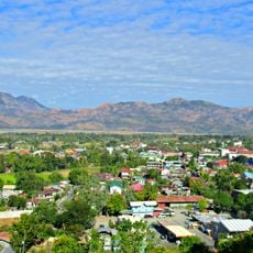
Cassamata Hill National Park
23 km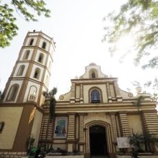
Bangued Cathedral
22.9 km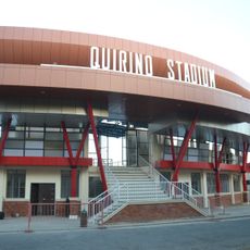
Quirino Stadium
11.2 km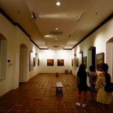
National Museum of the Philippines Ilocos Regional Complex
11.2 km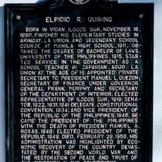
Elpidio R. Quirino historical marker
11.2 km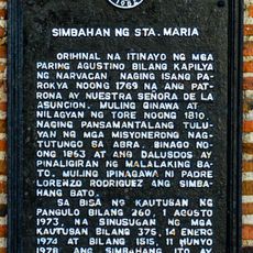
Church of Sta. Maria historical marker
14.2 km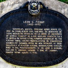
Leon C. Pichay historical marker
11.2 km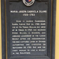
Maria Josefa Gabriela Silang historical marker
11.2 km
Church of Narvacan historical marker
8.7 km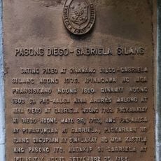
Diego–Gabriela Silang Pass historical marker
2.4 km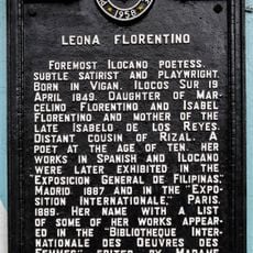
Leona Florentino historical marker
10.9 km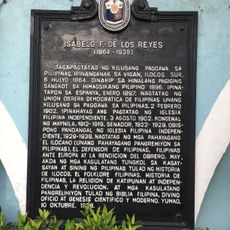
Isabelo F. de los Reyes historical marker
10.9 km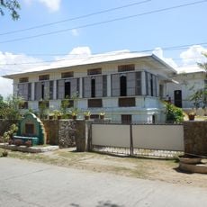
Querubin Ancestral House
8.7 km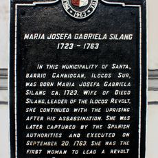
Maria Josefa Gabriela Silang historical marker
27 m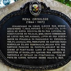
Mena Crisologo historical marker
11.2 km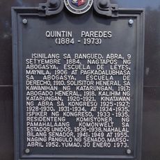
Quintin Paredes historical marker
23.2 km
Site of the Diocese of Nueva Segovia historical marker
11.1 km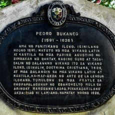
Pedro Bukaneg historical marker
11.2 km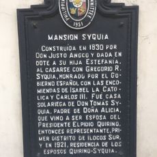
Syquia Mansion historical marker
10.6 km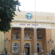
Ilocos Sur Capitol
11.2 km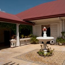
Syquia Mansion
10.6 km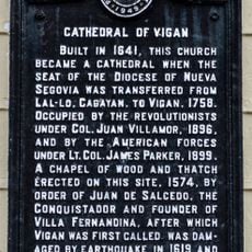
Cathedral of Vigan historical marker
11 km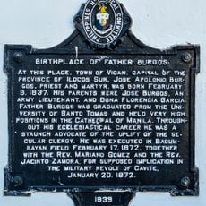
Birthplace of Father Burgos historical marker
11.2 km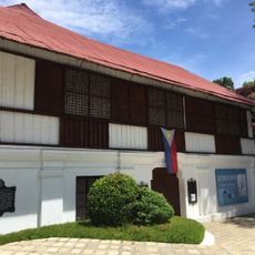
Father Burgos House
11.2 km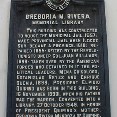
Gregoria M. Rivera Memorial Library historical marker
11.3 kmReviews
Visited this place? Tap the stars to rate it and share your experience / photos with the community! Try now! You can cancel it anytime.
Discover hidden gems everywhere you go!
From secret cafés to breathtaking viewpoints, skip the crowded tourist spots and find places that match your style. Our app makes it easy with voice search, smart filtering, route optimization, and insider tips from travelers worldwide. Download now for the complete mobile experience.

A unique approach to discovering new places❞
— Le Figaro
All the places worth exploring❞
— France Info
A tailor-made excursion in just a few clicks❞
— 20 Minutes