Enable Location

We need your location to show you interesting places around you

Discover nearby places

Find interesting locations and hidden gems around you

Precise directions

Get accurate directions and distances to places

Your location is never shared with other users. It's only used when you tap the location button.

San Carlos

Log in to your account

Start exploring — it's free

Trusted by 62,113 travelers worldwide

Continue with Google
Continue with Apple
or

We will send you a code to connect

By continuing, you accept our Terms and Conditions and our Privacy Policy

Check your inbox

We've sent a pincode in your inbox. Please enter the code below.

San Carlos

San Carlos, Component city in Pangasinan, Philippines.

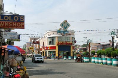
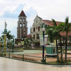
San Carlos is a component city in Pangasinan province in the Ilocos Region, organized into numerous barangays that form its administrative structure. The city functions as a commercial and residential center where neighborhoods, markets, and public facilities serve the local population.

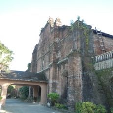
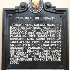
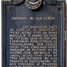
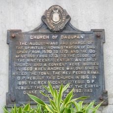
The settlement began as Binalatongan until 1660, when King Charles III of Spain ordered its destruction following local uprisings and renamed it. This turning point marked a rebirth for the community and shaped its later growth.

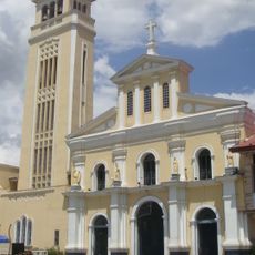
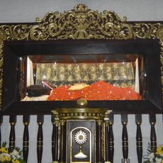
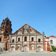
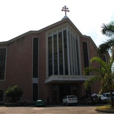
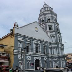
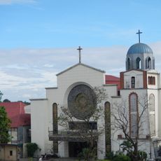
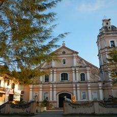
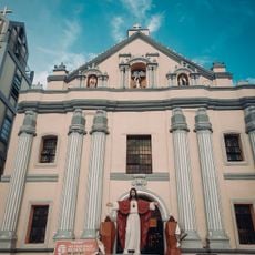
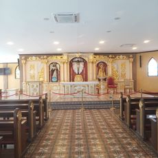
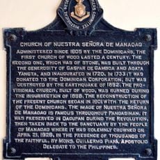
The Minor Basilica of Saint Dominic serves as a gathering place where local Catholics observe their faith through regular ceremonies and community celebrations. The building shapes how people experience their spiritual life and marks important moments in the city's collective calendar.

The city is reachable by regular bus services from Manila, and local transportation like tricycles and jeepneys help you move around the different areas. Using these shared transport options is a practical way to explore the city's neighborhoods.

The city holds the title of Mango-Bamboo Capital of the Philippines, known for its extensive mango orchards and bamboo plantations. This agricultural focus shapes both the local economy and the appearance of the surrounding land.

The community of curious travelers

AroundUs brings together thousands of curated places, local tips, and hidden gems, enriched daily by 60,000 contributors worldwide.

Start exploring
Location
Elevation above the sea
12 m
Shares border with
Binmaley, Urbiztondo
GPS coordinates
15.92806,120.34889
Latest update
December 17, 2025 09:55
Around this place
Manaoag Church
Philippines

Manaoag Church

19.8 km
St. Vincent Ferrer Statue
Philippines

St. Vincent Ferrer Statue

15.8 km
Apung Mamacalulu
Philippines

Apung Mamacalulu

11.1 km
Parish Church of Saints Peter and Paul
Philippines

Parish Church of Saints Peter and Paul

18.9 km
Saint Dominic de Guzman Parish Church
Philippines

Saint Dominic de Guzman Parish Church

275 m
Pangasinan Provincial Capitol
Philippines

Pangasinan Provincial Capitol

17.2 km
Metropolitan Cathedral of St. John the Evangelist
Philippines

Metropolitan Cathedral of St. John the Evangelist

12.8 km
Epiphany of Our Lord Co-Cathedral Parish
Philippines

Epiphany of Our Lord Co-Cathedral Parish

16.4 km
Casa Real
Philippines

Casa Real

16.3 km
Saint Ildephonse of Seville Parish Church
Philippines

Saint Ildephonse of Seville Parish Church

7 km
Our Lady of Lourdes Parish Church
Philippines

Our Lady of Lourdes Parish Church

15 km
Saint Joseph the Patriarch Parish Church
Philippines

Saint Joseph the Patriarch Parish Church

12.6 km
Bayambang Plaza
Philippines

Bayambang Plaza

17.5 km
Daniel Maramba historical marker
Philippines

Daniel Maramba historical marker

9.9 km
Saint Vincent Ferrer Prayer Park
Philippines

Saint Vincent Ferrer Prayer Park

15.7 km
Dagupan City Museum
Philippines

Dagupan City Museum

12.9 km
Ramos House historical marker
Philippines

Ramos House historical marker

16.8 km
City of San Carlos historical marker
Philippines

City of San Carlos historical marker

312 m
Casa Real of Lingayen historical marker
Philippines

Casa Real of Lingayen historical marker

16.3 km
Ramos House historical marker
Philippines

Ramos House historical marker

16.8 km
Church of Nuestra Señora de Manaoag historical marker
Philippines

Church of Nuestra Señora de Manaoag historical marker

19.7 km
Seat of the Revolutionary Government of the Philippines historical marker
Philippines

Seat of the Revolutionary Government of the Philippines historical marker

17.4 km
Church of San Carlos historical marker
Philippines

Church of San Carlos historical marker

298 m
The Launch historical marker
Philippines

The Launch historical marker

17.3 km
Eugenio Perez y Padlan historical marker
Philippines

Eugenio Perez y Padlan historical marker

10.5 km
Lingayen Beach historical marker
Philippines

Lingayen Beach historical marker

17.3 km
Church of Dagupan historical marker
Philippines

Church of Dagupan historical marker

12.8 km
Luzon Landing historical marker
Philippines

Luzon Landing historical marker

16.4 km
Show the full map
« San Carlos - Component city in Pangasinan, Philippines » is provided by Around Us (aroundus.com). Images and texts are derived from Wikimedia project under a Creative Commons license. You are allowed to copy, distribute, and modify copies of this page, under the conditions set by the license, as long as this note is clearly visible.

Discover hidden gems everywhere you go!

From secret cafés to breathtaking viewpoints, skip the crowded tourist spots and find places that match your style. Our app makes it easy with voice search, smart filtering, route optimization, and insider tips from travelers worldwide. Download now for the complete mobile experience.

Around Us App Screenshot

A unique approach to discovering new places

Le Figaro

All the places worth exploring

France Info

A tailor-made excursion in just a few clicks

20 Minutes

Around Us
Travel Guide & Maps
Download

Send to your phone

QR Code
1

Open the camera app on your mobile.

2

Point at the QR code with your camera. A notification will appear.

3

Tap the notification to open the link.