Aguilar, Administrative municipality in Pangasinan, Philippines
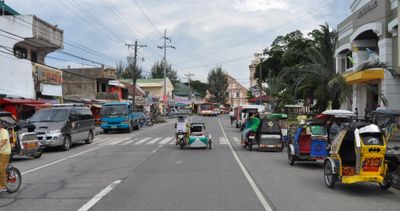
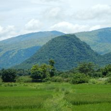
Aguilar is a third-class municipality in Pangasinan, Philippines, comprising 16 barangays across its territory. Agriculture forms the backbone of the local economy, with rice, corn, vegetables, and mango farming dominating the land use.
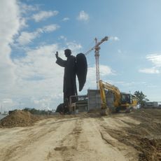
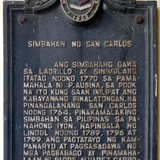
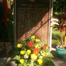
The municipality was established in 1805 by Spanish Governor-General Rafael María de Aguilar, who gave it his name. Before this founding, the area functioned as a cattle ranch called Sitio Balubad within the territory of Binalatongan.
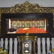
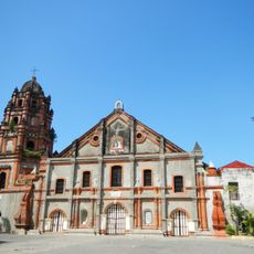
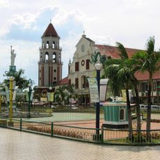
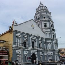
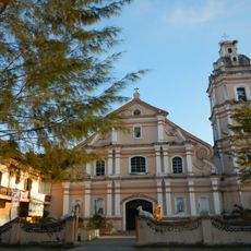
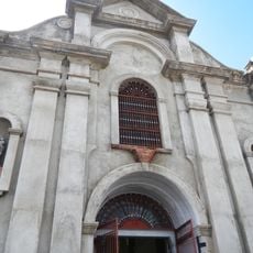
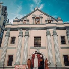
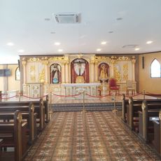
The St. Joseph the Patriarch Church, built in 1810, serves as a gathering place where residents come together for Catholic ceremonies and local celebrations. The structure remains central to the community's religious and social life.
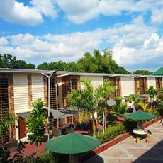
The local government operates under a mayor, vice mayor, and council members who oversee public affairs and services. Visitors should expect a rural setting with agricultural landscapes and basic local infrastructure throughout the area.
The area was originally known as Sitio Balubad, a cattle ranch, before gaining its political independence. This earlier identity remains woven into local stories and the town's sense of where it came from.
GPS coordinates: 15.84893,120.23515
Latest update: December 8, 2025 13:42
St. Vincent Ferrer Statue
22.5 km
Apung Mamacalulu
12.8 km
Parish Church of Saints Peter and Paul
21 km
Saint Dominic de Guzman Parish Church
14.8 km
Pangasinan Provincial Capitol
20.6 km
Manleluag Spring Protected Landscape
17 km
Metropolitan Cathedral of St. John the Evangelist
24 km
Epiphany of Our Lord Co-Cathedral Parish
19.3 km
Casa Real
19 km
Saint Ildephonse of Seville Parish Church
20.6 km
Our Lady of Lourdes Parish Church
14.6 km
Saint Joseph the Patriarch Parish Church
4.4 km
Dagupan Church
24 km
Bayambang Plaza
24.1 km
Daniel Maramba historical marker
24.6 km
Silverconcha Wavepool Resort
18.7 km
Saint Vincent Ferrer Prayer Park
22.5 km
Dagupan City Museum
24.1 km
Ramos House historical marker
20.1 km
Casa Real of Lingayen historical marker
19 km
Ramos House historical marker
20.1 km
City of San Carlos historical marker
14.7 km
The Launch historical marker
20.7 km
Church of San Carlos historical marker
14.7 km
Seat of the Revolutionary Government of the Philippines historical marker
24.1 km
Eugenio Perez y Padlan historical marker
18.7 km
Lingayen Beach historical marker
20.7 km
Church of Dagupan historical marker
24.1 kmVisited this place? Tap the stars to rate it and share your experience / photos with the community! Try now! You can cancel it anytime.
Discover hidden gems everywhere you go!
From secret cafés to breathtaking viewpoints, skip the crowded tourist spots and find places that match your style. Our app makes it easy with voice search, smart filtering, route optimization, and insider tips from travelers worldwide. Download now for the complete mobile experience.
A unique approach to discovering new places❞
— Le Figaro
All the places worth exploring❞
— France Info
A tailor-made excursion in just a few clicks❞
— 20 Minutes