Lian, municipality of the Philippines in the province of Batangas
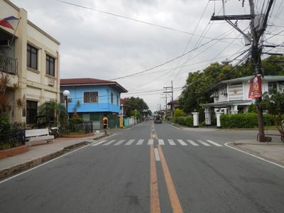
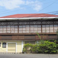
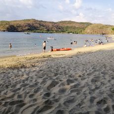
Location: Batangas
Inception: January 31, 1915
Elevation above the sea: 36 m
Shares border with: Calatagan, Tuy
Website: http://lian.gov.ph
GPS coordinates: 14.03333,120.65000
Latest update: March 7, 2025 20:20
Mount Pico de Loro
20.4 km
Fort Frank
26.2 km
Puzzle Mansion
28.4 km
Mount Marami
18.8 km
St. Gregory the Great Parish Church
27.9 km
Kaytitinga Falls
21 km
Aquaria Water Park
26.5 km
Villa Colmenar Natural Spring Resort
27.3 km
Lago de Oro
13.3 km
Paniman Beach
27.6 km
Andres Bonifacio Trial House historical marker
28.4 km
Emiliano Riego de Dios historical marker
28.3 km
Landing at Nasugbu historical marker
5 km
Sixto Castelo Lopez historical marker
13.9 km
Mount Nagpatong historical marker
26.6 km
Bonifacio Shrine and Eco-Tourism Park
26.6 km
The Church of Maragondon historical marker
28.3 km
Clemencia Castelo Lopez historical marker
13.9 km
Layag Layag Beach
17.2 km
Church of Balayan historical marker
13.6 km
Liberators Guerrilla historical marker
28.3 km
Parrot's Beak
20.1 km
Silyang Bato
18.8 km
Galicano C. Apacible historical marker
13.6 km
Where Bonifacio was Court-Martialled historical marker
28.4 km
Jose Rizal historical marker
8.8 km
Castelo–Lopez Ancestral House
13.9 km
Fuego Beach 2
14.1 kmReviews
Visited this place? Tap the stars to rate it and share your experience / photos with the community! Try now! You can cancel it anytime.
Discover hidden gems everywhere you go!
From secret cafés to breathtaking viewpoints, skip the crowded tourist spots and find places that match your style. Our app makes it easy with voice search, smart filtering, route optimization, and insider tips from travelers worldwide. Download now for the complete mobile experience.
A unique approach to discovering new places❞
— Le Figaro
All the places worth exploring❞
— France Info
A tailor-made excursion in just a few clicks❞
— 20 Minutes