General Emilio Aguinaldo, Administrative division in Cavite Province, Philippines.
General Emilio Aguinaldo is a municipality in Cavite that consists of multiple barangays and residential communities situated between the Narvaez and Kaytitinga Rivers. The area features a town hall and covered court as central facilities.
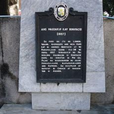
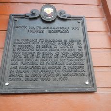
The municipality took its name from General Emilio Aguinaldo, the first president of the Philippines, who led the revolution against Spanish colonial rule. This naming honors a key figure in the nation's struggle for independence.
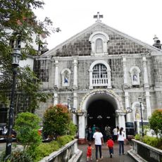
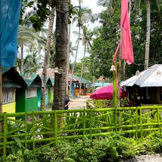
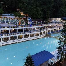
The St. Joseph Church and Rizalto Tala River Park serve as gathering places where residents meet for community events and daily activities. These spaces shape how local people spend their time together.
The Aguinaldo-Alfonso Road provides the main connection to neighboring communities and is the key route through the area. Visitors should plan their time to explore outside peak traffic hours for easier movement.
The area sits at the junction of two rivers that form natural boundaries between settlement clusters scattered throughout the territory. These waterways have shaped how neighborhoods developed in relation to the landscape.
GPS coordinates: 14.18433,120.79640
Latest update: December 7, 2025 19:29
Bonifacio Trial House
11.9 km
Puzzle Mansion
15.1 km
Mount Marami
12 km
St. Gregory the Great Parish Church
5.1 km
Casa Hacienda de Naic
15.6 km
Naic Church
15.5 km
Kaytitinga Falls
9.3 km
Father Modesto de Castro historical marker
15.5 km
Ternate Beach Resort
15 km
Villa Colmenar Natural Spring Resort
6.9 km
Casa Hacienda de Naic historical marker
15.6 km
Andres Bonifacio Trial House historical marker
11.9 km
Emiliano Riego de Dios historical marker
11.8 km
Thirteen Martyrs of Cavite historical marker
13.4 km
Seaside Beach Resort
16 km
Mount Nagpatong historical marker
12.2 km
Bonifacio Shrine and Eco-Tourism Park
12.2 km
The Church of Maragondon historical marker
12.1 km
Severino de las Alas historical marker
8.9 km
Paraiso de June Quixote Ecofarm Resort
10.1 km
Amadeo Municipal Hall
13.7 km
The Capture of Bonifacio historical marker
11.6 km
Bearseum
14.6 km
Site of Imprisonment of Andres Bonifacio historical marker
8.9 km
Town of Amadeo historical marker
13.7 km
Liberators Guerrilla historical marker
12 km
Parish of Saint Mary Magdalene historical marker
13.6 km
Silyang Bato
12 kmVisited this place? Tap the stars to rate it and share your experience / photos with the community! Try now! You can cancel it anytime.
Discover hidden gems everywhere you go!
From secret cafés to breathtaking viewpoints, skip the crowded tourist spots and find places that match your style. Our app makes it easy with voice search, smart filtering, route optimization, and insider tips from travelers worldwide. Download now for the complete mobile experience.
A unique approach to discovering new places❞
— Le Figaro
All the places worth exploring❞
— France Info
A tailor-made excursion in just a few clicks❞
— 20 Minutes