Enable Location

We need your location to show you interesting places around you

Discover nearby places

Find interesting locations and hidden gems around you

Precise directions

Get accurate directions and distances to places

Your location is never shared with other users. It's only used when you tap the location button.

Tagaytay

Log in to your account

Start exploring — it's free

Trusted by 61,550 travelers worldwide

Continue with Google
Continue with Apple
or

We will send you a code to connect

By continuing, you accept our Terms and Conditions and our Privacy Policy

Check your inbox

We've sent a pincode in your inbox. Please enter the code below.

Tagaytay, Mountain city in Cavite, Philippines

Description

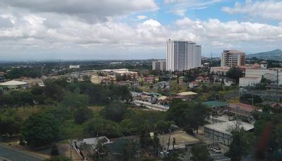
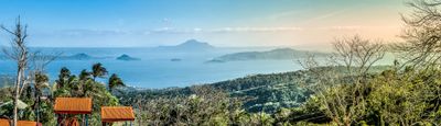
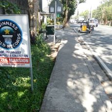
Tagaytay is a city on a mountain ridge in Cavite province, located about 60 kilometers south of Manila. The main road runs for several kilometers along the ridgeline, offering direct views of Taal Lake with its volcano in the center.

History

During the 1896 revolution, fighters used the forested slopes and narrow paths as natural protection from Spanish forces. Over the following decades, the area slowly developed into a retreat destination, mainly because of the cooler air and proximity to the capital.

Culture

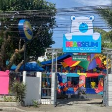
The name comes from a local word for a ridge, and residents often take early morning walks along the viewpoints to enjoy the cooler air. Many small restaurants and cafés lining the main road serve bulalo, a hearty bone marrow soup that pairs well with the fresh mountain climate.

Practical

The temperature remains consistently lower than in Manila throughout the year, making a visit comfortable at any time, especially in the early morning and late afternoon. The main road has several viewing points that are easy to reach on foot or by vehicle.

Did you know?

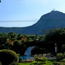
Mount Sungay rises to 709 meters above sea level, making it the highest point in the entire province of Cavite. On clear days, the elevation also allows views extending to Manila Bay and neighboring provinces.

Location
Inception
June 21, 1938
Elevation above the sea
292 m
Reference
0402119000
Shares border with
Mendez, Alfonso, Indang, Amadeo, Silang, Calamba, Talisay, Laurel
GPS coordinates
14.10000,120.93333
Latest update
December 14, 2025 22:57

AroundUs brings together thousands of curated places, local tips, and hidden gems, enriched daily by 60,000 contributors worldwide. Discover all places nearby (甲米地省).

« Tagaytay - Mountain city in Cavite, Philippines » is provided by Around Us (aroundus.com). Images and texts are derived from Wikimedia project under a Creative Commons license. You are allowed to copy, distribute, and modify copies of this page, under the conditions set by the license, as long as this note is clearly visible.

Discover hidden gems everywhere you go!

From secret cafés to breathtaking viewpoints, skip the crowded tourist spots and find places that match your style. Our app makes it easy with voice search, smart filtering, route optimization, and insider tips from travelers worldwide. Download now for the complete mobile experience.

Around Us App Screenshot

A unique approach to discovering new places

Le Figaro

All the places worth exploring

France Info

A tailor-made excursion in just a few clicks

20 Minutes

Around Us
Travel Guide & Maps
Download

Send to your phone

QR Code
1

Open the camera app on your mobile.

2

Point at the QR code with your camera. A notification will appear.

3

Tap the notification to open the link.