Tacurong, Component city in Sultan Kudarat, Philippines
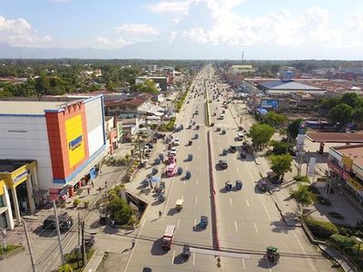
Tacurong is a component city in Sultan Kudarat province located where major highways intersect, making it a commercial hub for surrounding municipalities. It features an integrated transportation terminal that connects passengers to destinations across Mindanao through multiple bus operators.
The city was officially established as a municipality in 1951 through a presidential decree, formalizing its role as an administrative and trade center for the region. This action recognized the area's growing importance as a commercial crossroads in Mindanao.
The city is home to both Maguindanaon communities and settlers from Iloilo, whose daily practices and local celebrations reflect these two distinct cultural backgrounds.
The main transportation terminal operates with regular departures to major destinations, making it straightforward to reach surrounding areas. Visitors can easily explore local shops and markets throughout the city, which are typically open and accessible during daylight hours.
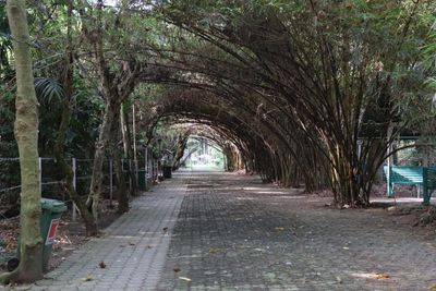
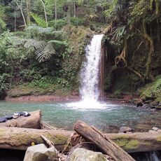
A bird sanctuary nearby draws various species and becomes the focal point of an annual festival celebrating birdwatching and conservation. This natural area transforms the city into an unusual destination for those interested in avian life and ecology.
Location: Sultan Kudarat
Inception: August 3, 1951
Elevation above the sea: 71 m
Shares border with: Lambayong, President Quirino, Tantangan
Website: http://tacurong.gov.ph
GPS coordinates: 6.68333,124.66667
Latest update: December 20, 2025 15:47
Mount Apo
74.9 km
Mount Matutum
57.8 km
Bangsamoro Parliament
73.6 km
Mount Ragang
113.9 km
Fort Pikit
42.1 km
Epol Falls
106.5 km
Bangsamoro Government Center
73.8 km
Cotabato Regional and Medical Center
74.6 km
Tantawan Park
75.8 km
Mount Apo Natural Park
77.6 km
Museo Dabawenyo
110.5 km
Pacman Beach Resort Complex
97.9 km
Tamontaka Church
74.3 km
Fuerte de Reina Regente
41.3 km
Burial Site of the Seventeen Filipino Martyrs of Koronadal historical marker
28.2 km
Sultan Dipatuan Kudarat historical marker
75.8 km
Mount Parker
68 km
Immaculate Conception Church of Tamontaka historical marker
74.2 km
Gen. Paulino Santos historical marker
84.7 km
Andres Bonifacio historical marker
99.1 km
Ohta Kyozaburo historical marker
102.8 km
Notre Dame Archdiocesan Seminary historical marker
77.1 km
Museyo Kutawato
53.9 km
KCC Cinema
28.9 km
Koronadal Cathedral
28.3 km
Wasag Beach
72.5 km
Balnunto Falls
48.1 km
Binaan falls
106.6 kmVisited this place? Tap the stars to rate it and share your experience / photos with the community! Try now! You can cancel it anytime.
Discover hidden gems everywhere you go!
From secret cafés to breathtaking viewpoints, skip the crowded tourist spots and find places that match your style. Our app makes it easy with voice search, smart filtering, route optimization, and insider tips from travelers worldwide. Download now for the complete mobile experience.
A unique approach to discovering new places❞
— Le Figaro
All the places worth exploring❞
— France Info
A tailor-made excursion in just a few clicks❞
— 20 Minutes