Alangalang, Administrative county in Leyte, Philippines
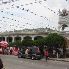
Alangalang is a municipality located in Leyte province with a rural character spread across multiple barangays and neighborhoods. The settlement sits surrounded by neighboring towns and is crossed by a national highway that serves as the main transportation route.
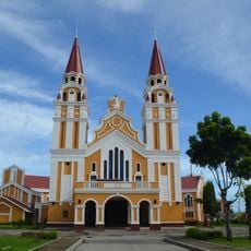
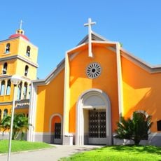
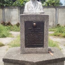
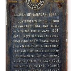
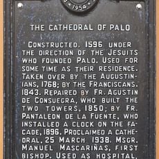
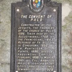
The area began as scattered communities in the 1590s, which were consolidated through the work of a Spanish priest-engineer who helped establish Christian settlements. This period laid the foundation for the settlement and how it developed over the centuries that followed.
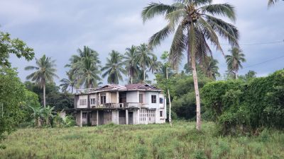
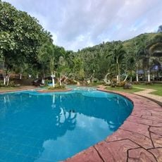
The place is deeply rooted in farming traditions that shape how residents live and celebrate together throughout the year. You can see this connection in local gatherings and festivals that bring communities together around shared customs.
A main highway passes through the area and connects you easily to neighboring towns and surrounding regions. Since this is a rural settlement, you should expect local conditions and allow extra time for getting around by regional transportation.
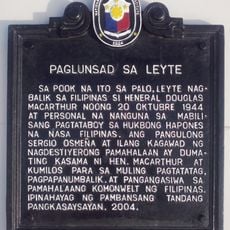
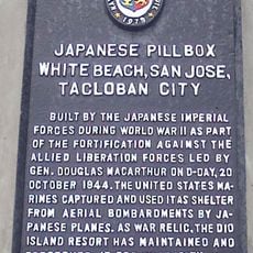
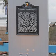
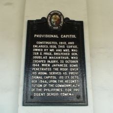
During World War II, this place temporarily served as a seat of local government when other locations became unsafe for officials. This unusual chapter in its history is remembered by older residents and reflects how the community adapted during turbulent times.
Location: 1st District
Address: Alangalang, Leyte, Philippines
GPS coordinates: 11.21548,124.86519
Latest update: December 11, 2025 11:07
San Juanico Bridge
15.2 kmMacArthur Landing Memorial National Park
16.8 km
Biliran
49.7 km
Price Mansion
15.5 km
Palo Cathedral
15.1 km
Leyte Provincial Capitol
15.6 km
Biliran Watchtower
50.3 km
Leyte Landing historical marker
16.8 km
Leyte Park
16 km
Tanauan Church
20.2 km
Patio Victoria Baluarte Beach Resort
17.8 km
Japanese Pillbox historical marker
17.8 km
Landing at Dulag, Leyte historical marker
33.4 km
Jaime C. de Veyra historical marker
20.2 km
Basey Church
23.5 km
Walter William Marquardt historical marker
26.7 km
Biliran Watchtower historical marker
50.3 km
Sibugay Mountain Resort
34.8 km
Battle of Ormoc Bay historical marker
36.6 km
Church of Basey historical marker
23.6 km
Norberto Romualdez historical marker
27 km
Church of Tanauan, Leyte historical marker
20.2 km
Capitol Building of the Philippines historical marker
15.6 km
Price Mansion
15.5 km
The Cathedral of Palo historical marker
15.2 km
Barugo Municipal Hall
18.8 km
Provisional Capitol historical marker
15.5 km
The Convent of Palo historical marker
15.2 kmVisited this place? Tap the stars to rate it and share your experience / photos with the community! Try now! You can cancel it anytime.
Discover hidden gems everywhere you go!
From secret cafés to breathtaking viewpoints, skip the crowded tourist spots and find places that match your style. Our app makes it easy with voice search, smart filtering, route optimization, and insider tips from travelers worldwide. Download now for the complete mobile experience.
A unique approach to discovering new places❞
— Le Figaro
All the places worth exploring❞
— France Info
A tailor-made excursion in just a few clicks❞
— 20 Minutes