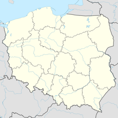
Wołowiec, Lesser Poland Voivodeship, Rural settlement in Lesser Poland Voivodeship, Poland.
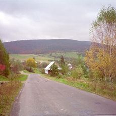
Wołowiec is a small village in Lesser Poland Voivodeship surrounded by agricultural fields and farmland. It falls under the administration of Gmina Sękowa and is located in the southeast part of the region.
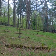
The village developed as an agricultural settlement and maintained its rural character through different periods of administrative changes. Its development reflects the broader history of this part of Poland and the region.
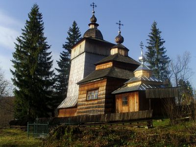
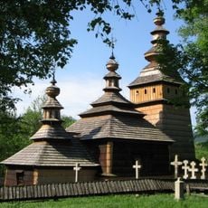
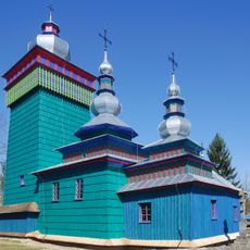
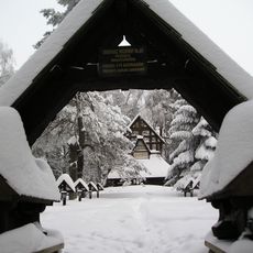
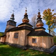
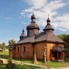
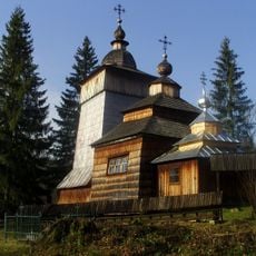
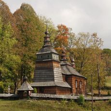
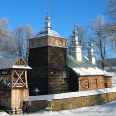
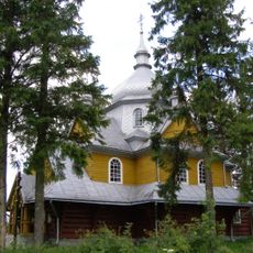
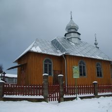
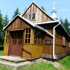
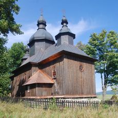
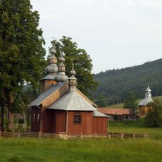
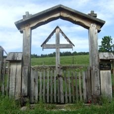
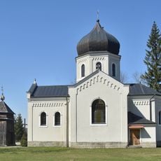
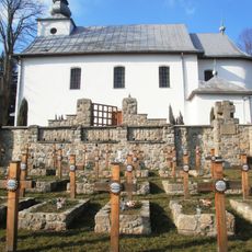
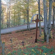
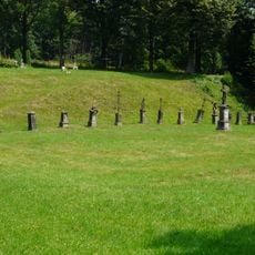
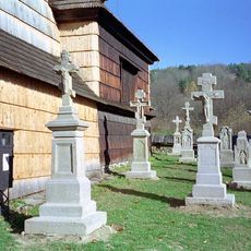
The Orthodox church here reflects the religious diversity of this border region and shows cultural influences that remain visible in the local landscape today. The presence of this building tells the story of different communities that have lived alongside each other over time.
The village connects to larger towns through local roads, making it accessible by car. Public transportation is limited, so bringing your own vehicle is the most practical option for visiting.
The village name comes from historical livestock farming, particularly ox breeding that shaped the area's agricultural roots. This connection to farming practices remains embedded in the place's identity and heritage.
Location: Gmina Sękowa
GPS coordinates: 49.53333,21.36667
Latest update: December 10, 2025 15:50
Diabli Kamień in Folusz
7.7 km
Magura Wątkowska
4.7 km
Nature reserve Kornuty
6.9 km
Saints Cosmas and Damian church in Kotań
7.6 km
Saint Michael Archangel church in Świątkowa Wielka
5 km
World War I Cemetery nr 60 in Przełęcz Małastowska
8.9 km
Saint Michael Archangel church in Świątkowa Mała
5.7 km
Orthodox Saints Cosmas and Damian church in Bartne
4.2 km
Church of the Pokrov in Wołowiec
2 km
Uniate /Greek Catholic/ Saints Cosmas and Damian church in Bartne
4.2 km
Orthodox church in Zdynia
8.7 km
Church of the Ascension of Christ in Gładyszów
7.8 km
Saint Demetrius Orthodox church in Bodaki
8.4 km
Church of Saint John the Baptist in Gładyszów
7.9 km
Saints Cosmas and Damian church in Krzywa
4.4 km
World War I Cemetery nr 54 in Krzywa
4.4 km
Cerkiew św. Dymitra w Bodakach
8.3 km
World War I Cemetery nr 44 in Długie
7 km
Paraskevi of Iconium church in Pętna
8.3 km
Saint Demetrius Catholic church in Bodaki
8.3 km
World War I Cemetery nr 64 in Bartne
4.2 km
World War I Cemetery nr 45 in Lipna
6.8 km
World War I Cemetery nr 63 in Pętna
7.1 km
Immaculate Conception church in Desznica
9 km
World War I Cemetery nr 69 in Bodaki
7.2 km
Ochabiska
3.1 km
Cmentarz grzebalny
8.3 km
Cmentarz (lapidarium łemkowskiej rzeźby sepulklarnej) w Kotani
7.6 kmVisited this place? Tap the stars to rate it and share your experience / photos with the community! Try now! You can cancel it anytime.
Discover hidden gems everywhere you go!
From secret cafés to breathtaking viewpoints, skip the crowded tourist spots and find places that match your style. Our app makes it easy with voice search, smart filtering, route optimization, and insider tips from travelers worldwide. Download now for the complete mobile experience.
A unique approach to discovering new places❞
— Le Figaro
All the places worth exploring❞
— France Info
A tailor-made excursion in just a few clicks❞
— 20 Minutes