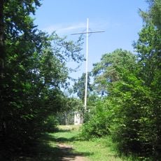
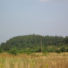
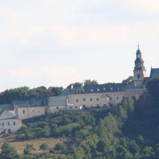
Brusznia, Mountain summit in Świętokrzyskie Province, Poland.
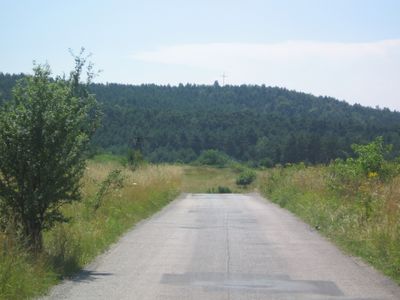
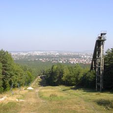
Brusznia is a mountain summit in the Świętokrzyskie range, located in south-central Poland. The peak rises above surrounding forest and provides views across the wooded slopes and valleys of this ancient mountain range.
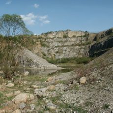
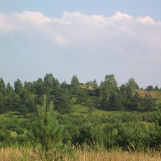
Brusznia is part of the ancient Świętokrzyskie mountain range, which formed during early continental collisions and was heavily eroded over geological time. The range ranks among Europe's oldest mountains and bears evidence of its long history in the landscape today.
Local residents maintain traditional seasonal gatherings at Brusznia summit, participating in nature observation activities and environmental education programs throughout the year.
Multiple marked trails ascend the summit from different directions, with information signage at the main trailheads. Visitors should wear sturdy hiking shoes and carry weather-appropriate gear, as conditions on the mountain change quickly.
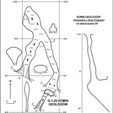
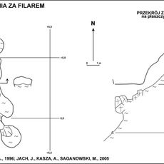
The summit displays visible rock formations and exposed geological layers that reveal how this ancient mountain range developed and changed over time. These features allow hikers to observe directly how Polish mountain landscapes were shaped and continue to evolve.
GPS coordinates: 50.86530,20.56360
Latest update: December 14, 2025 16:47
Kadzielnia Reserve in Kielce
3.8 km
Rezerwat przyrody Kadzielnia
3.8 km
Karczówka
1.8 km
Ślichowice Reserve in Kielce
2.9 km
Pierścienica
3.7 km
Rezerwat przyrody Biesak-Białogon
2.4 km
Kościół św. Karola Boromeusza w Kielcach
1.8 km
Rezerwat przyrody Karczówka
1.7 km
Krzyż na Bruszni
4 m
Church of Transfiguration in Kielce
1.4 km
Grabina
1.2 km
Komin Geologów
3.8 km
Immaculate Heart of Mary church in Kielce
3.6 km
Athletics Stadium in Kielce
3.7 km
Jaskinia Jeleniowska
3.8 km
Our Lady of Częstochowa church in Kielce
3.8 km
Dalnia (Góry Świętokrzyskie)
1.6 km
Jaskinia Urwista na Kadzielni
3.8 km
Jaskinia za Filarem
3.8 km
Kościół, ob. św. Karola Boromeusza, lata 1624-1631, poł. XVII
1.8 km
Ogrodzenie z basztami
1.8 km
Klasztor, lata 1629-1631, XIX w.
1.8 km
Mill at 52 Krakowska Street in Kielce
3.5 km
Zespół fabryczny d. Zakładów Białogońskich, obecnie KFP „Białogon”, wraz z osiedlem przemysłowym
1.5 km
Zespół klasztorny bernardynów, obecnie oblatów
1.8 km
Wayside chapel in Kielce
2.4 km
Teren niezabudowany na stoku góry
1.9 km
Zabudowania gospodarcze
1.9 kmVisited this place? Tap the stars to rate it and share your experience / photos with the community! Try now! You can cancel it anytime.
Discover hidden gems everywhere you go!
From secret cafés to breathtaking viewpoints, skip the crowded tourist spots and find places that match your style. Our app makes it easy with voice search, smart filtering, route optimization, and insider tips from travelers worldwide. Download now for the complete mobile experience.
A unique approach to discovering new places❞
— Le Figaro
All the places worth exploring❞
— France Info
A tailor-made excursion in just a few clicks❞
— 20 Minutes