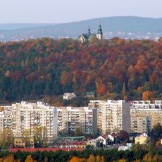
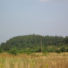
Grabina, Mountain summit in Kielce region, Poland
Description
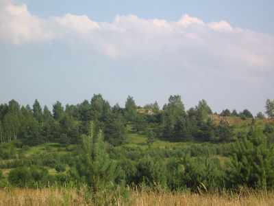
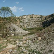
Grabina is a mountain summit in the Holy Cross Mountains standing at approximately 304 meters in elevation. Its slopes and former quarry areas display distinct Devonian limestone rock formations that define the mountain's geological character.
History
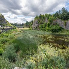
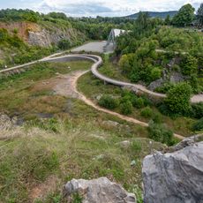
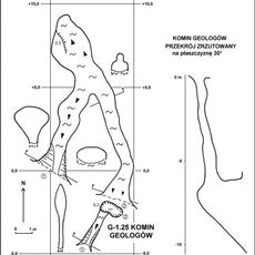
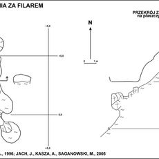
Grabina was mined for limestone and lead ore over centuries, with the deepest shaft in the region descending to approximately 118 meters below the surface. This extensive mining history permanently altered the mountain's profile.
Culture
The summit area displays the marks of limestone quarrying that shaped the landscape for generations. The abandoned mining sites tell of the economic importance this work held for local communities.
Practical
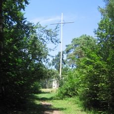
The area is accessible via marked hiking trails that suit different experience levels with varying degrees of difficulty. The site is best explored on foot during daylight hours to safely navigate the terrain and historical sites.
Did you know?
The summit contains fossils of marine creatures such as sponges, corals, and brachiopods from a tropical sea approximately 380 million years ago. These ancient traces reveal that the region was once submerged beneath warm ocean waters.
AroundUs brings together thousands of curated places, local tips, and hidden gems, enriched daily by 60,000 contributors worldwide. Discover all places nearby (Poland).
Kadzielnia Reserve in Kielce
3.1 km
Rezerwat przyrody Kadzielnia
3.1 km
Karczówka
981 m
Ślichowice Reserve in Kielce
1.8 km
Holy Virgin Mary Queen of Poland church in Kielce
3 km
Rezerwat przyrody Biesak-Białogon
3.1 km
Kościół św. Karola Boromeusza w Kielcach
1 km
Rezerwat przyrody Karczówka
892 m
Brusznia
1.2 km
Krzyż na Bruszni
1.2 km
Pomnik Niepodległości w Kielcach
3 km
Church of Transfiguration in Kielce
2.6 km
Komin Geologów
3.1 km
Immaculate Heart of Mary church in Kielce
2.7 km
Jaskinia Jeleniowska
3.1 km
Our Lady of Częstochowa church in Kielce
2.8 km
Dalnia (Góry Świętokrzyskie)
443 m
Jaskinia Urwista na Kadzielni
3.1 km
Jaskinia za Filarem
3.1 km
Kościół, ob. św. Karola Boromeusza, lata 1624-1631, poł. XVII
1 km
Ogrodzenie z basztami
983 m
Klasztor, lata 1629-1631, XIX w.
1 km
Mill at 52 Krakowska Street in Kielce
2.8 km
Zespół fabryczny d. Zakładów Białogońskich, obecnie KFP „Białogon”, wraz z osiedlem przemysłowym
2.7 km
Zespół klasztorny bernardynów, obecnie oblatów
1 km
Wayside chapel in Kielce
1.4 km
Teren niezabudowany na stoku góry
1.1 km
Zabudowania gospodarcze
1.1 kmDiscover hidden gems everywhere you go!
From secret cafés to breathtaking viewpoints, skip the crowded tourist spots and find places that match your style. Our app makes it easy with voice search, smart filtering, route optimization, and insider tips from travelers worldwide. Download now for the complete mobile experience.
A unique approach to discovering new places❞
— Le Figaro
All the places worth exploring❞
— France Info
A tailor-made excursion in just a few clicks❞
— 20 Minutes