Enable Location

We need your location to show you interesting places around you

Discover nearby places

Find interesting locations and hidden gems around you

Precise directions

Get accurate directions and distances to places

Your location is never shared with other users. It's only used when you tap the location button.

Nowa Huta

Log in to your account

Start exploring — it's free

Trusted by 61,422 travelers worldwide

Continue with Google
Continue with Apple
or

We will send you a code to connect

By continuing, you accept our Terms and Conditions and our Privacy Policy

Check your inbox

We've sent a pincode in your inbox. Please enter the code below.

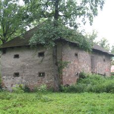
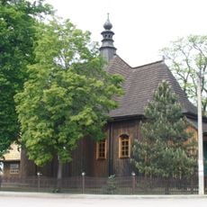
Nowa Huta, Socialist planned district in Kraków, Poland

Description

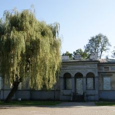
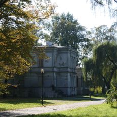
Nowa Huta is a city district in Kraków built in the 1950s according to socialist planning principles, featuring wide avenues, spacious squares, and apartment buildings designed in the socialist realist style. The layout follows a geometric grid pattern with a central plaza, making the area straightforward to navigate on foot.

History

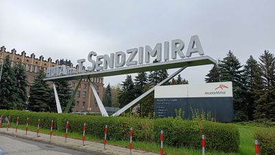
The district was founded in 1949 as a separate city centered on the Lenin Steelworks and merged with Kraków in 1951 to house factory workers. This founding reflected the socialist government's ambition to rapidly industrialize the region and demonstrate the superiority of planned urban design.

Culture

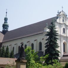
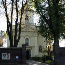
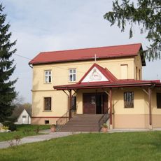
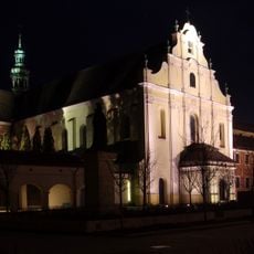
The Lord's Ark Church represents how residents came together to create a sacred space despite official resistance from authorities. Today it serves as a focal point where the neighborhood gathers and reflects its deep-rooted spiritual values.

Practical

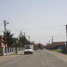
The district connects easily to central Kraków through an extensive tram and bus network, making it accessible by public transportation. Visitors can comfortably explore the wide streets and squares on foot, as the flat terrain and generous spacing make walking pleasant and straightforward.

Did you know?

The district layout follows a Renaissance-inspired radial plan with Central Square at its core, surrounded by symmetrically arranged residential neighborhoods. This deliberate geometric design was an attempt to create an ideal socialist city that symbolized order and accessibility for all residents.

Location
Inception
1991
Shares border with
Wzgórza Krzesławickie, Bieńczyce, Czyżyny, Podgórze
Address
Nowa Huta, Kraków, Poland
GPS coordinates
50.06601,20.11439
Latest update
December 6, 2025 16:02

AroundUs brings together thousands of curated places, local tips, and hidden gems, enriched daily by 60,000 contributors worldwide. Discover all places nearby (Kraków).

Unusual and secretive tour of Krakow

Krakow is a city where history lives in every corner. The old town center with its Main Market Square, St. Mary's Basilica, and Wawel Castle shows the medieval grandeur, while places like Oskar Schindler's Factory and the Ghetto Heroes Square speak to difficult periods in the city's past. This...

« Nowa Huta - Socialist planned district in Kraków, Poland » is provided by Around Us (aroundus.com). Images and texts are derived from Wikimedia project under a Creative Commons license. You are allowed to copy, distribute, and modify copies of this page, under the conditions set by the license, as long as this note is clearly visible.

Discover hidden gems everywhere you go!

From secret cafés to breathtaking viewpoints, skip the crowded tourist spots and find places that match your style. Our app makes it easy with voice search, smart filtering, route optimization, and insider tips from travelers worldwide. Download now for the complete mobile experience.

Around Us App Screenshot

A unique approach to discovering new places

Le Figaro

All the places worth exploring

France Info

A tailor-made excursion in just a few clicks

20 Minutes

Around Us
Travel Guide & Maps
Download

Send to your phone

QR Code
1

Open the camera app on your mobile.

2

Point at the QR code with your camera. A notification will appear.

3

Tap the notification to open the link.