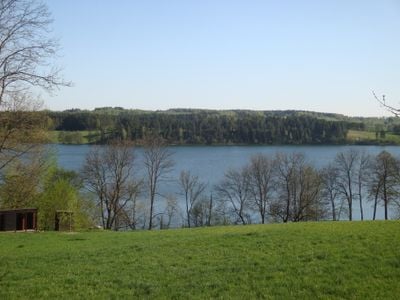
Rospuda Filipowska, Glacial lake in Suwałki Region, Poland.
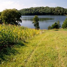
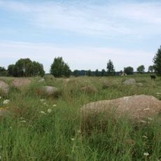
Rospuda Filipowska is a glacial lake in the Suwałki Region that spans approximately 3.44 square kilometers with varying depths throughout its basin. The landscape around it shows the characteristic features of a postglacial terrain in northeastern Poland.
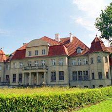
The lake marked a natural boundary between Lithuanian and Prussian territories during medieval times, serving as a frontier between rival regions. This role as a border shaped the political and economic significance of the area for centuries.
The lake serves as a gathering place for local people, where traditional fishing and everyday activities shape life along its shores. Fishers use methods handed down through generations, reflecting the region's relationship with its waters.
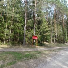
Visitors can reach the lake through an entry point near Supienie village, where kayaking equipment and camping facilities are available. Water activities are best enjoyed during warmer months when conditions are favorable.
The lake is part of a chain of nine connected water bodies along the Rospuda River, forming a rare aquatic corridor through the landscape. This linked structure makes the area especially appealing for paddling journeys, as one can explore an entire system of interconnected lakes.
The community of curious travelers
AroundUs brings together thousands of curated places, local tips, and hidden gems, enriched daily by 60,000 contributors worldwide.
Viaducts in Stańczyki
9.7 km
Suwałki Lakeland
16.4 km
Rominten Hunting Lodge
15.7 km
Rezerwat przyrody Jezioro Hańcza
16.4 km
Głazowisko Bachanowo
14.1 km
Observation tower in Stańczyki
9.4 km
Church of the Assumption in Filipów
5.7 km
Saint James church in Bakałarzewo
15.3 km
Nature reserve Struga Żytkiejmska
14.6 km
Kościół Trójcy Przenajświętszej w Pawłówce
12.8 km
Church of the Nativity of Virgin Mary in Przerośl
6 km
Saint Andrew Bobola church in Dubeninki
7.3 km
World War I cemetery in Rutka
17.2 km
Muzeum Motoryzacji Biała Olecka
12.3 km
Saint Michael Archangel church in Żytkiejmy
16.7 km
World War I Cemetery in Dubeninki
7.2 km
Evangelical cemetery in Stańczyki
9.5 km
Evangelical cemetery in Dubeninki
7.2 km
World War I Cemetery in Żytkiejmy
17.1 km
Nature reserve Rutka
16.8 km
Wiadukt kolejowy I na rz. Błędziance
9.7 km
Dzwonnica (przy kościele ) w Przeroślu
6 km
Wiadukt kolejowy II na rz. Błędziance
9.7 km
Biała Olecka Palace
12.2 km
Pałac (dec. dwór)
12.3 km
Ruiny kościoła ewangelickiego w Górnem
9.4 km
Zespół dworski w Rogajnach
8.5 km
Ruina kościoła ewangelickiego, XVII/XVIII
5.9 kmDiscover hidden gems everywhere you go!
From secret cafés to breathtaking viewpoints, skip the crowded tourist spots and find places that match your style. Our app makes it easy with voice search, smart filtering, route optimization, and insider tips from travelers worldwide. Download now for the complete mobile experience.
A unique approach to discovering new places❞
— Le Figaro
All the places worth exploring❞
— France Info
A tailor-made excursion in just a few clicks❞
— 20 Minutes