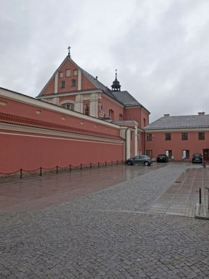
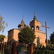
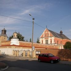
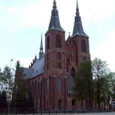
St. Anthony's Church, Ostrołęka, Catholic church in Ostrołęka, Poland
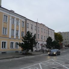
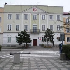
St. Anthony's Church is a Catholic church building in Ostrołęka that was constructed as part of a former Bernardine monastery complex. It displays Latin liturgical design elements and occupies a central place in the village layout.
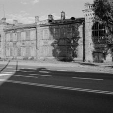
Construction of the building began in 1666 and was completed around 1696 after receiving royal and ecclesiastical approval. This period marked an important expansion of religious buildings in the region during the late 1600s.
The church serves as a gathering place where locals attend services and celebrate religious holidays together. It shapes the rhythm of community life through regular worship and shared spiritual moments.
The church is usually open during religious services and visiting follows standard etiquette for sacred places. The best time to visit is during scheduled masses or by arrangement with the local parish.
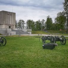
During the November Uprising of 1831, the church served as a defensive position during a military conflict in the area. This episode reveals how the building became caught up in regional historical events beyond its religious purpose.
Location: Ostrołęka
GPS coordinates: 53.08500,21.57170
Latest update: December 11, 2025 18:06
Church of the Visitation in Ostrołęka
261 m
Mauzoleum bitwy pod Ostrołęką
1 km
Church of Saint Francis of Assisi in Ostrołęka
2.1 km
Church of Christ the Redeemer in Ostrołęka
1.4 km
Church of Saint Adalbert of Prague in Ostrołęka
3.7 km
Madaliński Bridge in Ostrołęka
523 m
Muzeum Kultury Kurpiowskiej
344 m
Kościół Najświętszego Serca Pana Jezusa w Rzekuniu
5.4 km
Ławeczka Józefa Psarskiego w Ostrołęce
111 m
Ostrołęka Town Hall
286 m
Muzeum Żołnierzy Wyklętych w Ostrołęce
771 m
Culture Museum Kurpiowska
344 m
Pomnik Mauzoleum żołnierzy poległych w bitwie pod Ostrołęką 26 maja 1831 roku
1.1 km
Pomnik-mauzoleum w Ostrołęce
1.1 km
Zespół klasztorny bernardynów, gen. Ludwika Bogusławskiego 20 w Ostrołęce
18 m
Sacred Heart church in Rzekuń
5.4 km
Zespół urbanistyczny Starego Miasta (w granicach: rz. Narew - ul. Bogusławskiego - Kopernika, zespół kościelny - ul. Batorego - Pstrowskiego)
154 m
Zespół fortyfikacji ziemnych Fortu Bema
1 km
Pl. Gen. Bema 8
345 m
Zespół dworski
7.1 km
Manor in Stary Susk
7.1 km
Budynek koszarowy
3.6 km
Pl. Gen. Bema 4
333 m
Budynek starostwa
318 m
Plebania
10.5 km
Dom, XIX/XX (rekonstrukcja)
226 m
Budynek koszarowy, al. Wojska Polskiego 28 w Ostrołęce
3.2 km
Fortyfikacje ziemne
1.1 kmVisited this place? Tap the stars to rate it and share your experience / photos with the community! Try now! You can cancel it anytime.
Discover hidden gems everywhere you go!
From secret cafés to breathtaking viewpoints, skip the crowded tourist spots and find places that match your style. Our app makes it easy with voice search, smart filtering, route optimization, and insider tips from travelers worldwide. Download now for the complete mobile experience.
A unique approach to discovering new places❞
— Le Figaro
All the places worth exploring❞
— France Info
A tailor-made excursion in just a few clicks❞
— 20 Minutes