Enable Location

We need your location to show you interesting places around you

Discover nearby places

Find interesting locations and hidden gems around you

Precise directions

Get accurate directions and distances to places

Your location is never shared with other users. It's only used when you tap the location button.

Ostrołęka

Log in to your account

Start exploring — it's free

Trusted by 62,893 travelers worldwide

Continue with Google
Continue with Apple
or

We will send you a code to connect

By continuing, you accept our Terms and Conditions and our Privacy Policy

Check your inbox

We've sent a pincode in your inbox. Please enter the code below.

Discussion Reviews 3 Photos
72.8k Popularity

Ostrołęka, Administrative center in Masovian Voivodeship, Poland

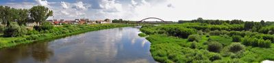
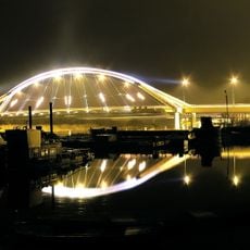
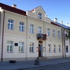
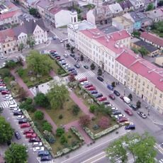
Ostrołęka is a city in Masovian Voivodeship, Poland, positioned on the eastern bank of the Narew River that winds through the center. A bridge dating from 1995 connects both shores and provides access to residential areas, parks, and public facilities on either side of the waterway.

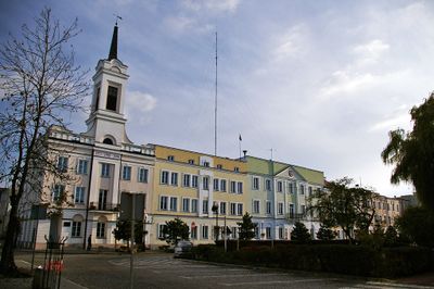
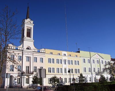
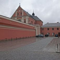
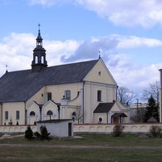
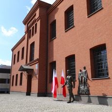
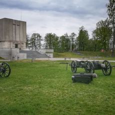
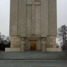
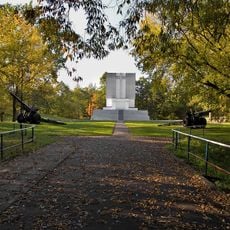
The settlement received its town charter in 1373 and grew into an important trading center in the Kurpie Forest region during the following centuries. A battle fought here during the Napoleonic Wars later earned the town's name a place on the Arc de Triomphe in Paris.

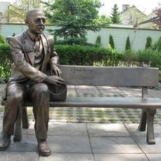
The name comes from Old Polish words referring to pointed structures or elevations, which reflects the local topography along the riverbanks. Visitors experience daily life along waterfront promenades where locals walk and enjoy views of the Narew.

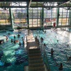
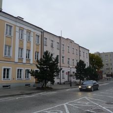
The city can be explored on foot, especially near the riverfront where paths follow the water's edge. Sports facilities and educational buildings are spread throughout the area and offer opportunities for activities during a visit.

The town's name appears on the Arc de Triomphe in Paris as a memorial to a battle fought here in 1807 during the Napoleonic campaigns. This inscription makes it one of the few Polish towns honored on that famous French monument.

The community of curious travelers

AroundUs brings together thousands of curated places, local tips, and hidden gems, enriched daily by 60,000 contributors worldwide.

Start exploring
Elevation above the sea
92 m
GPS coordinates
53.08431,21.56686
Latest update
December 14, 2025 17:05
Around this place
St. Anthony's Church, Ostrołęka
Poland

St. Anthony's Church, Ostrołęka

332 m
Church of the Visitation in Ostrołęka
Poland

Church of the Visitation in Ostrołęka

273 m
Mauzoleum bitwy pod Ostrołęką
Poland

Mauzoleum bitwy pod Ostrołęką

738 m
Park Wodny AQUARIUM
Poland

Park Wodny AQUARIUM

1.4 km
Church of Saint Francis of Assisi in Ostrołęka
Poland

Church of Saint Francis of Assisi in Ostrołęka

2.3 km
Church of Christ the Redeemer in Ostrołęka
Poland

Church of Christ the Redeemer in Ostrołęka

1.4 km
Church of Saint Adalbert of Prague in Ostrołęka
Poland

Church of Saint Adalbert of Prague in Ostrołęka

4 km
Madaliński Bridge in Ostrołęka
Poland

Madaliński Bridge in Ostrołęka

232 m
Muzeum Kultury Kurpiowskiej
Poland

Muzeum Kultury Kurpiowskiej

41 m
Kościół Najświętszego Serca Pana Jezusa w Rzekuniu
Poland

Kościół Najświętszego Serca Pana Jezusa w Rzekuniu

5.6 km
Ławeczka Józefa Psarskiego w Ostrołęce
Poland

Ławeczka Józefa Psarskiego w Ostrołęce

305 m
Ostrołęka Town Hall
Poland

Ostrołęka Town Hall

53 m
Muzeum Żołnierzy Wyklętych w Ostrołęce
Poland

Muzeum Żołnierzy Wyklętych w Ostrołęce

1.1 km
Culture Museum Kurpiowska
Poland

Culture Museum Kurpiowska

38 m
Pomnik Mauzoleum żołnierzy poległych w bitwie pod Ostrołęką 26 maja 1831 roku
Poland

Pomnik Mauzoleum żołnierzy poległych w bitwie pod Ostrołęką 26 maja 1831 roku

797 m
Pomnik-mauzoleum w Ostrołęce
Poland

Pomnik-mauzoleum w Ostrołęce

799 m
Sacred Heart church in Rzekuń
Poland

Sacred Heart church in Rzekuń

5.6 km
Poland

Cmentarz rzym.-kat. w Ostrołęce

802 m
Zespół klasztorny bernardynów, gen. Ludwika Bogusławskiego 20 w Ostrołęce
Poland

Zespół klasztorny bernardynów, gen. Ludwika Bogusławskiego 20 w Ostrołęce

320 m
Zespół urbanistyczny Starego Miasta (w granicach: rz. Narew - ul. Bogusławskiego - Kopernika, zespół kościelny - ul. Batorego - Pstrowskiego)
Poland

Zespół urbanistyczny Starego Miasta (w granicach: rz. Narew - ul. Bogusławskiego - Kopernika, zespół kościelny - ul. Batorego - Pstrowskiego)

179 m
Poland

Cmentarz rzym.-kat. w Rzekuniu

5.4 km
Zespół fortyfikacji ziemnych Fortu Bema
Poland

Zespół fortyfikacji ziemnych Fortu Bema

739 m
Poland

Budynek koszarowy

3.2 km
Poland

Budynek koszarowy

3.2 km
Dom, XIX/XX (rekonstrukcja)
Poland

Dom, XIX/XX (rekonstrukcja)

356 m
Pl. Gen. Bema 8
Poland

Pl. Gen. Bema 8

38 m
Pl. Gen. Bema 4
Poland

Pl. Gen. Bema 4

45 m
Poland

Kaplica cmentarna w Ostrołęce

860 m
Show the full map
« Ostrołęka - Administrative center in Masovian Voivodeship, Poland » is provided by Around Us (aroundus.com). Images and texts are derived from Wikimedia project under a Creative Commons license. You are allowed to copy, distribute, and modify copies of this page, under the conditions set by the license, as long as this note is clearly visible.

Discover hidden gems everywhere you go!

From secret cafés to breathtaking viewpoints, skip the crowded tourist spots and find places that match your style. Our app makes it easy with voice search, smart filtering, route optimization, and insider tips from travelers worldwide. Download now for the complete mobile experience.

Around Us App Screenshot

A unique approach to discovering new places

Le Figaro

All the places worth exploring

France Info

A tailor-made excursion in just a few clicks

20 Minutes

Around Us
Travel Guide & Maps
Download

Send to your phone

QR Code
1

Open the camera app on your mobile.

2

Point at the QR code with your camera. A notification will appear.

3

Tap the notification to open the link.