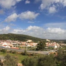
Rocha da Pena, Natural monument in Faro, Portugal.
Rocha da Pena is a table mountain in the Barrocal of the Algarve, in the municipality of Loulé, rising to 479 m. Its summit plateau is about 2 km long and up to 500 m wide, bordered by 50-metre limestone cliffs to the north and south. The limestone shows karst features such as karren fields, dolines, poljes and caves, including the Algar dos Mouros.
The rock formation originated during the Jurassic period when the region was shaped by geological forces. Evidence of human presence at the site dates back to prehistoric times, showing long-term occupation.
The name Algar dos Mouros, given to a cave on the plateau, recalls the legend that Moors took refuge behind the Iron Age stone walls after the fall of Salir Castle during the Reconquista. The walls still cross the full width of the plateau.
The site offers access for hiking and climbing, with routes that vary in difficulty and physical demand. Visitors should wear sturdy footwear and be prepared for uneven terrain and exposed conditions.
Two Iron Age stone walls run the full width of the plateau, and a cave there is still called Algar dos Mouros, where Moors are said to have hidden after the fall of Salir castle. The 5 km PR18 loop passes the ruins of two windmills on the eastern spur.
The community of curious travelers
AroundUs brings together thousands of curated places, local tips, and hidden gems, enriched daily by 94,700 contributors worldwide.