Enable Location

We need your location to show you interesting places around you

Discover nearby places

Find interesting locations and hidden gems around you

Precise directions

Get accurate directions and distances to places

Your location is never shared with other users. It's only used when you tap the location button.

Ponta de São Lourenço

Log in to your account

Start exploring — it's free

Trusted by 61,486 travelers worldwide

Continue with Google
Continue with Apple
or

We will send you a code to connect

By continuing, you accept our Terms and Conditions and our Privacy Policy

Check your inbox

We've sent a pincode in your inbox. Please enter the code below.

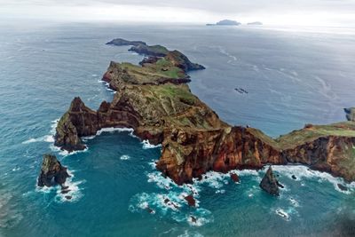
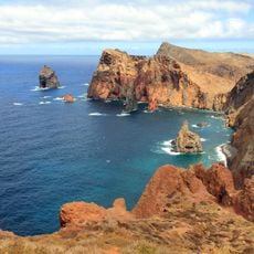
Ponta de São Lourenço, Protected peninsula at eastern tip of Madeira, Portugal

Description

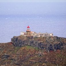
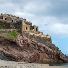
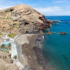
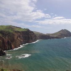
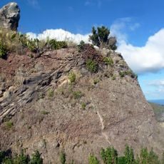
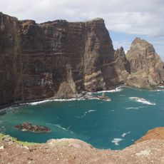
Ponta de São Lourenço is a volcanic peninsula at Madeira's eastern tip marked by steep cliffs and dark basalt rock formations. The landscape shifts noticeably between its northern and southern shorelines, each with distinct geological features and coastal characteristics.

History

The peninsula received protected status in 1982 to safeguard its geological formations and native species. This designation became the foundation for preserving the area's unique natural systems and preventing future development.

Culture

The area is an Important Bird Area that supports Madeira's largest colony of Caspian gulls and other protected seabirds. Visitors can observe these species nesting and resting along the cliffs and coastal edges.

Practical

A marked hiking trail crosses the peninsula and can be walked at a moderate pace with sturdy footwear required on the uneven ground. The area is exposed to wind and weather, so bring layers and be prepared for changing conditions.

Did you know?

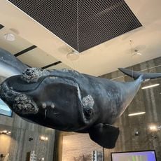
The peninsula hosts more than 140 plant species, with many found nowhere else in the world beyond Madeira's isolated location. The surrounding waters also serve as habitat for rarely seen marine mammals.

Location
Inception
1982
Elevation above the sea
337 m
Part of
Machico
GPS coordinates
32.74551,-16.69956
Latest update
December 6, 2025 17:41

AroundUs brings together thousands of curated places, local tips, and hidden gems, enriched daily by 60,000 contributors worldwide. Discover all places nearby (Caniçal).

Madeira tour: gardens, viewpoints, mountains

This collection covers the main natural areas and cultural sites across Madeira, a Portuguese island of volcanic origin in the Atlantic Ocean. The route connects coastal regions with highland areas, showcasing the diverse vegetation that results from the subtropical climate and varied elevation...

« Ponta de São Lourenço - Protected peninsula at eastern tip of Madeira, Portugal » is provided by Around Us (aroundus.com). Images and texts are derived from Wikimedia project under a Creative Commons license. You are allowed to copy, distribute, and modify copies of this page, under the conditions set by the license, as long as this note is clearly visible.

Discover hidden gems everywhere you go!

From secret cafés to breathtaking viewpoints, skip the crowded tourist spots and find places that match your style. Our app makes it easy with voice search, smart filtering, route optimization, and insider tips from travelers worldwide. Download now for the complete mobile experience.

Around Us App Screenshot

A unique approach to discovering new places

Le Figaro

All the places worth exploring

France Info

A tailor-made excursion in just a few clicks

20 Minutes

Around Us
Travel Guide & Maps
Download

Send to your phone

QR Code
1

Open the camera app on your mobile.

2

Point at the QR code with your camera. A notification will appear.

3

Tap the notification to open the link.