Maramureș, Historical region in northern Romania and western Ukraine.
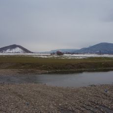
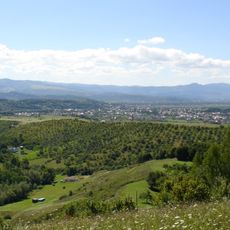
Maramureș is a historical region spanning across northeastern Romania and western Ukraine with mountainous terrain throughout. The Oaș, Gutâi, Țibleș, and Rodnei mountains of the Carpathians form a natural boundary around this territory.
The region was organized as a Romanian voivodeship within the Kingdom of Hungary starting from 1343 until 1402, when it became Máramaros County. This change marked an important shift in how the area was governed and controlled.
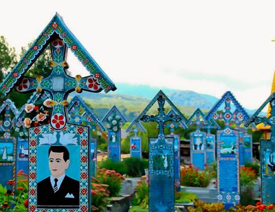
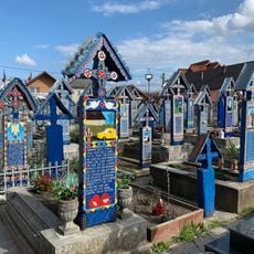
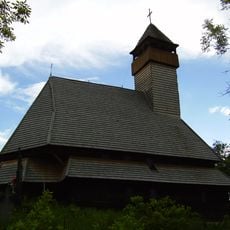
Romanian, Ukrainian, Hungarian, and Rusyn communities live across the region and keep their languages and traditions active in daily life. These groups have shaped the cultural character of the area and continue to do so through their celebrations and everyday customs.
Mountain passes in this area are difficult to cross during winter because of high elevation and severe weather. Visitors should be aware of seasonal challenges when trying to connect different parts of the region.
A distinctive feature was the nameși system, which granted free peasant status to residents of mountain villages. This created a social arrangement different from other medieval European regions.
Location: Romania
Inception: 1320
Website: http://prefecturamaramures.ro
GPS coordinates: 47.95000,23.65000
Latest update: December 18, 2025 11:41
Merry Cemetery
4.1 km
Săpânța-Peri Monastery
5.3 km
Memorial of the Victims of Communism and of the Resistance
18.2 km
Sighet prison
18.1 km
Vijnițer Klaus Temple in Sighetu Marmației
18.1 km
Dragoș Vodă high school in Sighetu Marmației
17.8 km
Saint Sergius hermitage, Hrushovo
9.5 km
Historic center of Sighetu Marmației
17.8 km
Piarists' monastery in Sighetu Marmației
17.8 km
Vyshovatski Waterfalls
18.5 km
Săpânța River
5.1 km
The Elevation of the Holy Cross Ukrainian Orthodox Church, Sighetu Marmației
18.2 km
Solotvyno-Sighetu Marmației Tisza bridge
16.9 km
Reformed church in Sighetu Marmației
17.6 km
Reformated church in Tiachiv
9 km
Palatul Cultural din Sighetu Marmației
17.5 km
Sztara-rika
15 km
Bushtyno Park
16.8 km
Lower Saint Nicholas Church, Serednie Vodiane
19 km
Hosszúmezői református templom
9.9 km
Парк
16.5 km
Saint Nicholas church, Nyzhnia Apsha
14.9 km
Озеро Солоне
19.4 km
Мочар
19.4 km
Тересвянська долина
11 km
Скелі з ієрогліфами, східні схили г. Бужора
18.3 km
Korona Szálló
17.9 km
Парк-арборетум
14.6 kmVisited this place? Tap the stars to rate it and share your experience / photos with the community! Try now! You can cancel it anytime.
Discover hidden gems everywhere you go!
From secret cafés to breathtaking viewpoints, skip the crowded tourist spots and find places that match your style. Our app makes it easy with voice search, smart filtering, route optimization, and insider tips from travelers worldwide. Download now for the complete mobile experience.
A unique approach to discovering new places❞
— Le Figaro
All the places worth exploring❞
— France Info
A tailor-made excursion in just a few clicks❞
— 20 Minutes