Chest opened
+${chestReward.xp} XP
Explorer
NOUVEAU ×${chestReward.collectible.quantity}
tapez pour fermer
Chest locked

Open chests in the app

Around Us is built for your phone — chests unlock when you walk, explore and capture nearby places.

Enable Location

We need your location to show you interesting places around you

Discover nearby places

Find interesting locations and hidden gems around you

Precise directions

Get accurate directions and distances to places

Your location is never shared with other users. It's only used when you tap the location button.

Karasuk

Log in to your account

Start exploring — it's free

Trusted by 72,888 travelers worldwide

Continue with Google
Continue with Apple
or

We will send you a code to connect

By continuing, you accept our Terms and Conditions and our Privacy Policy

Check your inbox

We've sent a pincode in your inbox. Please enter the code below.

Karasuk
Discussion Reviews 1 Photos
31.4k Popularity

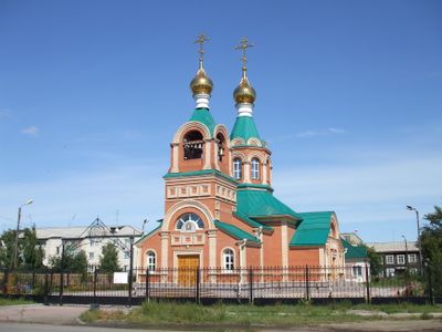
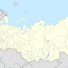
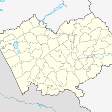
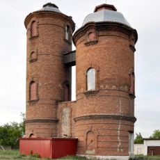
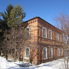
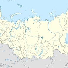
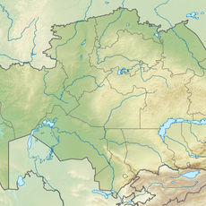
Karasuk, Administrative center in Novosibirsk Oblast, Russia

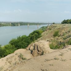
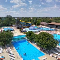
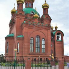
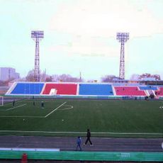
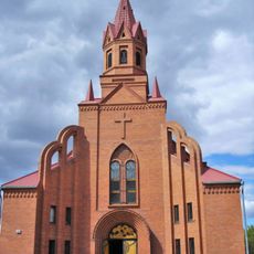
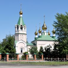
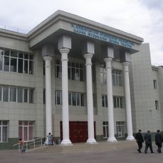
Karasuk is an administrative center in Novosibirsk Oblast situated along a river of the same name. The town features residential blocks, local shops, and public buildings arranged in a layout common to Siberian settlements.

The place was founded in 1912 and grew rapidly as a railway station in the region. This development led to recognition as an urban settlement in 1943 and finally to official town status in 1954.

The town functions as a local market hub where residents gather for trade and daily commerce in goods produced across the region. These shopping areas and gathering spaces reflect how people here conduct their everyday lives.

The town connects to larger centers through railway and road networks that are accessible to travelers. Visitors will find basic accommodation and eating options available upon arrival.

The name comes from Turkic languages and means "black water," reflecting how different peoples once lived in this region. This linguistic link shows how multiple cultures shaped Siberia's history.

The community of curious travelers

AroundUs brings together thousands of curated places, local tips, and hidden gems, enriched daily by 60,000 contributors worldwide.

Start exploring
Inception
1912
Elevation above the sea
110 m
GPS coordinates
53.73333,78.03333
Latest update
December 20, 2025 01:21
Around this place
Lake Chany
Russian Federation

Lake Chany

124.7 km
Kazakhstan

Mashkhur Jusup Mosque

176.3 km
Goose flight
Kazakhstan

Goose flight

176.5 km
Лава
Russian Federation

Лава

97.9 km
Annunciation Cathedral, Pavlodar
Kazakhstan

Annunciation Cathedral, Pavlodar

176.3 km
Pavlodar Central Stadium
Kazakhstan

Pavlodar Central Stadium

177.7 km
Zhelezinskaya Fortress
Kazakhstan

Zhelezinskaya Fortress

181 km
Kazakhstan

A. P. Chekhov Drama Theatre

177.9 km
Catholic church of Saint Thereza in Pavlodar
Kazakhstan

Catholic church of Saint Thereza in Pavlodar

174.8 km
Церковь Святого Апостола и Евангелиста Луки (Купино)
Russian Federation

Церковь Святого Апостола и Евангелиста Луки (Купино)

84.9 km
Kilty, Altai Krai
Russian Federation

Kilty, Altai Krai

144.1 km
Novosovkhozny
Russian Federation

Novosovkhozny

130.8 km
Насосная станция с двумя водонапорными башнями
Russian Federation

Насосная станция с двумя водонапорными башнями

84.7 km
Здание представительства компании «Зингер» (Краснозёрское)
Russian Federation

Здание представительства компании «Зингер» (Краснозёрское)

83.9 km
Карачилік
Russian Federation

Карачилік

12.8 km
Залізнична платформа 3023 км Барабушка
Russian Federation

Залізнична платформа 3023 км Барабушка

179 km
Mirny, Burlinsky District, Altai Krai
Russian Federation

Mirny, Burlinsky District, Altai Krai

37.6 km
Кусган
Russian Federation

Кусган

22.4 km
Остановочная Платформа 2997 км Мошкарь
Russian Federation

Остановочная Платформа 2997 км Мошкарь

181.6 km
Залізничний роз'їзд 151 км (Новосибірська область)
Russian Federation

Залізничний роз'їзд 151 км (Новосибірська область)

66.1 km
Центральный
Russian Federation

Центральный

94.6 km
Озерне Приволля
Russian Federation

Озерне Приволля

10.1 km
Залізнична платформа 3020 км
Russian Federation

Залізнична платформа 3020 км

178.2 km
Остановочни Платформа 3017 км (разъезд)
Russian Federation

Остановочни Платформа 3017 км (разъезд)

178.5 km
State Nature Sanctuary "Floodplain of the Irtysh River" (complex)
Kazakhstan

State Nature Sanctuary "Floodplain of the Irtysh River" (complex)

157.4 km
Il'ichevskiy Rayon
Kazakhstan

Il'ichevskiy Rayon

175.3 km
Industrial'nyy Rayon
Kazakhstan

Industrial'nyy Rayon

175.3 km
Aimautov Drama Theatre
Kazakhstan

Aimautov Drama Theatre

178.1 km
Show the full map
Reviews
Share your experience

No review yet

Discussions
Start a discussion...

No discussion yet

« Karasuk - Administrative center in Novosibirsk Oblast, Russia » is provided by Around Us (aroundus.com). Images and texts are derived from Wikimedia project under a Creative Commons license. You are allowed to copy, distribute, and modify copies of this page, under the conditions set by the license, as long as this note is clearly visible.

Discover hidden gems everywhere you go!

From secret cafés to breathtaking viewpoints, skip the crowded tourist spots and find places that match your style. Our app makes it easy with voice search, smart filtering, route optimization, and insider tips from travelers worldwide. Download now for the complete mobile experience.

Around Us App Screenshot

A unique approach to discovering new places

Le Figaro

All the places worth exploring

France Info

A tailor-made excursion in just a few clicks

20 Minutes

Around Us
Travel Guide & Maps
Download

Send to your phone

QR Code
1

Open the camera app on your mobile.

2

Point at the QR code with your camera. A notification will appear.

3

Tap the notification to open the link.