Enable Location

We need your location to show you interesting places around you

Discover nearby places

Find interesting locations and hidden gems around you

Precise directions

Get accurate directions and distances to places

Your location is never shared with other users. It's only used when you tap the location button.

Kologriv

Log in to your account

Start exploring — it's free

Trusted by 63,033 travelers worldwide

Continue with Google
Continue with Apple
or

We will send you a code to connect

By continuing, you accept our Terms and Conditions and our Privacy Policy

Check your inbox

We've sent a pincode in your inbox. Please enter the code below.

Kologriv
Discussion Reviews 1 Photos
16.9k Popularity

Kologriv, town in Russia

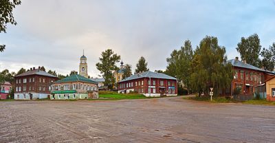
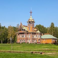
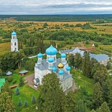
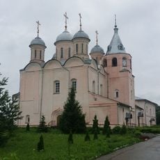
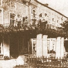
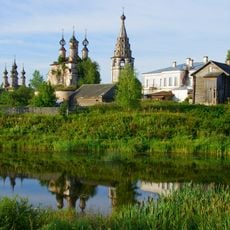
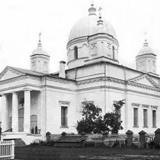
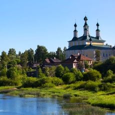
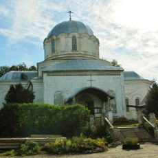
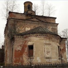
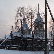
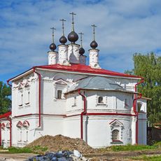
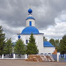
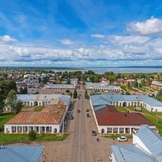
Kologriv is a small town in the Kostroma region of northern Russia situated at a bend of the Unzha River. It consists of wooden buildings with carved facades and paved streets that have remained largely unchanged since the 1800s.

Kologriv was a major trading and crafts center in the 1700s and 1800s with active markets and local merchants. The railway station later closed, which significantly slowed the town's growth and left it as a quiet settlement frozen in time.

Kologriv's name comes from Finno-Ugric roots meaning "fisher's bay". The town has long been connected to goose raising, which shaped local farming practices and became deeply embedded in how residents see their place in the region.

There is no train service to Kologriv; buses run only once or twice weekly from Manturovo. The single road into town passes through small villages and is the main way to arrive.

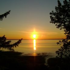
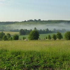
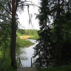
The Unzha River bend is a spring stopover for thousands of wild geese migrating northward in April and May. Visitors can watch these large flocks rest briefly before their long journey, making it a notable spot for birdwatching.

The community of curious travelers

AroundUs brings together thousands of curated places, local tips, and hidden gems, enriched daily by 60,000 contributors worldwide.

Start exploring
Elevation above the sea
140 m
GPS coordinates
58.82523,44.31144
Latest update
February 17, 2026 01:20
Around this place
Astashovo estate
Russian Federation

Astashovo estate

72.6 km
Kologrivsky Nature Reserve
Russian Federation

Kologrivsky Nature Reserve

29.7 km
Makaryev-Unzhensky Monastery
Russian Federation

Makaryev-Unzhensky Monastery

109.5 km
Avraamiev Monastery, Kostroma Oblast
Russian Federation

Avraamiev Monastery, Kostroma Oblast

97.8 km
Lake Chukhloma
Russian Federation

Lake Chukhloma

97.8 km
Paisievo-Galichsky Monastery
Russian Federation

Paisievo-Galichsky Monastery

125.7 km
Галичский кремль
Russian Federation

Галичский кремль

123.2 km
Нероново (Костромская область)
Russian Federation

Нероново (Костромская область)

107.4 km
Isakova Mointain
Russian Federation

Isakova Mointain

113.1 km
Kologriv local history museum
Russian Federation

Kologriv local history museum

729 m
Resurrection monastery in Soligalich
Russian Federation

Resurrection monastery in Soligalich

119.1 km
Holy Trinity Cathedral
Russian Federation

Holy Trinity Cathedral

123.3 km
Cathedral of the Nativity of the Theotokos, Soligalich
Russian Federation

Cathedral of the Nativity of the Theotokos, Soligalich

119.3 km
Кузнєцово (Шар'їнський район)
Russian Federation

Кузнєцово (Шар'їнський район)

78.4 km
Kazan Church, Nikolsk
Russian Federation

Kazan Church, Nikolsk

102 km
Церковь Николая Чудотворца, что на Дору
Russian Federation

Церковь Николая Чудотворца, что на Дору

102.6 km
Церковь Космы и Дамиана (Логдуз)
Russian Federation

Церковь Космы и Дамиана (Логдуз)

132.1 km
Yelkhovetsky
Russian Federation

Yelkhovetsky

89.2 km
Богчино (залізничний роз'їзд, Костромська область)
Russian Federation

Богчино (залізничний роз'їзд, Костромська область)

120.1 km
Прохоров (Костромська область)
Russian Federation

Прохоров (Костромська область)

133.8 km
Дюковское лесничество
Russian Federation

Дюковское лесничество

68.4 km
Петрушино (Мантуровський район)
Russian Federation

Петрушино (Мантуровський район)

55 km
Шумовка (Костромська область)
Russian Federation

Шумовка (Костромська область)

121.5 km
Носковський (кордон)
Russian Federation

Носковський (кордон)

77.9 km
Church of the Epiphany, Galich
Russian Federation

Church of the Epiphany, Galich

124.2 km
Saints Cosmas and Damian church, Galich
Russian Federation

Saints Cosmas and Damian church, Galich

125.4 km
Trade Arcades, Galich
Russian Federation

Trade Arcades, Galich

124.1 km
Bobrishny Ugor reserve
Russian Federation

Bobrishny Ugor reserve

94 km
Show the full map
Reviews
Share your experience

No review yet

Discussions
Start a discussion...

No discussion yet

« Kologriv - town in Russia » is provided by Around Us (aroundus.com). Images and texts are derived from Wikimedia project under a Creative Commons license. You are allowed to copy, distribute, and modify copies of this page, under the conditions set by the license, as long as this note is clearly visible.

Discover hidden gems everywhere you go!

From secret cafés to breathtaking viewpoints, skip the crowded tourist spots and find places that match your style. Our app makes it easy with voice search, smart filtering, route optimization, and insider tips from travelers worldwide. Download now for the complete mobile experience.

Around Us App Screenshot

A unique approach to discovering new places

Le Figaro

All the places worth exploring

France Info

A tailor-made excursion in just a few clicks

20 Minutes

Around Us
Travel Guide & Maps
Download

Send to your phone

QR Code
1

Open the camera app on your mobile.

2

Point at the QR code with your camera. A notification will appear.

3

Tap the notification to open the link.