Chest opened
+${chestReward.xp} XP
Explorer
NOUVEAU ×${chestReward.collectible.quantity}
tapez pour fermer
Chest locked

Open chests in the app

Around Us is built for your phone — chests unlock when you walk, explore and capture nearby places.

Enable Location

We need your location to show you interesting places around you

Discover nearby places

Find interesting locations and hidden gems around you

Precise directions

Get accurate directions and distances to places

Your location is never shared with other users. It's only used when you tap the location button.

Kamskiye Polyany

Log in to your account

Start exploring — it's free

Trusted by 72,877 travelers worldwide

Continue with Google
Continue with Apple
or

We will send you a code to connect

By continuing, you accept our Terms and Conditions and our Privacy Policy

Check your inbox

We've sent a pincode in your inbox. Please enter the code below.

Discussion Reviews 1 Photos
13k Popularity

Kamskiye Polyany, Urban settlement in Nizhnekamsky District, Tatarstan, Russia.

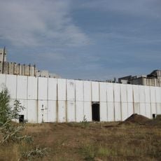
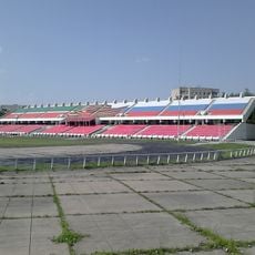
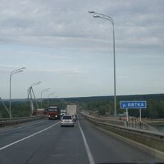
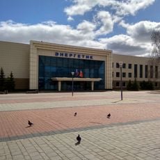
Kamskiye Polyany sits on the left bank of the Kama River about 37 kilometers southwest of Nizhnekamsk, the district center in Tatarstan. The settlement houses machine building plants, textile manufacturing units, and construction panel production facilities that form the basis of local economic activity.

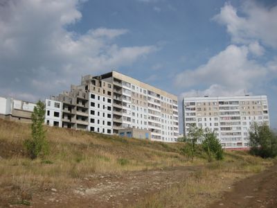
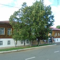
The settlement originated in the 18th century as the rural village of Polyanki and became an urban-type settlement in 1982 during construction of the Tatar Nuclear Power Station. This shift marked a transition from agricultural community to industrial center.

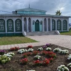
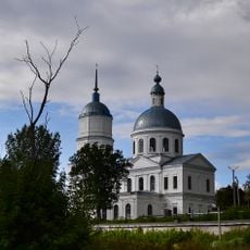
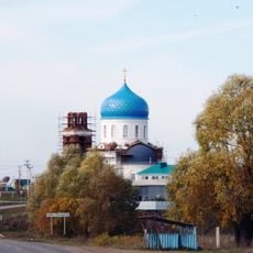
Russian and Tatar communities have shaped the social fabric of this settlement over many generations, each maintaining their own customs and ways of life. Their coexistence is visible in everyday interactions, local celebrations, and the shared spaces throughout the town.

The settlement is best reached via connections to the district center Nizhnekamsk, with the Kama River forming a defining geographical boundary. Visitors should expect that industrial facilities dominate much of the landscape and infrastructure, reflecting the local economy.

The village was once a quiet riverside settlement before nuclear power development triggered rapid transformation in the 1980s. This swift shift from rural community to industrial hub continues to shape the character and identity of the place today.

The community of curious travelers

AroundUs brings together thousands of curated places, local tips, and hidden gems, enriched daily by 60,000 contributors worldwide.

Start exploring
Location
Городское поселение посёлок городского типа Камские Поляны
GPS coordinates
55.43056,51.41389
Latest update
December 7, 2025 20:42
Around this place
Tataria Nuclear Power Station
Russian Federation

Tataria Nuclear Power Station

8.3 km
Шайтан шәһәрчеге
Russian Federation

Шайтан шәһәрчеге

52.5 km
Nizhne Kam Mosque
Russian Federation

Nizhne Kam Mosque

34.3 km
Nadezhda Durova Estate, Elabuga
Russian Federation

Nadezhda Durova Estate, Elabuga

55 km
Russian Federation

Regional Historical Museum Naberezhnye Chelny

62.3 km
Täwbä Mosque, Çallı
Russian Federation

Täwbä Mosque, Çallı

64.1 km
Cathedral of the Holy Mandylion, Elabuga
Russian Federation

Cathedral of the Holy Mandylion, Elabuga

54.1 km
Stroitel Stadium
Russian Federation

Stroitel Stadium

62.5 km
Dolphinarium in Naberezhnye Chelny
Russian Federation

Dolphinarium in Naberezhnye Chelny

62 km
Russian Federation

Ivan Shishkin's House Museum

54.1 km
Church of Saints Cosmas and Damian
Russian Federation

Church of Saints Cosmas and Damian

67.8 km
Church of the Protection of the Theotokos, Elabuga
Russian Federation

Church of the Protection of the Theotokos, Elabuga

54.7 km
Elabuzhsky Monastery
Russian Federation

Elabuzhsky Monastery

55.8 km
Troitskoe Cemetery, Elabuga
Russian Federation

Troitskoe Cemetery, Elabuga

53.9 km
Ananʹinskiĭ Mound
Russian Federation

Ananʹinskiĭ Mound

55.3 km
Memorial museum of Boris Pasternak
Russian Federation

Memorial museum of Boris Pasternak

48.9 km
Bekhterev's museum in Elabuga
Russian Federation

Bekhterev's museum in Elabuga

54.1 km
Mamadysh bridge
Russian Federation

Mamadysh bridge

26.4 km
Chistopol Mosque
Russian Federation

Chistopol Mosque

49.5 km
Gogol Street 1, Elabuga
Russian Federation

Gogol Street 1, Elabuga

54.1 km
Мемориальный комплекс М. И. Цветаевой
Russian Federation

Мемориальный комплекс М. И. Цветаевой

54.9 km
Palace of Culture Energetik
Russian Federation

Palace of Culture Energetik

62.5 km
Габдулла Тукай исемендәге үзәк китапханә
Russian Federation

Габдулла Тукай исемендәге үзәк китапханә

33 km
Площадь Памяти
Russian Federation

Площадь Памяти

54 km
Yelkhovo village history museum named after Khaliulla Akhmetshin
Russian Federation

Yelkhovo village history museum named after Khaliulla Akhmetshin

62.7 km
Saint Nicholas Church (Elabuga)
Russian Federation

Saint Nicholas Church (Elabuga)

54.4 km
Monument to Ibrahim the First
Russian Federation

Monument to Ibrahim the First

52 km
Тереклек бирүче Өчле гыйбадәтханәсе
Russian Federation

Тереклек бирүче Өчле гыйбадәтханәсе

66.3 km
Show the full map
Reviews
Share your experience

No review yet

Discussions
Start a discussion...

No discussion yet

« Kamskiye Polyany - Urban settlement in Nizhnekamsky District, Tatarstan, Russia » is provided by Around Us (aroundus.com). Images and texts are derived from Wikimedia project under a Creative Commons license. You are allowed to copy, distribute, and modify copies of this page, under the conditions set by the license, as long as this note is clearly visible.

Discover hidden gems everywhere you go!

From secret cafés to breathtaking viewpoints, skip the crowded tourist spots and find places that match your style. Our app makes it easy with voice search, smart filtering, route optimization, and insider tips from travelers worldwide. Download now for the complete mobile experience.

Around Us App Screenshot

A unique approach to discovering new places

Le Figaro

All the places worth exploring

France Info

A tailor-made excursion in just a few clicks

20 Minutes

Around Us
Travel Guide & Maps
Download

Send to your phone

QR Code
1

Open the camera app on your mobile.

2

Point at the QR code with your camera. A notification will appear.

3

Tap the notification to open the link.