Chest opened
+${chestReward.xp} XP
Explorer
NOUVEAU ×${chestReward.collectible.quantity}
tapez pour fermer
Chest locked

Open chests in the app

Around Us is built for your phone — chests unlock when you walk, explore and capture nearby places.

Enable Location

We need your location to show you interesting places around you

Discover nearby places

Find interesting locations and hidden gems around you

Precise directions

Get accurate directions and distances to places

Your location is never shared with other users. It's only used when you tap the location button.

Kubachi

Log in to your account

Start exploring — it's free

Trusted by 72,887 travelers worldwide

Continue with Google
Continue with Apple
or

We will send you a code to connect

By continuing, you accept our Terms and Conditions and our Privacy Policy

Check your inbox

We've sent a pincode in your inbox. Please enter the code below.

Discussion Reviews 2 Photos
19.7k Popularity

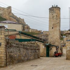
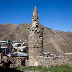
Kubachi, Mountain settlement in Dakhadayevsky District, Russia

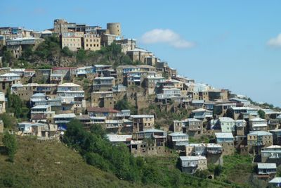
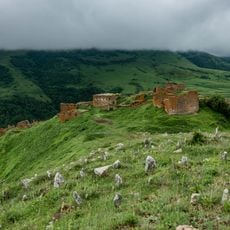
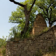
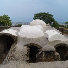
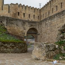
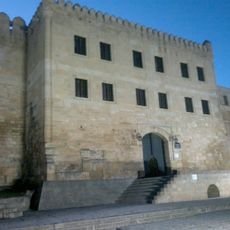
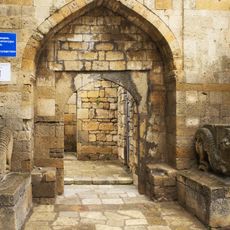
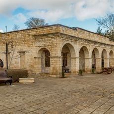
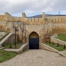
Kubachi is a mountain settlement in Dakhadayevsky District situated at approximately 1,750 meters elevation on Dagestan's hilly terrain. Stone buildings line narrow passages that follow the natural contours of the land, creating a tightly woven community layout.

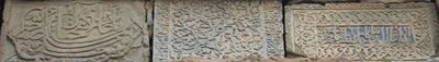
Medieval sources documented this place under the name Zerihgaran, when chain mail production was a major craft. This ancient connection to metalwork shaped the community's development and economic focus over centuries.

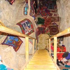
Metalworkers here create intricate decorative pieces and tools using methods passed down through generations. This craft remains central to how residents connect with their heritage and identity.

The settlement sits at a significant elevation, so visitors should prepare for mountain terrain and variable weather. Sturdy footwear helps when exploring the narrow lanes and sloped pathways throughout the community.

The settlement maintains metalworking traditions that trace back to medieval times, with craftspeople still using techniques rarely seen elsewhere. Many workshops operate openly where visitors can watch artisans at work.

The community of curious travelers

AroundUs brings together thousands of curated places, local tips, and hidden gems, enriched daily by 60,000 contributors worldwide.

Start exploring
Elevation above the sea
1,750 m
GPS coordinates
42.08611,47.60333
Latest update
December 7, 2025 10:07
Around this place
Naryn Castle
Russian Federation

Naryn Castle

55.6 km
Derbent Fortress
Russian Federation

Derbent Fortress

55.6 km
Derbent Wall
Russian Federation

Derbent Wall

54.4 km
Khuchni Fortress
Russian Federation

Khuchni Fortress

32.2 km
Khanagsky Waterfall
Russian Federation

Khanagsky Waterfall

29.7 km
Кумухская джума-мечеть
Russian Federation

Кумухская джума-мечеть

41.2 km
Пещера Дюрк
Russian Federation

Пещера Дюрк

29.3 km
Водохранилище крестообразное (Дербент)
Russian Federation

Водохранилище крестообразное (Дербент)

55.5 km
Джума-мечеть (Кумух)
Russian Federation

Джума-мечеть (Кумух)

41.2 km
Ворота «Нарын-Кала-Капы» (Дербент)
Russian Federation

Ворота «Нарын-Кала-Капы» (Дербент)

55.6 km
Родник «Кала-Булаг» (Дербент)
Russian Federation

Родник «Кала-Булаг» (Дербент)

55.6 km
Мавзолей (Кала-Корейш)
Russian Federation

Мавзолей (Кала-Корейш)

4.9 km
Мечеть с минаретом (Дербент)
Russian Federation

Мечеть с минаретом (Дербент)

55.7 km
Архитектурный комплекс села Амузги (Амузги)
Russian Federation

Архитектурный комплекс села Амузги (Амузги)

2 km
Кладбище уцмиев (Кала-Корейш)
Russian Federation

Кладбище уцмиев (Кала-Корейш)

4.9 km
Джума-мечеть (Кала-Корейш)
Russian Federation

Джума-мечеть (Кала-Корейш)

4.9 km
Арабское кладбище (Кара-корейш)
Russian Federation

Арабское кладбище (Кара-корейш)

4.9 km
Джума-мечеть с минаретом (Рича)
Russian Federation

Джума-мечеть с минаретом (Рича)

36.9 km
Водохранилище круглое (Дербент)
Russian Federation

Водохранилище круглое (Дербент)

55.6 km
Тюрьма подземная малая (зиндан) (Дербент)
Russian Federation

Тюрьма подземная малая (зиндан) (Дербент)

55.6 km
Постройка служебная (Дербент)
Russian Federation

Постройка служебная (Дербент)

55.6 km
Баня ханская (Дербент)
Russian Federation

Баня ханская (Дербент)

55.5 km
Тюрьма подземная (зиндан) (Дербент)
Russian Federation

Тюрьма подземная (зиндан) (Дербент)

55.6 km
Ворота «Джарчи-Капы» (Дербент)
Russian Federation

Ворота «Джарчи-Капы» (Дербент)

55.6 km
Ханская канцелярия (комендантский дом) (Дербент)
Russian Federation

Ханская канцелярия (комендантский дом) (Дербент)

55.6 km
Дворец ханский (Дербент)
Russian Federation

Дворец ханский (Дербент)

55.6 km
Гауптвахта (Дербент)
Russian Federation

Гауптвахта (Дербент)

55.6 km
Ворота «Даг-Капы» (Дербент)
Russian Federation

Ворота «Даг-Капы» (Дербент)

55.5 km
Show the full map
Reviews
Share your experience

No review yet

Discussions
Start a discussion...

No discussion yet

« Kubachi - Mountain settlement in Dakhadayevsky District, Russia » is provided by Around Us (aroundus.com). Images and texts are derived from Wikimedia project under a Creative Commons license. You are allowed to copy, distribute, and modify copies of this page, under the conditions set by the license, as long as this note is clearly visible.

Discover hidden gems everywhere you go!

From secret cafés to breathtaking viewpoints, skip the crowded tourist spots and find places that match your style. Our app makes it easy with voice search, smart filtering, route optimization, and insider tips from travelers worldwide. Download now for the complete mobile experience.

Around Us App Screenshot

A unique approach to discovering new places

Le Figaro

All the places worth exploring

France Info

A tailor-made excursion in just a few clicks

20 Minutes

Around Us
Travel Guide & Maps
Download

Send to your phone

QR Code
1

Open the camera app on your mobile.

2

Point at the QR code with your camera. A notification will appear.

3

Tap the notification to open the link.