Chest opened
+${chestReward.xp} XP
Explorer
NOUVEAU ×${chestReward.collectible.quantity}
tapez pour fermer
Chest locked

Open chests in the app

Around Us is built for your phone — chests unlock when you walk, explore and capture nearby places.

Enable Location

We need your location to show you interesting places around you

Discover nearby places

Find interesting locations and hidden gems around you

Precise directions

Get accurate directions and distances to places

Your location is never shared with other users. It's only used when you tap the location button.

Log in to your account

Start exploring — it's free

Trusted by 72,876 travelers worldwide

Continue with Google
Continue with Apple
or

We will send you a code to connect

By continuing, you accept our Terms and Conditions and our Privacy Policy

Check your inbox

We've sent a pincode in your inbox. Please enter the code below.

Blagoveshchenka
Discussion Reviews Photo
11.4k Popularity

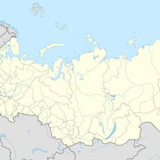
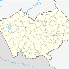
Blagoveshchenka, Administrative settlement in Altai Krai, Russia.

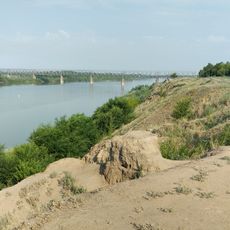
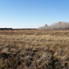
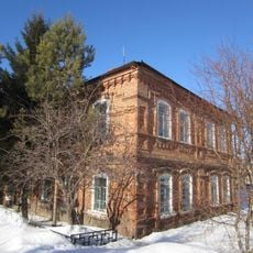
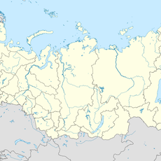
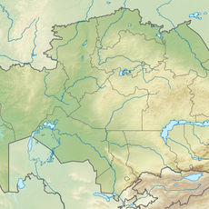
Blagoveshchenka is an urban-type settlement in Altai Krai that serves as the administrative hub for Blagoveshchensky District. It sits at an elevation of 109 meters in a landscape defined by the presence of two nearby lakes.

The settlement was founded in 1908 and initially fell under the Slavgorod administrative region until a reorganization in 1925. This shift reflected broader territorial changes happening across Altai Krai during the early Soviet period.

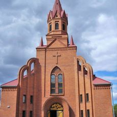
The settlement takes its name from the Russian Orthodox concept of annunciation, which shapes how locals understand their community's identity. This religious connection remains visible in the way people refer to and think about their home.

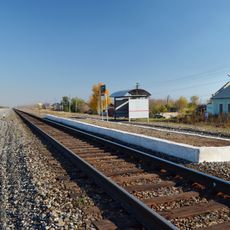
The settlement operates in the UTC+7 time zone and uses postal code 658670 for correspondence and planning. The location between two lakes means the landscape can vary significantly depending on the season and weather conditions.

The settlement sits at coordinates 52.833333°N, 79.866667°E, occupying a rare geographical position wedged between Kuchuk and Kulunda lakes. This in-between location makes it a distinct point in the otherwise flat steppe landscape.

The community of curious travelers

AroundUs brings together thousands of curated places, local tips, and hidden gems, enriched daily by 60,000 contributors worldwide.

Start exploring
Location
Благовіщенська селищна рада
Inception
1908
Elevation above the sea
109 m
GPS coordinates
52.83333,79.86667
Latest update
December 8, 2025 13:41
Around this place
Kazakhstan

Mashkhur Jusup Mosque

205.8 km
Goose flight
Kazakhstan

Goose flight

208 km
Лава
Russian Federation

Лава

87 km
Annunciation Cathedral, Pavlodar
Kazakhstan

Annunciation Cathedral, Pavlodar

207.6 km
Pavlodar Central Stadium
Kazakhstan

Pavlodar Central Stadium

206.9 km
Kazakhstan

A. P. Chekhov Drama Theatre

207.6 km
State Forest Nature Reservat "Ertis Ormany"
Kazakhstan

State Forest Nature Reservat "Ertis Ormany"

131.7 km
Kazakhstan

Borli

170.3 km
Catholic church of Saint Thereza in Pavlodar
Kazakhstan

Catholic church of Saint Thereza in Pavlodar

202.7 km
Kazakhstan

Tuz

189.1 km
Kilty, Altai Krai
Russian Federation

Kilty, Altai Krai

55.8 km
Russian Federation

Родина

158.5 km
Kolos, Novoalexandrovsky Selsoviet, Rubtsovsky District, Altai Krai
Russian Federation

Kolos, Novoalexandrovsky Selsoviet, Rubtsovsky District, Altai Krai

182.2 km
Novosovkhozny
Russian Federation

Novosovkhozny

71.6 km
Здание представительства компании «Зингер» (Краснозёрское)
Russian Federation

Здание представительства компании «Зингер» (Краснозёрское)

133.8 km
Traktorny
Russian Federation

Traktorny

168.3 km
Mirny, Burlinsky District, Altai Krai
Russian Federation

Mirny, Burlinsky District, Altai Krai

127.1 km
Дальній (Ребріхинський район)
Russian Federation

Дальній (Ребріхинський район)

175.7 km
Паново (селище, Ребріхинський район)
Russian Federation

Паново (селище, Ребріхинський район)

152.8 km
Центральный
Russian Federation

Центральный

105.3 km
Водная горка
Russian Federation

Водная горка

145.8 km
Podstepnovsky
Russian Federation

Podstepnovsky

138 km
Гоноховський
Russian Federation

Гоноховський

107.2 km
Zarnitsa
Russian Federation

Zarnitsa

164.8 km
State Nature Sanctuary "Floodplain of the Irtysh River" (complex)
Kazakhstan

State Nature Sanctuary "Floodplain of the Irtysh River" (complex)

217.4 km
Il'ichevskiy Rayon
Kazakhstan

Il'ichevskiy Rayon

206.1 km
Industrial'nyy Rayon
Kazakhstan

Industrial'nyy Rayon

206.1 km
Aimautov Drama Theatre
Kazakhstan

Aimautov Drama Theatre

205.9 km
Show the full map
Reviews
Share your experience

No review yet

Discussions
Start a discussion...

No discussion yet

« Blagoveshchenka - Administrative settlement in Altai Krai, Russia » is provided by Around Us (aroundus.com). Images and texts are derived from Wikimedia project under a Creative Commons license. You are allowed to copy, distribute, and modify copies of this page, under the conditions set by the license, as long as this note is clearly visible.

Discover hidden gems everywhere you go!

From secret cafés to breathtaking viewpoints, skip the crowded tourist spots and find places that match your style. Our app makes it easy with voice search, smart filtering, route optimization, and insider tips from travelers worldwide. Download now for the complete mobile experience.

Around Us App Screenshot

A unique approach to discovering new places

Le Figaro

All the places worth exploring

France Info

A tailor-made excursion in just a few clicks

20 Minutes

Around Us
Travel Guide & Maps
Download

Send to your phone

QR Code
1

Open the camera app on your mobile.

2

Point at the QR code with your camera. A notification will appear.

3

Tap the notification to open the link.