Enable Location

We need your location to show you interesting places around you

Discover nearby places

Find interesting locations and hidden gems around you

Precise directions

Get accurate directions and distances to places

Your location is never shared with other users. It's only used when you tap the location button.

Tabasaransky District

Log in to your account

Start exploring — it's free

Trusted by 61,981 travelers worldwide

Continue with Google
Continue with Apple
or

We will send you a code to connect

By continuing, you accept our Terms and Conditions and our Privacy Policy

Check your inbox

We've sent a pincode in your inbox. Please enter the code below.

Tabasaransky District

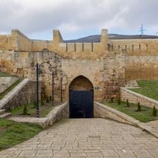
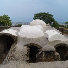
Tabasaransky District, Municipal district in Dagestan, Russia

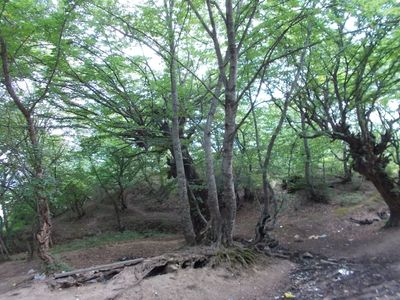
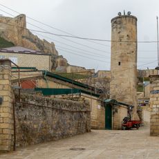
Tabasaransky District is a municipal area in southeastern Dagestan comprising numerous rural settlements connected by mountain roads. The district spreads across hilly terrain where smaller villages and farming communities form the backbone of local life.

The district was established as an administrative unit in 1929 within the Dagestan Autonomous Soviet Socialist Republic. It maintained its territorial structure through subsequent political changes and continues to function as a distinct administrative division.

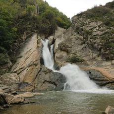
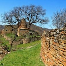
The area is marked by sacred springs, particularly near Darvag village, which hold spiritual meaning for local people. These sites reflect how residents connect with their landscape through traditional beliefs and practices.

The district is rural and best explored by personal transport, as public transit options are limited in this mountainous region. Road conditions vary with seasons, so planning ahead for travel is important when visiting outlying villages.

The district operates through a network of local government units that manage day-to-day affairs in individual villages across the region. This decentralized approach allows smaller communities to address their own needs with direct input from residents.

The community of curious travelers

AroundUs brings together thousands of curated places, local tips, and hidden gems, enriched daily by 60,000 contributors worldwide.

Start exploring
Location
Inception
1929
Capital city
Khuchni
GPS coordinates
41.94830,47.94610
Latest update
December 7, 2025 19:28
Around this place
Naryn Castle
Russian Federation

Naryn Castle

29.5 km
Derbent Fortress
Russian Federation

Derbent Fortress

29.6 km
Derbent Wall
Russian Federation

Derbent Wall

28 km
Khuchni Fortress
Russian Federation

Khuchni Fortress

2 km
Khanagsky Waterfall
Russian Federation

Khanagsky Waterfall

3.1 km
Пещера Дюрк
Russian Federation

Пещера Дюрк

6.2 km
Дом, в котором в 1830-1834 гг. жил писатель, декабрист А.А. Бестужев-Марлинский (Дербент)
Russian Federation

Дом, в котором в 1830-1834 гг. жил писатель, декабрист А.А. Бестужев-Марлинский (Дербент)

29.9 km
Водохранилище крестообразное (Дербент)
Russian Federation

Водохранилище крестообразное (Дербент)

29.5 km
Ворота «Нарын-Кала-Капы» (Дербент)
Russian Federation

Ворота «Нарын-Кала-Капы» (Дербент)

29.6 km
Родник «Кала-Булаг» (Дербент)
Russian Federation

Родник «Кала-Булаг» (Дербент)

29.6 km
Водохранилище подземное № 2 (Дербент)
Russian Federation

Водохранилище подземное № 2 (Дербент)

29.8 km
Мавзолей (Кала-Корейш)
Russian Federation

Мавзолей (Кала-Корейш)

29.4 km
Мечеть с минаретом (Дербент)
Russian Federation

Мечеть с минаретом (Дербент)

29.8 km
Ворота «Баят-Капы» (Дербент)
Russian Federation

Ворота «Баят-Капы» (Дербент)

29.8 km
Кладбище уцмиев (Кала-Корейш)
Russian Federation

Кладбище уцмиев (Кала-Корейш)

29.4 km
Джума-мечеть (Кала-Корейш)
Russian Federation

Джума-мечеть (Кала-Корейш)

29.4 km
Арабское кладбище (Кара-корейш)
Russian Federation

Арабское кладбище (Кара-корейш)

29.2 km
Кладбище Джум-Джум (Дербент)
Russian Federation

Кладбище Джум-Джум (Дербент)

29.7 km
Водохранилище круглое (Дербент)
Russian Federation

Водохранилище круглое (Дербент)

29.6 km
Дворец ханский (Дербент)
Russian Federation

Дворец ханский (Дербент)

29.6 km
Постройка служебная (Дербент)
Russian Federation

Постройка служебная (Дербент)

29.5 km
Ворота «Джарчи-Капы» (Дербент)
Russian Federation

Ворота «Джарчи-Капы» (Дербент)

29.7 km
Тюрьма подземная малая (зиндан) (Дербент)
Russian Federation

Тюрьма подземная малая (зиндан) (Дербент)

29.6 km
Тюрьма подземная (зиндан) (Дербент)
Russian Federation

Тюрьма подземная (зиндан) (Дербент)

29.6 km
Ханская канцелярия (комендантский дом) (Дербент)
Russian Federation

Ханская канцелярия (комендантский дом) (Дербент)

29.6 km
Гауптвахта (Дербент)
Russian Federation

Гауптвахта (Дербент)

29.6 km
Ворота «Даг-Капы» (Дербент)
Russian Federation

Ворота «Даг-Капы» (Дербент)

29.5 km
Баня ханская (Дербент)
Russian Federation

Баня ханская (Дербент)

29.5 km
Show the full map
« Tabasaransky District - Municipal district in Dagestan, Russia » is provided by Around Us (aroundus.com). Images and texts are derived from Wikimedia project under a Creative Commons license. You are allowed to copy, distribute, and modify copies of this page, under the conditions set by the license, as long as this note is clearly visible.

Discover hidden gems everywhere you go!

From secret cafés to breathtaking viewpoints, skip the crowded tourist spots and find places that match your style. Our app makes it easy with voice search, smart filtering, route optimization, and insider tips from travelers worldwide. Download now for the complete mobile experience.

Around Us App Screenshot

A unique approach to discovering new places

Le Figaro

All the places worth exploring

France Info

A tailor-made excursion in just a few clicks

20 Minutes

Around Us
Travel Guide & Maps
Download

Send to your phone

QR Code
1

Open the camera app on your mobile.

2

Point at the QR code with your camera. A notification will appear.

3

Tap the notification to open the link.