Volga Upland, Elevated plateau near Volga River, Russia
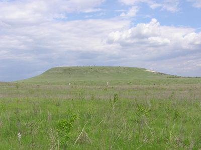
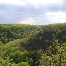
Volga Upland is an elevated plateau that stretches for hundreds of kilometers along the western bank of the Volga River, defined by steep slopes, river gorges, and eroded ravines cutting through the landscape. The terrain features mixed forests, grasslands, and open areas with scattered settlements and agricultural land spread across its ridge and lower slopes.
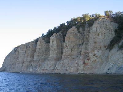
This upland formed during the Carboniferous and Cretaceous periods through ancient sea deposits that later shaped into limestone, dolomite, sandstone, and chalk layers. In more recent centuries, it became a crossroads for trade routes and military campaigns, marking boundaries between historical empires and peoples who left their mark on the region.
Indigenous peoples and Slavic settlers have shaped the region's cultural identity for centuries, visible in local crafts, festivals, and the way communities relate to the river and the elevated terrain. The upland itself holds symbolic meaning for inhabitants as a defining feature of their homeland.
The best time to explore is spring through autumn when walking and travel are easy, while winters bring severe cold that makes movement difficult across the open terrain. Visitors should expect variable elevation and scattered facilities, with towns and villages providing lodging and supplies along the edges rather than in the middle of the plateau itself.
Several of the highest points, including the Zhiguli range, are called mountains by locals despite reaching only about 384 meters in elevation, a height that would be considered hills elsewhere. This naming reflects how local communities perceive and relate to their landscape as something grand and worthy of respect.
The community of curious travelers
AroundUs brings together thousands of curated places, local tips, and hidden gems, enriched daily by 60,000 contributors worldwide.