Enable Location

We need your location to show you interesting places around you

Discover nearby places

Find interesting locations and hidden gems around you

Precise directions

Get accurate directions and distances to places

Your location is never shared with other users. It's only used when you tap the location button.

Pervomaysky District, Altai Krai

Log in to your account

Start exploring — it's free

Trusted by 61,995 travelers worldwide

Continue with Google
Continue with Apple
or

We will send you a code to connect

By continuing, you accept our Terms and Conditions and our Privacy Policy

Check your inbox

We've sent a pincode in your inbox. Please enter the code below.

Pervomaysky District, Altai Krai

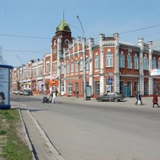
Pervomaysky District, Altai Krai, Municipal district in northeastern Altai Krai, Russia.

Pervomaysky District is a municipal district in northeastern Altai Krai containing numerous rural settlements spread across its territory. The area is divided into smaller administrative units that organize the local communities.

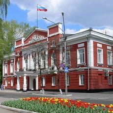
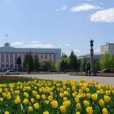
The district was established in 1935 as an administrative unit in the Altai region and developed as an independent territorial entity. A nearby urban center became its administrative hub, though it remained governed separately.

The district's name reflects a Russian naming tradition tied to May 1st, a day celebrated for labor and solidarity. This choice was common during the Soviet era and continues to shape how locals identify their region.

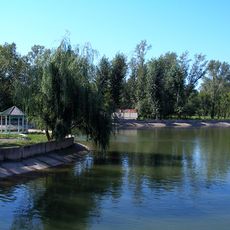
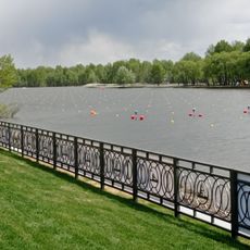
Visitors should know that the district is located in a rural area with scattered settlements requiring advance planning for travel. Local infrastructure reflects typical rural conditions with basic services and connections.

The district was a center for agricultural development during the Soviet era, attracting settlers from across the union. This settlement history shaped the diverse composition of its rural communities today.

The community of curious travelers

AroundUs brings together thousands of curated places, local tips, and hidden gems, enriched daily by 60,000 contributors worldwide.

Start exploring
Location
Capital city
Novoaltaysk
GPS coordinates
53.40000,83.93333
Latest update
December 8, 2025 13:40
Around this place
Altai State Medical University
Russian Federation

Altai State Medical University

11.8 km
House Under the Spire
Russian Federation

House Under the Spire

11.9 km
Altai Regional Drama Theatre
Russian Federation

Altai Regional Drama Theatre

12.2 km
Mountain Pharmacy
Russian Federation

Mountain Pharmacy

12.4 km
Изумрудный парк (Барнаул)
Russian Federation

Изумрудный парк (Барнаул)

11 km
New Bridge, Barnaul
Russian Federation

New Bridge, Barnaul

12.1 km
Altai State Academy of Culture and Arts
Russian Federation

Altai State Academy of Culture and Arts

11.8 km
Barnaul Planetarium
Russian Federation

Barnaul Planetarium

11.1 km
Monaster Ikony Matki Bożej „Znak” w Barnaule
Russian Federation

Monaster Ikony Matki Bożej „Znak” w Barnaule

11.9 km
Saint Nicholas Church, Barnaul
Russian Federation

Saint Nicholas Church, Barnaul

11.9 km
Altai Youth Theatre
Russian Federation

Altai Youth Theatre

11.9 km
People's House, Barnaul
Russian Federation

People's House, Barnaul

12.4 km
Dynamo Stadium
Russian Federation

Dynamo Stadium

11.7 km
Polyakov and Yakovlev House
Russian Federation

Polyakov and Yakovlev House

11.6 km
Polyakov Trade House
Russian Federation

Polyakov Trade House

11.9 km
Rodina Cinema, Barnaul
Russian Federation

Rodina Cinema, Barnaul

12 km
State Art Museum of Altai Krai
Russian Federation

State Art Museum of Altai Krai

12 km
Gosudarstvennyĭ muzeĭ istorii literatury iskusstva i kulʹtury Altai︠a︡
Russian Federation

Gosudarstvennyĭ muzeĭ istorii literatury iskusstva i kulʹtury Altai︠a︡

11.4 km
Rowing Canal
Russian Federation

Rowing Canal

6.8 km
House of the Head of the Altai Mining District
Russian Federation

House of the Head of the Altai Mining District

11.9 km
Archaeological and Ethnographic Museum of Altai
Russian Federation

Archaeological and Ethnographic Museum of Altai

12.1 km
Church of the Theotokos of the Sign
Russian Federation

Church of the Theotokos of the Sign

12.1 km
Architect House, Barnaul
Russian Federation

Architect House, Barnaul

12.4 km
Old City Duma Building, Barnaul
Russian Federation

Old City Duma Building, Barnaul

11.9 km
House of the Hodegetria Church, Barnaul
Russian Federation

House of the Hodegetria Church, Barnaul

11.8 km
Alexander Nevsky Chapel
Russian Federation

Alexander Nevsky Chapel

11.9 km
House of Culture of the Barnaul Melange Combine
Russian Federation

House of Culture of the Barnaul Melange Combine

11.9 km
Дом Советов (Барнаул)
Russian Federation

Дом Советов (Барнаул)

12.1 km
Show the full map
« Pervomaysky District, Altai Krai - Municipal district in northeastern Altai Krai, Russia » is provided by Around Us (aroundus.com). Images and texts are derived from Wikimedia project under a Creative Commons license. You are allowed to copy, distribute, and modify copies of this page, under the conditions set by the license, as long as this note is clearly visible.

Discover hidden gems everywhere you go!

From secret cafés to breathtaking viewpoints, skip the crowded tourist spots and find places that match your style. Our app makes it easy with voice search, smart filtering, route optimization, and insider tips from travelers worldwide. Download now for the complete mobile experience.

Around Us App Screenshot

A unique approach to discovering new places

Le Figaro

All the places worth exploring

France Info

A tailor-made excursion in just a few clicks

20 Minutes

Around Us
Travel Guide & Maps
Download

Send to your phone

QR Code
1

Open the camera app on your mobile.

2

Point at the QR code with your camera. A notification will appear.

3

Tap the notification to open the link.