Enable Location

We need your location to show you interesting places around you

Discover nearby places

Find interesting locations and hidden gems around you

Precise directions

Get accurate directions and distances to places

Your location is never shared with other users. It's only used when you tap the location button.

Chertanovo Severnoye District

Log in to your account

Start exploring — it's free

Trusted by 63,708 travelers worldwide

Continue with Google
Continue with Apple
or

We will send you a code to connect

By continuing, you accept our Terms and Conditions and our Privacy Policy

Check your inbox

We've sent a pincode in your inbox. Please enter the code below.

Chertanovo Severnoye District
Discussion Reviews 1 Photos
15.5k Popularity

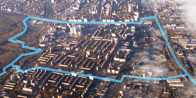
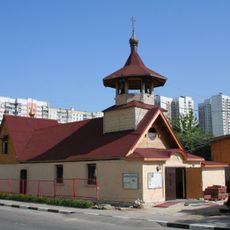
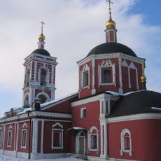
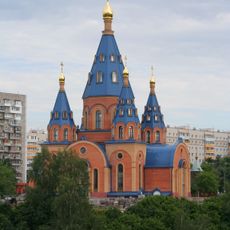
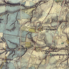
Chertanovo Severnoye District, human settlement in Russia

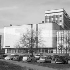
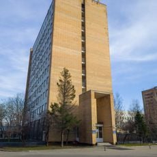
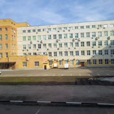
Chertanovo Severnoye is a residential district in southern Moscow featuring large reinforced concrete apartment blocks built primarily during the 1970s and 1980s. The area is defined by wide streets, open spaces between buildings, and a functional layout designed to house many families efficiently.

The district was conceived in the 1970s as an experiment in Soviet housing to accommodate many families in high-rise buildings. Development continued through the 1980s, shaping Moscow's southern expansion during that period.

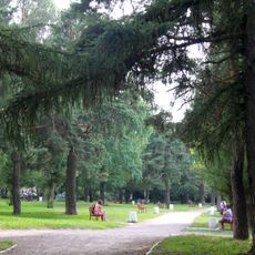
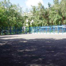
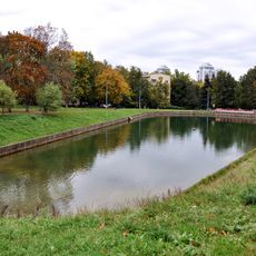
The district's name reflects its position in the northern section of the Chertanovo area, established during the Soviet era. Residents use the open streets and small parks as natural gathering points for everyday social interaction and family activities.

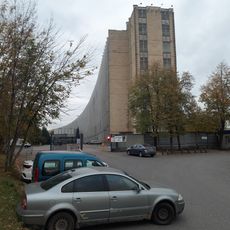
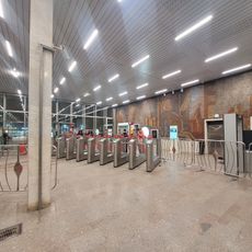
The district is easy to navigate by public bus, and the wide streets enable straightforward orientation while walking. Small parks and green areas offer rest stops, while underground garages reduce car clutter on streets and improve accessibility.

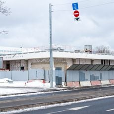
The district is known for its underground garage system, an innovative solution that keeps cars out of sight and frees public space for pedestrians. This approach was an attempt to maximize efficiency in Soviet-era urban planning.

The community of curious travelers

AroundUs brings together thousands of curated places, local tips, and hidden gems, enriched daily by 60,000 contributors worldwide.

Start exploring
Location
Inception
2003
GPS coordinates
55.63222,37.60694
Latest update
February 19, 2026 23:40
Around this place
Bitsa Park
Russian Federation

Bitsa Park

2.8 km
Shalom Theatre
Russian Federation

Shalom Theatre

3.3 km
Electronic Computing Technology Scientific-Research Center
Russian Federation

Electronic Computing Technology Scientific-Research Center

1 km
Church of Saint Boris and Gleb in Zyuzino
Russian Federation

Church of Saint Boris and Gleb in Zyuzino

3.4 km
Korobkovsky Sad
Russian Federation

Korobkovsky Sad

3.9 km
Arshinovskiy park
Russian Federation

Arshinovskiy park

3.2 km
Pokrovsky Park
Russian Federation

Pokrovsky Park

3.4 km
Moskvoretsky Market
Russian Federation

Moskvoretsky Market

2.7 km
Church of Saint Thomas at Kantemirovskaya
Russian Federation

Church of Saint Thomas at Kantemirovskaya

3.2 km
Church of the Protection of the Theotokos at Gorodnya
Russian Federation

Church of the Protection of the Theotokos at Gorodnya

3.5 km
Church of the Derzhavnaya Icon of the Theotokos in Chertanovo
Russian Federation

Church of the Derzhavnaya Icon of the Theotokos in Chertanovo

394 m
Sosenki
Russian Federation

Sosenki

4 km
Бирюлёво (усадьба)
Russian Federation

Бирюлёво (усадьба)

3.1 km
Perekopsky Pond
Russian Federation

Perekopsky Pond

3.5 km
North Vestibule of Kashirskaya
Russian Federation

North Vestibule of Kashirskaya

3.8 km
Prozorovsky-Beketov Estate in Zyuzino
Russian Federation

Prozorovsky-Beketov Estate in Zyuzino

3.4 km
Church of Saint Eudoxia of Moscow in Kotlovka
Russian Federation

Church of Saint Eudoxia of Moscow in Kotlovka

3.7 km
Перекопская улица 9 Усадьба Зюзино
Russian Federation

Перекопская улица 9 Усадьба Зюзино

3.3 km
Учебный аэродром (фрагмент) в Чертаново (Чертаново Северное)
Russian Federation

Учебный аэродром (фрагмент) в Чертаново (Чертаново Северное)

645 m
Перекопская улица 7 c3
Russian Federation

Перекопская улица 7 c3

3.4 km
Перекопская улица 7 c2
Russian Federation

Перекопская улица 7 c2

3.4 km
Podolskikh Kursantov Street 1
Russian Federation

Podolskikh Kursantov Street 1

2.4 km
Holy Trinity church in Chertanovo
Russian Federation

Holy Trinity church in Chertanovo

2.3 km
Varshavskoye Highway 129 k1
Russian Federation

Varshavskoye Highway 129 k1

2.1 km
Varshavskoye Highway 129 k2 c6
Russian Federation

Varshavskoye Highway 129 k2 c6

2.2 km
Shalom Theatre
Russian Federation

Shalom Theatre

3.3 km
Южный вестибюль метро Чертановская
Russian Federation

Южный вестибюль метро Чертановская

839 m
South Vestibule of Kashirskaya
Russian Federation

South Vestibule of Kashirskaya

3.6 km
Show the full map
Reviews
Share your experience

No review yet

Discussions
Start a discussion...

No discussion yet

« Chertanovo Severnoye District - human settlement in Russia » is provided by Around Us (aroundus.com). Images and texts are derived from Wikimedia project under a Creative Commons license. You are allowed to copy, distribute, and modify copies of this page, under the conditions set by the license, as long as this note is clearly visible.

Discover hidden gems everywhere you go!

From secret cafés to breathtaking viewpoints, skip the crowded tourist spots and find places that match your style. Our app makes it easy with voice search, smart filtering, route optimization, and insider tips from travelers worldwide. Download now for the complete mobile experience.

Around Us App Screenshot

A unique approach to discovering new places

Le Figaro

All the places worth exploring

France Info

A tailor-made excursion in just a few clicks

20 Minutes

Around Us
Travel Guide & Maps
Download

Send to your phone

QR Code
1

Open the camera app on your mobile.

2

Point at the QR code with your camera. A notification will appear.

3

Tap the notification to open the link.