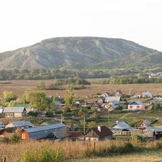
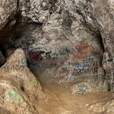
Yuraktau, Mountain summit in Ishimbaysky District, Russia
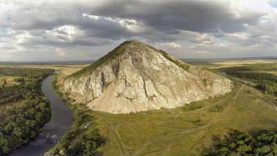
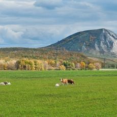
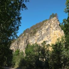
Yuraktau is a summit with a conical shape that rises 338 meters above sea level and extends roughly 1 kilometer in length. The slopes descend at angles between 20 and 30 degrees, while the lower section features natural scree formations.
The mountain formed over 230 million years ago as a reef structure in a tropical sea during the Lower Permian period of the Late Paleozoic era. This geological origin shaped the rock formations visible on the peak today.
The name Yuraktau comes from the Bashkir language, where 'Yüräk tau' means 'heart mountain' and refers to the peak's distinctive silhouette. This reflects how the local people see and name the landscape around them.
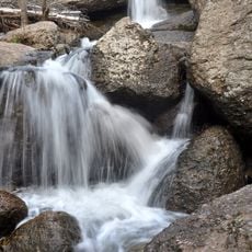
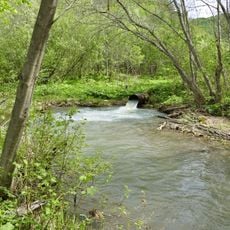
Multiple springs emerge from the northern slope, with one containing sulfur compounds, while Lake Moksha lies at the mountain's base. The Belaya River flows about 220 meters below, shaping the landscape around the peak.
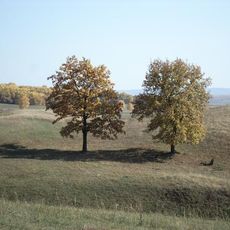
The peak stands prominently above the surrounding terrain, offering wide views over the valley and river below. This makes it an easily recognizable landmark from a distance across the region.
GPS coordinates: 53.74156,56.09679
Latest update: December 8, 2025 13:44
Kushtau
5.4 km
Trataw mountain
20.8 km
Kuk-Karauk waterfall
41.8 km
Sufiya Mosque, Kantyukovka
34.9 km
Lake Beloye
35.2 km
Tabynsky monastery
35.1 km
Babushka-tower, Ishimbay
32.2 km
Salavat Yulayev Cave
39.5 km
Arena Sterlitamak
18.8 kmЗіганівський грот
41.2 km
Kalimoskan rock
39.5 km
Sodovik Stadium
13.7 km
Стерлитамакская государственная филармония
14.2 km
Church of the Theotokos of Kazan
15.9 km
Annunciation convent
18.6 km
Berkhomut
41.8 km
Салаватский историко-краеведческий музей
43.2 km
Samolyot
32.7 km
Kirov Palace of Culture
32.8 km
Park Polyakova in Ishimbay
30.6 km
"Ozodlik" Sterlitamakdagi yodgorlik
17.7 km
Eňeü parkı
31.7 km
Neftyanik stadionu
32.7 km
Zeki Velidi museum in Ishimbaysky District
31.4 km
А. М. Матросов исемендәге Үҙәк мәҙәниәт һәм ял паркы (Ишембай)
33 km
Ишембай заказнигы
36.5 km
Памятник природы регионального значения "Белое озеро"
30.4 km
Әхмәр ҡәберлеге (Ишембай районы)
18.5 kmVisited this place? Tap the stars to rate it and share your experience / photos with the community! Try now! You can cancel it anytime.
Discover hidden gems everywhere you go!
From secret cafés to breathtaking viewpoints, skip the crowded tourist spots and find places that match your style. Our app makes it easy with voice search, smart filtering, route optimization, and insider tips from travelers worldwide. Download now for the complete mobile experience.
A unique approach to discovering new places❞
— Le Figaro
All the places worth exploring❞
— France Info
A tailor-made excursion in just a few clicks❞
— 20 Minutes