Västergötland
Västergötland, Historical province in Västra Götaland County, Sweden
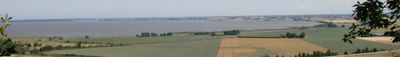
Västergötland is a historical province in Sweden that stretches between lakes Vänern and Vättern, connecting large agricultural plains with more than a dozen table mountains. The landscape shifts between open flatland, forests, and hills that spread across Västra Götaland County.
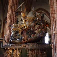
The region was one of the earliest centers of the Swedish kingdom and gained its own bishopric during the 11th century. The medieval legal document from the 13th century carries its name and reflects the political weight of the area.
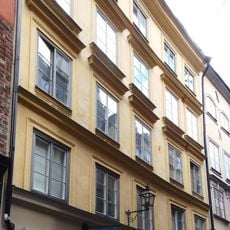
The table mountains are surrounded by villages that show their agricultural roots in traditional red wooden farmhouses. Many place names end in -hem or -köping, pointing to settlements that existed before Christianity reached the area.
The area is best explored by car, as roads connect fields, lakes, and hill ranges. Gothenburg serves as a starting point for trips into other parts of the province.
Hornborgasjön attracts thousands of cranes in spring, stopping on their way north. The plains reveal rock layers from the Silurian, a period about 400 million years ago.
Location: Västra Götaland County
Inception: January 1, 1905
Accessibility: Acceso limitado en silla de ruedas
Operator: Solna stad
Part of: Sweden
Shares border with: Småland, Halland, Bohuslän
Address: Slottsbacken
Opening Hours: Martes, Jueves-Domingo 11:00-17:00; Miércoles 11:00-20:00
Phone: +46510484660
Email: info@lackoslott.se
Website: https://lackoslott.se
GPS coordinates: 57.72800,12.70000
Latest update: December 11, 2025 22:55
Photo license: CC BY-SA 3.0
Storkyrkan
359.1 km
Stortorget
359.1 km
Saint George and the Dragon in Storkyrkan
359.1 km
Nobel Prize Museum
359.1 km
Indebetouska huset
359.1 km
Västerlånggatan 31
359 km
Nobel Library
359.1 km
Obelisk at Slottsbacken
359.2 km
Grillska huset
359.1 km
Stortorgsbrunnen
359.1 km
Schantzska huset
359 km
Hovförvaltningens hus
359.1 km
Uppland Runic Inscription 53
359 km
Seyfridtzska huset
359 km
Trångsund
359.1 km
Trädgårdsgatan
359.2 km
Källargränd
359.1 km
Solgränd
359 km
Trädgårdstvärgränd
359.2 km
Nationalgalleriet
359 km
Ankargränd
359 km
Cornelis Vreeswijk Museum
359.1 km
Statue of Olaus Petri
359.1 km
Palmstedts hus
359 km
Jacob Sauers house
359 km
Rådstugan
359.1 km
Literary sign: Lars Forssell
359.1 km
Storkyrkans gård
359.1 kmVisited this place? Tap the stars to rate it and share your experience / photos with the community! Try now! You can cancel it anytime.
Discover hidden gems everywhere you go!
From secret cafés to breathtaking viewpoints, skip the crowded tourist spots and find places that match your style. Our app makes it easy with voice search, smart filtering, route optimization, and insider tips from travelers worldwide. Download now for the complete mobile experience.
A unique approach to discovering new places❞
— Le Figaro
All the places worth exploring❞
— France Info
A tailor-made excursion in just a few clicks❞
— 20 Minutes