Enable Location

We need your location to show you interesting places around you

Discover nearby places

Find interesting locations and hidden gems around you

Precise directions

Get accurate directions and distances to places

Your location is never shared with other users. It's only used when you tap the location button.

Lindhagensplan

Log in to your account

Start exploring — it's free

Trusted by 63,060 travelers worldwide

Continue with Google
Continue with Apple
or

We will send you a code to connect

By continuing, you accept our Terms and Conditions and our Privacy Policy

Check your inbox

We've sent a pincode in your inbox. Please enter the code below.

Lindhagensplan
Discussion Reviews 1 Photos
1.2k Popularity

Lindhagensplan, Urban bicycle bridge and cycling infrastructure in Stockholm, Sweden

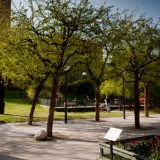
Lindhagensplan is a bicycle bridge with protected cycling lanes in Stockholm that connects western neighborhoods with the city center. The facility clearly separates bicycle traffic from motor vehicles and pedestrians, making daily commutes easier across multiple routes.

The bridge was built in the 1990s as part of Sweden's efforts to make cycling safer and more appealing. Since then it has become a model for integrating cycling infrastructure into heavily trafficked urban areas.

This cycling hub reflects Swedish urban planning principles that prioritize sustainable transportation and equal access for all community members.

Access is straightforward and runs on level ground, so cyclists of all skill levels can use it easily. In rain or snow, riders should adjust their bikes to wet surfaces, and visibility may be reduced during bad weather.

The bridge operates without traffic lights or complex rules and instead relies on physical separation and mutual awareness. This makes the crossing feel more natural and less stressful for cyclists than at traditional signal-controlled intersections.

The community of curious travelers

AroundUs brings together thousands of curated places, local tips, and hidden gems, enriched daily by 60,000 contributors worldwide.

Start exploring
GPS coordinates
59.33169,18.01884
Latest update
December 14, 2025 18:42
Reviews
Share your experience

No review yet

Discussions
Start a discussion...

No discussion yet

« Lindhagensplan - Urban bicycle bridge and cycling infrastructure in Stockholm, Sweden » is provided by Around Us (aroundus.com). Images and texts are derived from Wikimedia project under a Creative Commons license. You are allowed to copy, distribute, and modify copies of this page, under the conditions set by the license, as long as this note is clearly visible.

Discover hidden gems everywhere you go!

From secret cafés to breathtaking viewpoints, skip the crowded tourist spots and find places that match your style. Our app makes it easy with voice search, smart filtering, route optimization, and insider tips from travelers worldwide. Download now for the complete mobile experience.

Around Us App Screenshot

A unique approach to discovering new places

Le Figaro

All the places worth exploring

France Info

A tailor-made excursion in just a few clicks

20 Minutes

Around Us
Travel Guide & Maps
Download

Send to your phone

QR Code
1

Open the camera app on your mobile.

2

Point at the QR code with your camera. A notification will appear.

3

Tap the notification to open the link.