Umphang, Administrative district in western Tak Province, Thailand
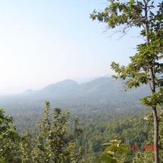
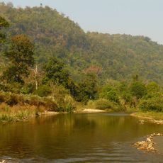
Umphang is an administrative district in western Tak Province covering mountainous terrain across several elevation zones. The area is defined by forested ridges intersected by rivers and ranks among the less densely populated regions of northern Thailand.
The area was originally founded in 1898 as Mae Klong under Uthai Thani Province and received its current name after transferring to Tak Province in 1926. This border region underwent several administrative reorganizations during the early 20th century.
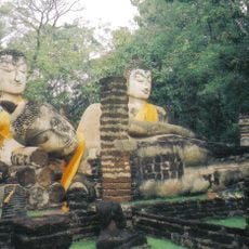
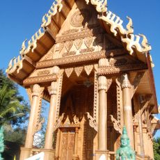
The Karen people shape the area with their traditions and handicrafts, which you can observe in local markets and when visiting villages.
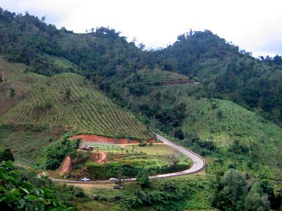
Reaching the district requires driving along the winding Highway 1090 from Mae Sot, a journey that demands patience and attentiveness. Visitors should allow extra time, adjust to mountain road conditions, and plan the drive during daylight hours.
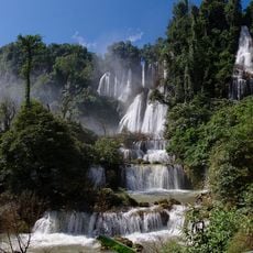
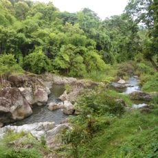
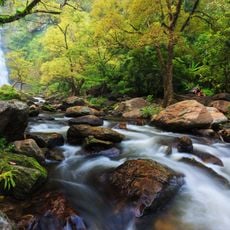
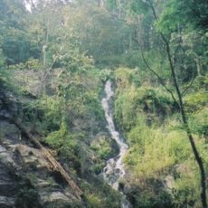
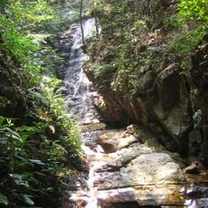
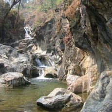
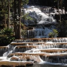
The district is home to a massive waterfall that tumbles over steep rock faces in multiple tiers, drawing visitors from afar. The water cascades down wide and dramatically, located within dense forests and stands as one of the country's most striking natural sights.
Location: Tak
Elevation above the sea: 691 m
GPS coordinates: 16.01667,98.86278
Latest update: December 7, 2025 20:22
Thi Lo Su waterfall
15.4 km
Huai Kha Khaeng Wildlife Sanctuary
76.3 km
Thungyai Naresuan Wildlife Sanctuary
76.3 km
Wat Phra Si Iriyabot
88.1 km
Kamphaeng Phet Historical Park
87.8 km
Uttamanusorn Bridge
106.8 km
Thungyai-Huai Kha Khaeng Wildlife Sanctuaries
76.3 km
Leke
91.8 km
Wat Wang Wiwekaram
108.1 km
Mae Wong National Park
39.8 km
Khlong Lan National Park
38.4 km
Wat Phra Kaeo
87.5 km
Wat Chang Rop
87.6 km
Wat Phra Borom That
86.3 km
Khlong Wang Chao National Park
79.8 km
Taksin Maharat National Park
85.4 km
Lan Sang National Park
86.9 km
Nam Tok Pha Charoen National Park
57.3 km
Kamphaeng Phet Provincial Administrative Organization Stadium
87.1 km
Wat Thai Samakkhi
91.2 km
Wat Khao Nang Thong
101.5 km
Wat Mani Phraison
83.8 km
Wat Chumphon Khiri
84.1 km
Wat Nong Luang
13.7 km
Wat Bang
87.4 km
Mahniyadanar Sandawshin Pagoda
103.2 km
Khlong Lan Waterfall
45.9 km
Phabaung Taung
107.1 kmVisited this place? Tap the stars to rate it and share your experience / photos with the community! Try now! You can cancel it anytime.
Discover hidden gems everywhere you go!
From secret cafés to breathtaking viewpoints, skip the crowded tourist spots and find places that match your style. Our app makes it easy with voice search, smart filtering, route optimization, and insider tips from travelers worldwide. Download now for the complete mobile experience.
A unique approach to discovering new places❞
— Le Figaro
All the places worth exploring❞
— France Info
A tailor-made excursion in just a few clicks❞
— 20 Minutes