Enable Location

We need your location to show you interesting places around you

Discover nearby places

Find interesting locations and hidden gems around you

Precise directions

Get accurate directions and distances to places

Your location is never shared with other users. It's only used when you tap the location button.

Thung Salaeng Luang National Park

Log in to your account

Start exploring — it's free

Trusted by 61,987 travelers worldwide

Continue with Google
Continue with Apple
or

We will send you a code to connect

By continuing, you accept our Terms and Conditions and our Privacy Policy

Check your inbox

We've sent a pincode in your inbox. Please enter the code below.

Thung Salaeng Luang National Park

Thung Salaeng Luang National Park, National park spanning mountainous regions in Phitsanulok and Phetchabun Provinces, Thailand

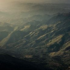
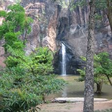
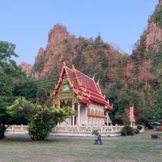
Thung Salaeng Luang is a national park spanning mountainous regions across Phitsanulok and Phetchabun Provinces with diverse topography featuring limestone hills, slate formations, and hardpan soil. Elevations range from 300 to 1,028 meters (984 to 3,373 feet), creating varied landscapes with different vegetation zones.

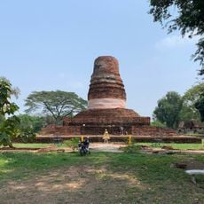
The park was established in 1963 as Thailand's third national park and became significant in regional history. From the late 1960s through the early 1980s, it served as a base for guerrilla fighters, an important chapter in the area's modern past.

The name comes from Strychnos nux-vomica trees that grow throughout the region, reflecting how Thai people traditionally name places after local plants they find important. As you walk through the landscape, you notice these trees scattered across the terrain.

The park is only accessible by private car since no public transportation serves the area and GPS navigation often fails. Plan for longer travel times and verify routes locally before heading out.

Tham Phra Wang Daeng in the western section is Thailand's longest cave system, extending deep underground for several kilometers. This underground formation offers visitors a different experience from the park's surface trails.

The community of curious travelers

AroundUs brings together thousands of curated places, local tips, and hidden gems, enriched daily by 60,000 contributors worldwide.

Start exploring
Inception
January 29, 1963
GPS coordinates
16.82780,100.87000
Latest update
December 9, 2025 18:40
« Thung Salaeng Luang National Park - National park spanning mountainous regions in Phitsanulok and Phetchabun Provinces, Thailand » is provided by Around Us (aroundus.com). Images and texts are derived from Wikimedia project under a Creative Commons license. You are allowed to copy, distribute, and modify copies of this page, under the conditions set by the license, as long as this note is clearly visible.

Discover hidden gems everywhere you go!

From secret cafés to breathtaking viewpoints, skip the crowded tourist spots and find places that match your style. Our app makes it easy with voice search, smart filtering, route optimization, and insider tips from travelers worldwide. Download now for the complete mobile experience.

Around Us App Screenshot

A unique approach to discovering new places

Le Figaro

All the places worth exploring

France Info

A tailor-made excursion in just a few clicks

20 Minutes

Around Us
Travel Guide & Maps
Download

Send to your phone

QR Code
1

Open the camera app on your mobile.

2

Point at the QR code with your camera. A notification will appear.

3

Tap the notification to open the link.