Enable Location

We need your location to show you interesting places around you

Discover nearby places

Find interesting locations and hidden gems around you

Precise directions

Get accurate directions and distances to places

Your location is never shared with other users. It's only used when you tap the location button.

Ürgüp

Log in to your account

Start exploring — it's free

Trusted by 62,473 travelers worldwide

Continue with Google
Continue with Apple
or

We will send you a code to connect

By continuing, you accept our Terms and Conditions and our Privacy Policy

Check your inbox

We've sent a pincode in your inbox. Please enter the code below.

Ürgüp, district in Nevşehir Province, Turkey

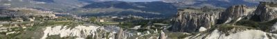
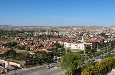
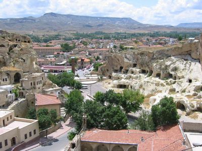
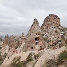
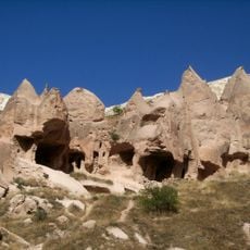
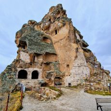
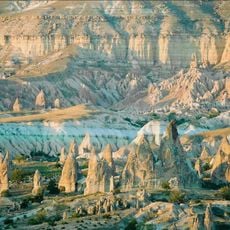
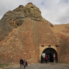
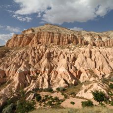
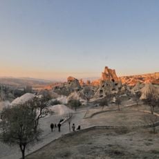
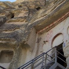
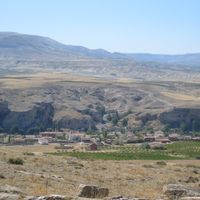
Ürgüp is a town in Nevşehir Province built into and around soft volcanic rock formations characteristic of Cappadocia. The old town center features stone houses with wooden balconies and carved windows, narrow winding streets, and visible cave dwellings carved into the hillsides above the main residential areas.

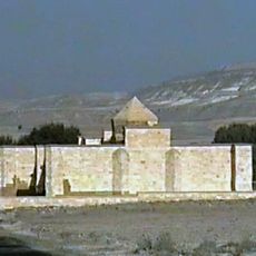
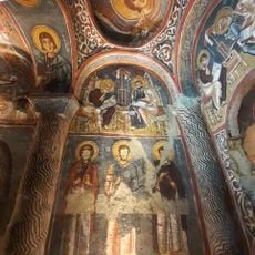
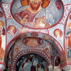
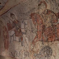
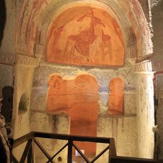
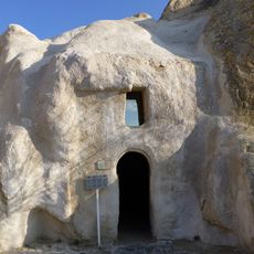
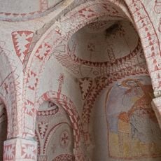
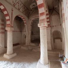
Ürgüp developed as an important religious center during the Byzantine period, with churches and monasteries carved into the rock. The town was also a key point on the Silk Road connecting Istanbul and Jerusalem, which shaped its cultural and commercial importance throughout the medieval period.

Ürgüp takes its name from its Byzantine past as a religious center, and this heritage remains visible in the old churches and stone structures throughout the town. Local crafts such as pottery and weaving are still practiced today, with workshops where visitors can watch artisans at work or try their hand at creating ceramics.

Spring and autumn offer the most comfortable conditions for exploring the town, as the weather is mild and the surrounding landscape is at its best. The town serves as a convenient base from which to spend two to three days visiting main attractions and enjoying local food and wine.

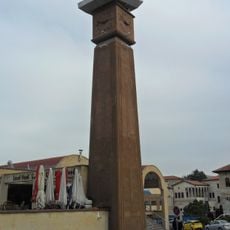
Temenni Hill rises about 80 meters above the town and holds a local tradition where visitors tie cloth strips to trees while making a wish. The hilltop also contains the Saint Georges Church and ancient tombs, and offers a distant view of Erciyes Mountain.

The community of curious travelers

AroundUs brings together thousands of curated places, local tips, and hidden gems, enriched daily by 60,000 contributors worldwide.

Start exploring
Elevation above the sea
1,043 m
GPS coordinates
38.62944,34.91194
Latest update
February 7, 2026 09:31
Administrative divisions
« Ürgüp - district in Nevşehir Province, Turkey » is provided by Around Us (aroundus.com). Images and texts are derived from Wikimedia project under a Creative Commons license. You are allowed to copy, distribute, and modify copies of this page, under the conditions set by the license, as long as this note is clearly visible.

Discover hidden gems everywhere you go!

From secret cafés to breathtaking viewpoints, skip the crowded tourist spots and find places that match your style. Our app makes it easy with voice search, smart filtering, route optimization, and insider tips from travelers worldwide. Download now for the complete mobile experience.

Around Us App Screenshot

A unique approach to discovering new places

Le Figaro

All the places worth exploring

France Info

A tailor-made excursion in just a few clicks

20 Minutes

Around Us
Travel Guide & Maps
Download

Send to your phone

QR Code
1

Open the camera app on your mobile.

2

Point at the QR code with your camera. A notification will appear.

3

Tap the notification to open the link.