Enable Location

We need your location to show you interesting places around you

Discover nearby places

Find interesting locations and hidden gems around you

Precise directions

Get accurate directions and distances to places

Your location is never shared with other users. It's only used when you tap the location button.

Leicestershire

Log in to your account

Start exploring — it's free

Trusted by 61,818 travelers worldwide

Continue with Google
Continue with Apple
or

We will send you a code to connect

By continuing, you accept our Terms and Conditions and our Privacy Policy

Check your inbox

We've sent a pincode in your inbox. Please enter the code below.

Leicestershire

Leicestershire, Ceremonial county in East Midlands, England.

Description

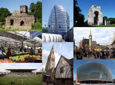
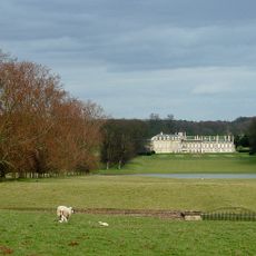
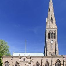
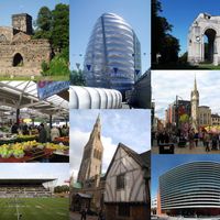
Leicestershire is a ceremonial county in the East Midlands and stretches across gentle hills, farmland, and patches of woodland crossed by several rivers. The county includes urban centers like Leicester and Loughborough as well as numerous villages and market towns scattered across the rural countryside.

History

The county boundaries were documented in the Domesday Book of 1086 and remained largely unchanged afterward. During the Middle Ages trade and craft developed, while the Industrial Revolution later brought textile factories and mining to different parts of the area.

Culture

The name comes from Old English meaning the land of the Ligore, a Celtic tribe living here before the Roman conquest. Today you see pubs and shops everywhere offering traditional dishes from the region, while local markets sell cheese and meat products from centuries-old craft traditions.

Practical

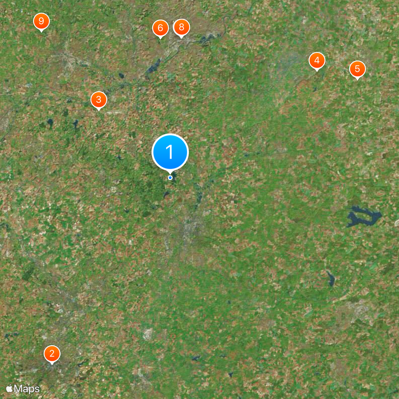
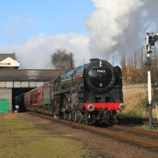
Towns and larger settlements are connected by buses and trains, making day trips and tours around the county possible. Many rural areas are best reached by car, as public connections are less frequent there.

Did you know?

The Charnwood woodland areas in the northwest contain some of the oldest rocks in England, over 600 million years old and formed before complex life emerged. Walkers also find Bardon Hill here, the highest natural point in the county at 278 meters (912 feet) above sea level.

Location
Capital city
Leicester
Shares border with
Rutland, Lincolnshire, Nottinghamshire, Derbyshire, Warwickshire, Northamptonshire
GPS coordinates
52.71667,-1.18333
Latest update
December 16, 2025 14:43

AroundUs brings together thousands of curated places, local tips, and hidden gems, enriched daily by 60,000 contributors worldwide. Discover all places nearby (East Midlands).

Administrative divisions
« Leicestershire - Ceremonial county in East Midlands, England » is provided by Around Us (aroundus.com). Images and texts are derived from Wikimedia project under a Creative Commons license. You are allowed to copy, distribute, and modify copies of this page, under the conditions set by the license, as long as this note is clearly visible.

Discover hidden gems everywhere you go!

From secret cafés to breathtaking viewpoints, skip the crowded tourist spots and find places that match your style. Our app makes it easy with voice search, smart filtering, route optimization, and insider tips from travelers worldwide. Download now for the complete mobile experience.

Around Us App Screenshot

A unique approach to discovering new places

Le Figaro

All the places worth exploring

France Info

A tailor-made excursion in just a few clicks

20 Minutes

Around Us
Travel Guide & Maps
Download

Send to your phone

QR Code
1

Open the camera app on your mobile.

2

Point at the QR code with your camera. A notification will appear.

3

Tap the notification to open the link.