Enable Location

We need your location to show you interesting places around you

Discover nearby places

Find interesting locations and hidden gems around you

Precise directions

Get accurate directions and distances to places

Your location is never shared with other users. It's only used when you tap the location button.

Pennines

Log in to your account

Start exploring — it's free

Trusted by 67,497 travelers worldwide

Continue with Google
Continue with Apple
or

We will send you a code to connect

By continuing, you accept our Terms and Conditions and our Privacy Policy

Check your inbox

We've sent a pincode in your inbox. Please enter the code below.

Pennines
Discussion Reviews 2 Photos
153k Popularity

Pennines, Mountain range in Northern England.

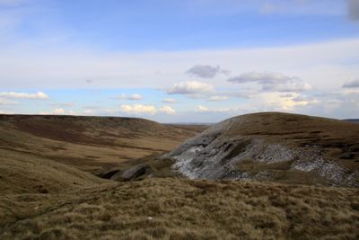
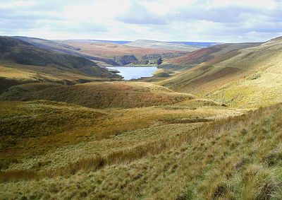
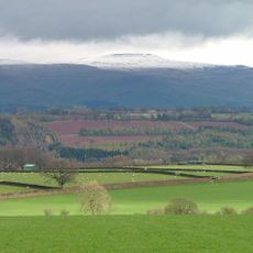
The Pennines are a mountain range in northern England extending 400 kilometers from the Peak District to the Scottish border, forming a natural division between the northeast and northwest. The chain consists mainly of moorland, heathland, and open grassland cut by deep valleys with rivers and streams.

Bronze Age inhabitants constructed stone circles and henges here, leaving traces of their settlements across the mountainous terrain. Later, Roman troops used the valleys as through routes and built roads that some modern paths still follow today.

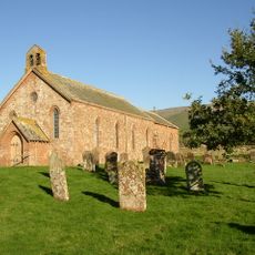
Shepherds shaped this area over centuries by building dry stone walls that still cross fields and pastures today. Many villages along the slopes preserve their architecture of local sandstone and slate, giving settlements a consistent grey appearance.

Multiple long-distance trails cross this mountain range, including the Pennine Way, which allows hikers to traverse the entire length from south to north. Weather changes quickly, so visitors should bring warm clothing and waterproof gear even in summer.

The limestone geology creates underground cave networks throughout much of the area, with numerous natural chambers and water-carved passages beneath the surface. Some of these caves shelter rare bat species that overwinter in the cool damp conditions.

The community of curious travelers

AroundUs brings together thousands of curated places, local tips, and hidden gems, enriched daily by 60,000 contributors worldwide.

Start exploring
Location
Elevation above the sea
893 m
GPS coordinates
54.70414,-2.48218
Latest update
December 14, 2025 20:59
Around this place
Cross Fell
United Kingdom

Cross Fell

321 m
Great Dun Fell
United Kingdom

Great Dun Fell

3 km
Church of St Lawrence
United Kingdom

Church of St Lawrence

4.8 km
Howgill Castle
United Kingdom

Howgill Castle

5.7 km
United Kingdom

Maiden Way Roman Road, Melmerby Fell from Bank Rigg northwards to Rowgill Burn

4.2 km
United Kingdom

Prehistoric hut circle settlement, associated field system and a medieval shieling 2.35km south west of Great Dun Fell radio tra

4.1 km
United Kingdom

Barns, Byres, Wagon Sheds And Saw Mill To North East Of Howgill Castle

5.7 km
United Kingdom

Hanging Walls of Mark Anthony

4.4 km
United Kingdom

Upper Slatesike lead mine and ore works, 750m north east of Black Dub

1.9 km
United Kingdom

Cashwell hush and lead mining remains

2.5 km
United Kingdom

Townhead lime kilns and associated features including part of a tramway on Rusby Hill and Ladslack Hill

4.2 km
United Kingdom

Silverband mine aerial ropeway, brake house and inclined plane

3.7 km
United Kingdom

Cross To South Of St Lawrence's Church

4.8 km
United Kingdom

Waterfall

1.3 km
United Kingdom

Greencastle

4 km
United Kingdom

Gate Piers To South East Of Howgill Castle

5.8 km
United Kingdom

Blackburn Shop (Ancient Sheiling)

3.4 km
United Kingdom

Tees Head

1 km
United Kingdom

Cash Force

4.4 km
United Kingdom

Boundary Stone On North Side Of Road Between Flosh Farm And The Church Of All Saints

5 km
United Kingdom

Waterfall

4.7 km
United Kingdom

Waterfall

4.8 km
United Kingdom

Waterfall

4.7 km
United Kingdom

Waterfall

4.6 km
United Kingdom

Waterfall

4.5 km
United Kingdom

Lime Kiln

4.2 km
United Kingdom

Lime kiln

2.9 km
United Kingdom

Lime Kiln

2.9 km
Show the full map
Reviews
Share your experience

No review yet

Discussions
Start a discussion...

No discussion yet

« Pennines - Mountain range in Northern England » is provided by Around Us (aroundus.com). Images and texts are derived from Wikimedia project under a Creative Commons license. You are allowed to copy, distribute, and modify copies of this page, under the conditions set by the license, as long as this note is clearly visible.

Discover hidden gems everywhere you go!

From secret cafés to breathtaking viewpoints, skip the crowded tourist spots and find places that match your style. Our app makes it easy with voice search, smart filtering, route optimization, and insider tips from travelers worldwide. Download now for the complete mobile experience.

Around Us App Screenshot

A unique approach to discovering new places

Le Figaro

All the places worth exploring

France Info

A tailor-made excursion in just a few clicks

20 Minutes

Around Us
Travel Guide & Maps
Download

Send to your phone

QR Code
1

Open the camera app on your mobile.

2

Point at the QR code with your camera. A notification will appear.

3

Tap the notification to open the link.