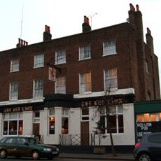
Greenford, Residential suburb in West London, England.
Greenford is a residential suburb in the northern part of the London Borough of Ealing, featuring a mix of houses and apartment buildings. Horsenden Hill, the highest point in the area, rises approximately 85 meters and offers views across the neighborhood.
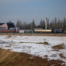
The settlement was first recorded in 848 as Grenan forda, meaning a ford near green fields. Industrial development in the 19th century transformed it from a rural outpost into a modern suburb with factories and urban expansion.
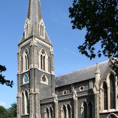
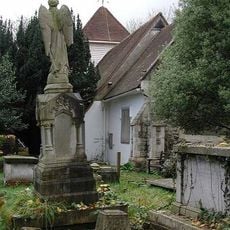
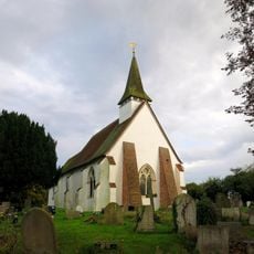
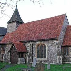
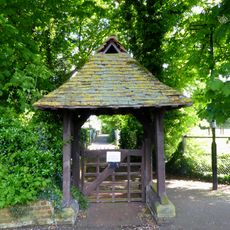
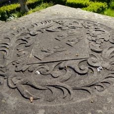
The Parish Church of Holy Cross, a Gothic structure from the 14th century, anchors the local community and serves as a focal point for residents. Its churchyard and surrounding green spaces provide a quiet retreat within the residential area.
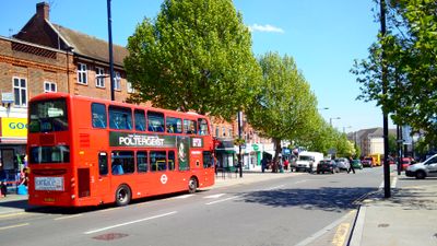
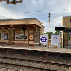
The area has its own Central Line underground station, providing quick connections to central London. Multiple bus routes run through the neighborhood, linking it to surrounding areas and shopping centers.
William Perkin founded the first synthetic dye factory here in 1856, pioneering the modern organic chemistry industry. This groundbreaking production made the area a center for chemical innovation worldwide.
Location: London Borough of Ealing
Shares border with: Dormers Wells
GPS coordinates: 51.52990,-0.36280
Latest update: December 17, 2025 08:33
Windmill Bridge
2.9 km
Wharncliffe Viaduct
2.5 km
Southall Railway Centre
2.7 km
London Motorcycle Museum
585 m
St. Mary's Church, Hanwell
2.1 km
St Mary's Perivale
2.8 kmPerivale Wood
2.6 km
St Mary the Virgin, Northolt
1.6 km
Northolt Manor
1.6 km
Litten Nature Reserve
850 m
Down Barns Moated Site
3 km
Palace Cinema
2.3 km
Parish Church of the Holy Cross (old Church), Greenford
1.1 km
Church of St George
2.4 km
Holy Cross New Church, Greenford
1.1 km
Church of St Barnabas
2.4 km
Water Pump (On The South Side Of West Middlesex Golf Course, Nearly Opposite Lyndhurst Avenue)
2.1 km
Hanwell Community Centre
2.1 km
Hanwell Bridge
2.8 km
The Water Tower
3 km
Red Lion Public House
2.2 km
Greenford War Memorial
533 m
Lych Gate To North West Of Church Of St Mary The Virgin
2.8 km
Stable Block At Brent Lodge Park
2.1 km
Colleton Tomb, St Mary The Virgin Churchyard
2.8 km
Main Up Side Building and Downside Island Platform at Hanwell Station
2.6 km
Hanwell flight of locks and brick boundary wall of St Bernard's Hospital
3 km
Entrance Archway And 2 Lodges, (One Each Side Of Entrance) To St Bernard's Hospital
2.5 kmVisited this place? Tap the stars to rate it and share your experience / photos with the community! Try now! You can cancel it anytime.
Discover hidden gems everywhere you go!
From secret cafés to breathtaking viewpoints, skip the crowded tourist spots and find places that match your style. Our app makes it easy with voice search, smart filtering, route optimization, and insider tips from travelers worldwide. Download now for the complete mobile experience.
A unique approach to discovering new places❞
— Le Figaro
All the places worth exploring❞
— France Info
A tailor-made excursion in just a few clicks❞
— 20 Minutes