Enable Location

We need your location to show you interesting places around you

Discover nearby places

Find interesting locations and hidden gems around you

Precise directions

Get accurate directions and distances to places

Your location is never shared with other users. It's only used when you tap the location button.

Montgomery County

Log in to your account

Start exploring — it's free

Trusted by 62,994 travelers worldwide

Continue with Google
Continue with Apple
or

We will send you a code to connect

By continuing, you accept our Terms and Conditions and our Privacy Policy

Check your inbox

We've sent a pincode in your inbox. Please enter the code below.

Discussion Reviews 1 Photos
12.5k Popularity

Montgomery County, Administrative county in central Kentucky, United States.

Montgomery County is an administrative county in central Kentucky with Mount Sterling as its seat. The area sits between Lexington to the west and the Appalachian foothills to the east.

The county was established in 1796, roughly 17 years after the first settlers arrived in the Mount Sterling area around 1779. This early settlement shaped how the region grew during westward expansion.

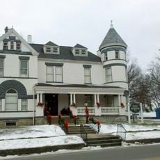
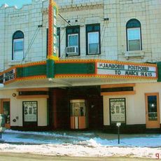
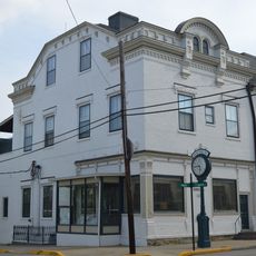
The Gateway Regional Arts Center displays works by local artists and hosts classes in a historic building on the National Register. Visitors can see what today's regional art scene looks like and experience how the community gathers around creative activities.

Visitors can reach the area via Interstate 64 and US Route 60, which link it to Lexington in the west or Huntington, West Virginia in the east. Spring and summer months offer the most pleasant conditions for exploring the area.

Court Day, held every third Monday in October, draws around 130,000 people who buy and sell art, crafts, and goods throughout the streets and public spaces. This trade and arts festival has grown into one of the county's defining events over more than 200 years.

The community of curious travelers

AroundUs brings together thousands of curated places, local tips, and hidden gems, enriched daily by 60,000 contributors worldwide.

Start exploring
Location
Inception
December 14, 1796
Capital city
Mount Sterling
Shares border with
Nicholas County, Bath County, Menifee County, Powell County, Clark County, Bourbon County
GPS coordinates
38.03000,-83.91000
Latest update
December 7, 2025 20:44
Around this place
Cane Ridge
United States of America

Cane Ridge

29.1 km
United States of America

Pilot Knob State Nature Preserve

13.4 km
Goshen Primitive Baptist Church
United States of America

Goshen Primitive Baptist Church

14.2 km
Bluegrass Heritage Museum
United States of America

Bluegrass Heritage Museum

24 km
Old Providence Church
United States of America

Old Providence Church

31.2 km
Confederate Monument of Mt. Sterling
United States of America

Confederate Monument of Mt. Sterling

3.5 km
Mound Hill Archaeological Site
United States of America

Mound Hill Archaeological Site

21 km
Clark Mansion
United States of America

Clark Mansion

24.8 km
Clark County Court House
United States of America

Clark County Court House

23.9 km
KEAS Tabernacle Christian Methodist Episcopal Church
United States of America

KEAS Tabernacle Christian Methodist Episcopal Church

3.8 km
Leeds Center for the Arts
United States of America

Leeds Center for the Arts

23.7 km
Enoch Smith House
United States of America

Enoch Smith House

5.2 km
William Hickman House
United States of America

William Hickman House

24.1 km
Confederate Monument in Owingsville
United States of America

Confederate Monument in Owingsville

18.2 km
Methodist Episcopal Church South
United States of America

Methodist Episcopal Church South

4.2 km
Church of the Ascension
United States of America

Church of the Ascension

4.2 km
Walker Buckner House
United States of America

Walker Buckner House

27.1 km
Corinth Christian Methodist Episcopal Church
United States of America

Corinth Christian Methodist Episcopal Church

13.5 km
Raccoon John Smith House
United States of America

Raccoon John Smith House

17.7 km
Thomas Deye Owings House
United States of America

Thomas Deye Owings House

18 km
Snow Hill
United States of America

Snow Hill

23.3 km
Bybee House
United States of America

Bybee House

27.3 km
J.J. Nesbitt House
United States of America

J.J. Nesbitt House

17.8 km
Clay City National Bank Building
United States of America

Clay City National Bank Building

18.9 km
Owingsville Commercial District and Courthouse Square
United States of America

Owingsville Commercial District and Courthouse Square

18.1 km
Erasmus Riggs House
United States of America

Erasmus Riggs House

29.1 km
Thomas A. Dorsey Farmhouse
United States of America

Thomas A. Dorsey Farmhouse

32.7 km
Double Arch
United States of America

Double Arch

29.2 km
Show the full map
Reviews
Share your experience

No review yet

Discussions
Start a discussion...

No discussion yet

« Montgomery County - Administrative county in central Kentucky, United States » is provided by Around Us (aroundus.com). Images and texts are derived from Wikimedia project under a Creative Commons license. You are allowed to copy, distribute, and modify copies of this page, under the conditions set by the license, as long as this note is clearly visible.

Discover hidden gems everywhere you go!

From secret cafés to breathtaking viewpoints, skip the crowded tourist spots and find places that match your style. Our app makes it easy with voice search, smart filtering, route optimization, and insider tips from travelers worldwide. Download now for the complete mobile experience.

Around Us App Screenshot

A unique approach to discovering new places

Le Figaro

All the places worth exploring

France Info

A tailor-made excursion in just a few clicks

20 Minutes

Around Us
Travel Guide & Maps
Download

Send to your phone

QR Code
1

Open the camera app on your mobile.

2

Point at the QR code with your camera. A notification will appear.

3

Tap the notification to open the link.