Enable Location

We need your location to show you interesting places around you

Discover nearby places

Find interesting locations and hidden gems around you

Precise directions

Get accurate directions and distances to places

Your location is never shared with other users. It's only used when you tap the location button.

Log in to your account

Start exploring — it's free

Trusted by 66,171 travelers worldwide

Continue with Google
Continue with Apple
or

We will send you a code to connect

By continuing, you accept our Terms and Conditions and our Privacy Policy

Check your inbox

We've sent a pincode in your inbox. Please enter the code below.

Pilot Knob State Nature Preserve
Discussion Reviews Photo
3.5k Popularity

Pilot Knob State Nature Preserve, State nature preserve in Powell County, Kentucky.

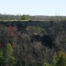
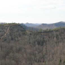
Pilot Knob State Nature Preserve is a state nature preserve in Powell County, near Stanton, Kentucky. The land is covered in oak-hickory forest and crossed by several hiking trails of different lengths and difficulty levels.

In 1769, explorers used this elevated spot as a viewpoint to survey the Kentucky landscape. Its position made it a useful reference point during the early exploration of the region.

The Kentucky Ornithological Society lists this site as a key spot for bird watching in Eastern Kentucky. Visitors who walk the trails in the early morning hours are likely to spot a wide range of songbirds and raptors.

The preserve is best explored on foot, and the trails vary from easy loops on lower ground to steeper sections near the summit. Sturdy footwear is a good idea, especially if you plan to reach the top.

The sandstone at the summit is over 250 million years old and holds traces of a prehistoric river system that once ran through this area. These ancient layers are visible on the surface and easy to spot during the hike.

The community of curious travelers

AroundUs brings together thousands of curated places, local tips, and hidden gems, enriched daily by 60,000 contributors worldwide.

Start exploring
GPS coordinates
37.91100,-83.93600
Latest update
March 3, 2026 13:58
Around this place
Fort Boonesborough State Park
United States of America

Fort Boonesborough State Park

29.2 km
Furnace Mountain
United States of America

Furnace Mountain

17.8 km
Goshen Primitive Baptist Church
United States of America

Goshen Primitive Baptist Church

16.9 km
Fort Boonesborough State Park
United States of America

Fort Boonesborough State Park

29 km
Bluegrass Heritage Museum
United States of America

Bluegrass Heritage Museum

23 km
Old Providence Church
United States of America

Old Providence Church

27.4 km
Confederate Monument of Mt. Sterling
United States of America

Confederate Monument of Mt. Sterling

16.2 km
Mound Hill Archaeological Site
United States of America

Mound Hill Archaeological Site

27 km
Clark Mansion
United States of America

Clark Mansion

23.7 km
Clark County Court House
United States of America

Clark County Court House

23.1 km
KEAS Tabernacle Christian Methodist Episcopal Church
United States of America

KEAS Tabernacle Christian Methodist Episcopal Church

16.1 km
Leeds Center for the Arts
United States of America

Leeds Center for the Arts

23 km
Enoch Smith House
United States of America

Enoch Smith House

15.9 km
William Hickman House
United States of America

William Hickman House

23.2 km
Ravenna Motor Vehicle Service Building
United States of America

Ravenna Motor Vehicle Service Building

25.3 km
Confederate Monument in Owingsville
United States of America

Confederate Monument in Owingsville

30 km
Methodist Episcopal Church South
United States of America

Methodist Episcopal Church South

16.5 km
Church of the Ascension
United States of America

Church of the Ascension

16.3 km
Corinth Christian Methodist Episcopal Church
United States of America

Corinth Christian Methodist Episcopal Church

14.5 km
Raccoon John Smith House
United States of America

Raccoon John Smith House

29.8 km
Thomas Deye Owings House
United States of America

Thomas Deye Owings House

30 km
Irvine Historic Business District
United States of America

Irvine Historic Business District

23.8 km
Irvine Grade School
United States of America

Irvine Grade School

23.8 km
Bybee House
United States of America

Bybee House

21.8 km
J.J. Nesbitt House
United States of America

J.J. Nesbitt House

29.9 km
Clay City National Bank Building
United States of America

Clay City National Bank Building

5.8 km
Natural Bridge State Resort Park
United States of America

Natural Bridge State Resort Park

26 km
Double Arch
United States of America

Double Arch

23.6 km
Show the full map
Reviews
Share your experience

No review yet

Discussions
Start a discussion...

No discussion yet

« Pilot Knob State Nature Preserve - State nature preserve in Powell County, Kentucky » is provided by Around Us (aroundus.com). Images and texts are derived from Wikimedia project under a Creative Commons license. You are allowed to copy, distribute, and modify copies of this page, under the conditions set by the license, as long as this note is clearly visible.

Discover hidden gems everywhere you go!

From secret cafés to breathtaking viewpoints, skip the crowded tourist spots and find places that match your style. Our app makes it easy with voice search, smart filtering, route optimization, and insider tips from travelers worldwide. Download now for the complete mobile experience.

Around Us App Screenshot

A unique approach to discovering new places

Le Figaro

All the places worth exploring

France Info

A tailor-made excursion in just a few clicks

20 Minutes

Around Us
Travel Guide & Maps
Download

Send to your phone

QR Code
1

Open the camera app on your mobile.

2

Point at the QR code with your camera. A notification will appear.

3

Tap the notification to open the link.