Enable Location

We need your location to show you interesting places around you

Discover nearby places

Find interesting locations and hidden gems around you

Precise directions

Get accurate directions and distances to places

Your location is never shared with other users. It's only used when you tap the location button.

Elk County

Log in to your account

Start exploring — it's free

Trusted by 61,506 travelers worldwide

Continue with Google
Continue with Apple
or

We will send you a code to connect

By continuing, you accept our Terms and Conditions and our Privacy Policy

Check your inbox

We've sent a pincode in your inbox. Please enter the code below.

Elk County, County in southeast Kansas, United States.

Description

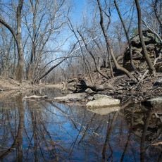
Elk County is an administrative division in southeast Kansas with rolling grasslands and limestone outcrops scattered throughout its territory. The Elk River winds through the region, creating a landscape of open plains dotted with farmland and rural settlements.

History

The territory officially became a county on March 25, 1875, and was named after the Elk River that flows through its southeastern section. This establishment was part of the broader settlement and administrative organization of Kansas during the late 1800s.

Culture

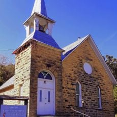
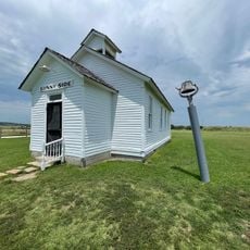
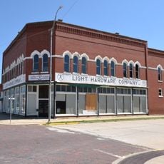
Five communities - Howard, Longton, Moline, Grenola, and Elk Falls - reflect how rural life is organized across the county, with each town maintaining its own character and local traditions. Walking through these places, you notice how residents are connected to the land and to each other through long-standing habits and community bonds.

Practical

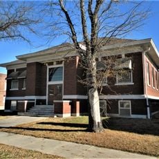
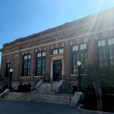
County offices including the driver's license department and treasurer's office are located at the administrative center in Howard. It is best to call ahead since these offices typically operate by appointment rather than regular walk-in hours.

Did you know?

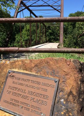
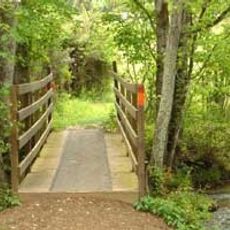
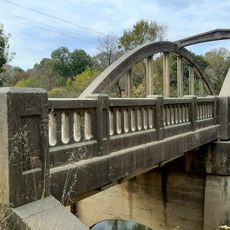
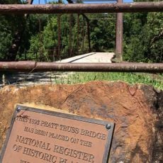
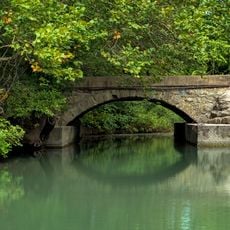
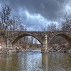
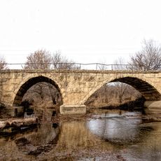
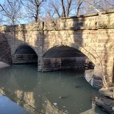
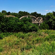
The oldest suspension bridge in Kansas stands within this county, showcasing early engineering efforts in the region. In addition, the Flint Oak Hunting Club draws hunters from across North America, demonstrating how the area has gained recognition beyond its borders.

Location
Inception
March 3, 1875
Capital city
Howard
Shares border with
Greenwood County, Chautauqua County, Wilson County, Montgomery County, Cowley County, Butler County
GPS coordinates
37.45000,-96.23330
Latest update
December 10, 2025 16:02

AroundUs brings together thousands of curated places, local tips, and hidden gems, enriched daily by 60,000 contributors worldwide. Discover all places nearby (Kansas).

Around this place
Hulah Lake
United States of America

Hulah Lake

58.7 km
Elk City State Park
United States of America

Elk City State Park

46.3 km
El Dorado State Park
United States of America

El Dorado State Park

65.9 km
Cross Timbers State Park
United States of America

Cross Timbers State Park

44 km
Norman No. 1 Oil Well
United States of America

Norman No. 1 Oil Well

49.7 km
Independence Public Library
United States of America

Independence Public Library

53.2 km
Beaumont St. Louis and San Francisco Railroad Water Tank
United States of America

Beaumont St. Louis and San Francisco Railroad Water Tank

34.9 km
Greenwood Hotel
United States of America

Greenwood Hotel

41.7 km
Booth Theater
United States of America

Booth Theater

52.9 km
Booth Hotel
United States of America

Booth Hotel

52.9 km
Gold Dust Hotel
United States of America

Gold Dust Hotel

37.2 km
Robertson House
United States of America

Robertson House

41.7 km
Brown Hotel
United States of America

Brown Hotel

49 km
Niotaze Methodist Episcopal Church
United States of America

Niotaze Methodist Episcopal Church

46.5 km
Little House On The Prairie Museum
United States of America

Little House On The Prairie Museum

50.4 km
Cedar Creek Bridge
United States of America

Cedar Creek Bridge

49.1 km
Elk Falls Pratt Truss Bridge
United States of America

Elk Falls Pratt Truss Bridge

9.5 km
Eureka Carnegie Library
United States of America

Eureka Carnegie Library

42 km
East Badger Creek Culvert
United States of America

East Badger Creek Culvert

65.3 km
Esch's Spur Bridge
United States of America

Esch's Spur Bridge

59.8 km
Silver Creek Bridge
United States of America

Silver Creek Bridge

60.6 km
Brush Creek Bridge
United States of America

Brush Creek Bridge

39.1 km
Stockbrands and Kemmerer Department Store
United States of America

Stockbrands and Kemmerer Department Store

65.2 km
Little Walnut River Pratt Truss Bridge
United States of America

Little Walnut River Pratt Truss Bridge

63.1 km
Dewlen-Spohnhauer Bridge
United States of America

Dewlen-Spohnhauer Bridge

55.1 km
Independence Historical Museum & Art Center
United States of America

Independence Historical Museum & Art Center

52.8 km
Swimming Beach
United States of America

Swimming Beach

58.5 km
Independence Downtown Historic District
United States of America

Independence Downtown Historic District

53 km
Show the full map
Administrative divisions
« Elk County - County in southeast Kansas, United States » is provided by Around Us (aroundus.com). Images and texts are derived from Wikimedia project under a Creative Commons license. You are allowed to copy, distribute, and modify copies of this page, under the conditions set by the license, as long as this note is clearly visible.

Discover hidden gems everywhere you go!

From secret cafés to breathtaking viewpoints, skip the crowded tourist spots and find places that match your style. Our app makes it easy with voice search, smart filtering, route optimization, and insider tips from travelers worldwide. Download now for the complete mobile experience.

Around Us App Screenshot

A unique approach to discovering new places

Le Figaro

All the places worth exploring

France Info

A tailor-made excursion in just a few clicks

20 Minutes

Around Us
Travel Guide & Maps
Download

Send to your phone

QR Code
1

Open the camera app on your mobile.

2

Point at the QR code with your camera. A notification will appear.

3

Tap the notification to open the link.