Cherokee County

Log in to your account

AroundUs is a community-driven map of interesting places, built by curious explorers like you. It grows with every review, story, and photo you share.
Connect to save your favorite spots, contribute locations, and create personalized routes.
Continue with Google
Continue with Apple
Continue with X
Continue with Facebook
Continue with email
By continuing, you accept our Terms and Conditions and our Privacy Policy
Create an account
Add to collection
Map
Suggest a change
Share

Cherokee County, Administrative county in southeastern Kansas, United States

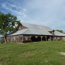
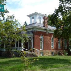
Cherokee County is an administrative county in southeastern Kansas that borders Missouri and Oklahoma. The area encompasses several small towns and rural communities spread across its jurisdiction.

The county was officially established on August 30, 1855, during Kansas's territorial period before statehood. This marked a time of significant change as the region experienced westward settlement and development.

The County Commissioners maintain regular public meetings in Columbus, fostering community participation in local governance and decision-making processes.

Visitors and residents can access basic services at the County Clerk's office, including voter registration and hunting license applications. The town of Columbus serves as the administrative center.

The Emergency Management Department coordinates responses across three state boundaries, creating specialized protocols for multi-jurisdictional incidents.

Location: Kansas

Inception: August 30, 1855

Capital city: Columbus

Shares border with: Crawford County, Ottawa County, Labette County, Craig County, Newton County, Jasper County

Website: http://CherokeeCountyKS.com

GPS coordinates: 37.16670,-94.85000

Latest update: December 7, 2025 20:25

Photos
Around this place
Ghost light
United States of America

Ghost light

30.9 km
Big Brutus
United States of America

Big Brutus

14.3 km
Rainbow Bridge
United States of America

Rainbow Bridge

14.2 km
Kan-O-Tex Service Station
United States of America

Kan-O-Tex Service Station

21.1 km
Fifth and Main Historic District
United States of America

Fifth and Main Historic District

30.9 km
John Patrick McNaughton Barn
United States of America

John Patrick McNaughton Barn

30.4 km
Scottish Rite Cathedral
United States of America

Scottish Rite Cathedral

30.9 km
Pittsburg Public Library
United States of America

Pittsburg Public Library

30 km
Joplin Downtown Historic District
United States of America

Joplin Downtown Historic District

31.2 km
Oswego Public Library
United States of America

Oswego Public Library

22.9 km
Baxter Springs Independent Oil and Gas Service Station
United States of America

Baxter Springs Independent Oil and Gas Service Station

18.7 km
Edgar Backus Schermerhorn House
United States of America

Edgar Backus Schermerhorn House

22.6 km
Johnston Library
United States of America

Johnston Library

18.6 km
Joplin Supply Company
United States of America

Joplin Supply Company

31 km
Fox Theatre
United States of America

Fox Theatre

31.1 km
Olivia Apartments
United States of America

Olivia Apartments

30.7 km
Joplin Carnegie Library
United States of America

Joplin Carnegie Library

31.1 km
Rial A. Niles House
United States of America

Rial A. Niles House

19.3 km
Elks Club Lodge No. 501
United States of America

Elks Club Lodge No. 501

30.9 km
Statue of Mickey Mantle
United States of America

Statue of Mickey Mantle

27 km
Ridgway Apartments
United States of America

Ridgway Apartments

30.7 km
Columbus Public Carnegie Library
United States of America

Columbus Public Carnegie Library

902 m
Gentry Apartments
United States of America

Gentry Apartments

30.9 km
South Main Street Historic District
United States of America

South Main Street Historic District

31.1 km
Everett J. Ritchie Tri-State Mineral Museum
United States of America

Everett J. Ritchie Tri-State Mineral Museum

28 km
Galena Mining & Historical Museum
United States of America

Galena Mining & Historical Museum

21.1 km
Fox Theater
United States of America

Fox Theater

30.1 km
Allen's Fillin' Station
United States of America

Allen's Fillin' Station

26.1 km
Show the full map
Reviews

Visited this place? Tap the stars to rate it and share your experience / photos with the community! Try now! You can cancel it anytime.

Administrative divisions
« Cherokee County - Administrative county in southeastern Kansas, United States » is provided by Around Us (aroundus.com). Images and texts are derived from Wikimedia project under a Creative Commons license. You are allowed to copy, distribute, and modify copies of this page, under the conditions set by the license, as long as this note is clearly visible.

Discover hidden gems everywhere you go!

From secret cafés to breathtaking viewpoints, skip the crowded tourist spots and find places that match your style. Our app makes it easy with voice search, smart filtering, route optimization, and insider tips from travelers worldwide. Download now for the complete mobile experience.

Around Us App Screenshot

A unique approach to discovering new places

Le Figaro

All the places worth exploring

France Info

A tailor-made excursion in just a few clicks

20 Minutes