Wabaunsee County

Log in to your account

AroundUs is a community-driven map of interesting places, built by curious explorers like you. It grows with every review, story, and photo you share.
Connect to save your favorite spots, contribute locations, and create personalized routes.
Continue with Google
Continue with Apple
Continue with X
Continue with Facebook
Continue with email
By continuing, you accept our Terms and Conditions and our Privacy Policy
Create an account
Add to collection
Map
Suggest a change
Share

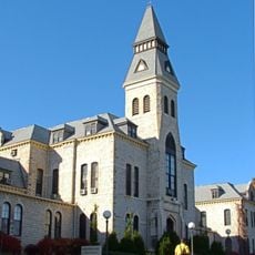
Wabaunsee County, Administrative county in eastern Kansas, United States.

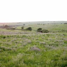
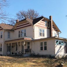
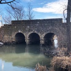
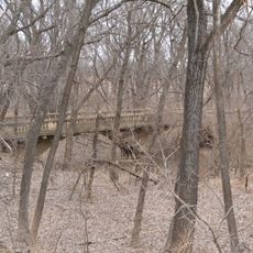
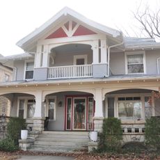
Wabaunsee County is an administrative area in eastern Kansas with rolling hills, prairie grasslands, and waterways throughout. The county seat of Alma serves as the administrative hub, while Lake Wabaunsee near Eskridge is a notable water feature in the landscape.

The county was established in 1855 and named after Potawatomi Chief Waubonsie, whose name translates to dawn of day in the Potawatomi language. It became a focal point for conflicts over Kansas' future in the decades preceding the Civil War.

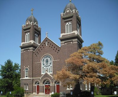
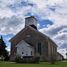
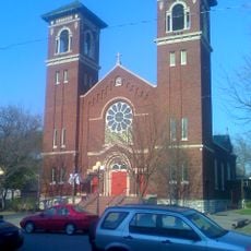
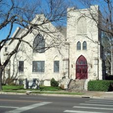
The Beecher Bible and Rifle Church shows the county's role in the free-state movement before the Civil War. This building stands as a witness to the struggles over Kansas' future during that era.

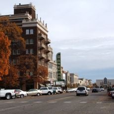
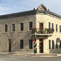
Alma provides administrative services for residents and visitors, including information and permits. The lake and rural landscape are best explored by car, and understanding local roads helps with planning your route through the county.

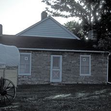
During World War II, Lake Wabaunsee hosted a German prisoner of war camp where detainees worked on local agricultural and infrastructure projects. This chapter of the county's story often goes unnoticed by visitors today.

Location: Kansas

Inception: 1855

Capital city: Alma

Shares border with: Pottawatomie County, Lyon County, Shawnee County, Osage County, Riley County, Morris County, Geary County

Website: http://Wabaunsee.KansasGov.com

GPS coordinates: 39.01861,-96.29250

Latest update: December 10, 2025 15:53

Photos
Around this place
Johnny Kaw
United States of America

Johnny Kaw

30.2 km
World War I Memorial Stadium
United States of America

World War I Memorial Stadium

31.4 km
Konza Prairie
United States of America

Konza Prairie

24.5 km
Beecher Bible and Rifle Church
United States of America

Beecher Bible and Rifle Church

14.7 km
Flint Hills Discovery Center
United States of America

Flint Hills Discovery Center

29.1 km
Hale Library
United States of America

Hale Library

31.4 km
United States of America

St. Mary's Mission

27.7 km
Oz Museum
United States of America

Oz Museum

20.5 km
Anderson Hall
United States of America

Anderson Hall

31.3 km
Seven Dolors Catholic Church
United States of America

Seven Dolors Catholic Church

29.5 km
Seaton Hall
United States of America

Seaton Hall

31.5 km
Pottawatomie Indian Pay Station
United States of America

Pottawatomie Indian Pay Station

27.7 km
First Congregational Church
United States of America

First Congregational Church

29.9 km
Dickens Hall
United States of America

Dickens Hall

31.3 km
Manhattan Carnegie Library Building
United States of America

Manhattan Carnegie Library Building

29.5 km
Security State Bank
United States of America

Security State Bank

23.8 km
Downtown Manhattan Historic District
United States of America

Downtown Manhattan Historic District

29.3 km
Paxico Historic District
United States of America

Paxico Historic District

11.9 km
Alma Downtown Historic District
United States of America

Alma Downtown Historic District

672 m
George and Virginia Trout House
United States of America

George and Virginia Trout House

20.7 km
E. A. and Ura Wharton House
United States of America

E. A. and Ura Wharton House

29.7 km
Cassius & Adelia Baker House
United States of America

Cassius & Adelia Baker House

20.7 km
Bluemont Hall
United States of America

Bluemont Hall

31.2 km
Woman's Club House
United States of America

Woman's Club House

29.9 km
Stuewe House
United States of America

Stuewe House

378 m
Southeast Stone Arch Bridge
United States of America

Southeast Stone Arch Bridge

20.5 km
McCauley Bridge
United States of America

McCauley Bridge

43.5 km
Houston and Pierre Streets Residential Historic District
United States of America

Houston and Pierre Streets Residential Historic District

29.6 km
Show the full map
Reviews

Visited this place? Tap the stars to rate it and share your experience / photos with the community! Try now! You can cancel it anytime.

Administrative divisions
« Wabaunsee County - Administrative county in eastern Kansas, United States » is provided by Around Us (aroundus.com). Images and texts are derived from Wikimedia project under a Creative Commons license. You are allowed to copy, distribute, and modify copies of this page, under the conditions set by the license, as long as this note is clearly visible.

Discover hidden gems everywhere you go!

From secret cafés to breathtaking viewpoints, skip the crowded tourist spots and find places that match your style. Our app makes it easy with voice search, smart filtering, route optimization, and insider tips from travelers worldwide. Download now for the complete mobile experience.

Around Us App Screenshot

A unique approach to discovering new places

Le Figaro

All the places worth exploring

France Info

A tailor-made excursion in just a few clicks

20 Minutes