Pottawatomie County

Log in to your account

AroundUs is a community-driven map of interesting places, built by curious explorers like you. It grows with every review, story, and photo you share.
Connect to save your favorite spots, contribute locations, and create personalized routes.
By continuing, you accept our Terms and Conditions and our Privacy Policy
Add to collection
Map
Suggest a change
Share

Pottawatomie County, County seat in northeast Kansas, United States.

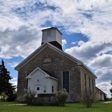
Pottawatomie County spans across a large area of Kansas and contains several communities including Westmoreland, Wamego, and St. Marys. The terrain features prairie and farmland alongside sections of Tuttle Creek Lake.

The county was established in 1857 as an administrative division and named after the Potawatomi people who originally inhabited the region. This naming honors the Native American presence that came before settlement.

Agriculture shapes daily life here, with farms and ranches scattered throughout the landscape where families have worked the land for generations. Local fairs bring people together to celebrate and share their farming heritage.

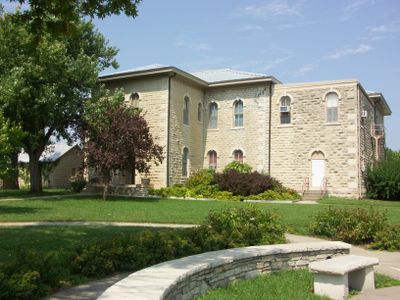
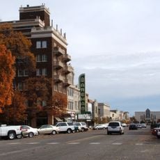
Visitors can find the administrative center in Westmoreland where various local services are handled. The multiple communities are accessible by road, and outdoor recreation areas near the lake are open to the public.

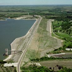
Sections of Tuttle Creek Lake within the county offer fishing and boating opportunities set against Flint Hills prairie. This water resource played a key role in the region's growth and recreational use.

Location: Kansas

Inception: February 20, 1857

Capital city: Westmoreland

Shares border with: Marshall County, Wabaunsee County, Nemaha County, Jackson County, Shawnee County, Riley County

Website: http://PottCounty.org

GPS coordinates: 39.33330,-96.30000

Latest update: December 7, 2025 19:29

Photos
Around this place
Bill Snyder Family Football Stadium
United States of America

Bill Snyder Family Football Stadium

29.2 km
Tuttle Creek Lake
United States of America

Tuttle Creek Lake

31.6 km
Johnny Kaw
United States of America

Johnny Kaw

29.1 km
World War I Memorial Stadium
United States of America

World War I Memorial Stadium

29.4 km
Beecher Bible and Rifle Church
United States of America

Beecher Bible and Rifle Church

21.4 km
Flint Hills Discovery Center
United States of America

Flint Hills Discovery Center

28.4 km
United States of America

Sunset Zoo

30.9 km
Hale Library
United States of America

Hale Library

28.9 km
United States of America

St. Mary's Mission

25.9 km
Oz Museum
United States of America

Oz Museum

14.6 km
Anderson Hall
United States of America

Anderson Hall

29.1 km
Seven Dolors Catholic Church
United States of America

Seven Dolors Catholic Church

28.7 km
Seaton Hall
United States of America

Seaton Hall

29.1 km
Pottawatomie Indian Pay Station
United States of America

Pottawatomie Indian Pay Station

25.9 km
Goodnow House
United States of America

Goodnow House

29.9 km
First Congregational Church
United States of America

First Congregational Church

28.6 km
Dickens Hall
United States of America

Dickens Hall

28.8 km
Manhattan Carnegie Library Building
United States of America

Manhattan Carnegie Library Building

28.6 km
Downtown Manhattan Historic District
United States of America

Downtown Manhattan Historic District

28.4 km
Jeremiah Platt House
United States of America

Jeremiah Platt House

29.5 km
E. A. and Ura Wharton House
United States of America

E. A. and Ura Wharton House

28.5 km
George and Virginia Trout House
United States of America

George and Virginia Trout House

14.4 km
Cassius & Adelia Baker House
United States of America

Cassius & Adelia Baker House

14.4 km
Bluemont Hall
United States of America

Bluemont Hall

28.9 km
Woman's Club House
United States of America

Woman's Club House

28.9 km
Cardwell Hall
United States of America

Cardwell Hall

28.9 km
John McKimmons Barn
United States of America

John McKimmons Barn

10.9 km
Houston and Pierre Streets Residential Historic District
United States of America

Houston and Pierre Streets Residential Historic District

28.8 km
Show the full map
Reviews

Visited this place? Tap the stars to rate it and share your experience / photos with the community! Try now! You can cancel it anytime.

Administrative divisions
« Pottawatomie County - County seat in northeast Kansas, United States » is provided by Around Us (aroundus.com). Images and texts are derived from Wikimedia project under a Creative Commons license. You are allowed to copy, distribute, and modify copies of this page, under the conditions set by the license, as long as this note is clearly visible.

Discover hidden gems everywhere you go!

From secret cafés to breathtaking viewpoints, skip the crowded tourist spots and find places that match your style. Our app makes it easy with voice search, smart filtering, route optimization, and insider tips from travelers worldwide. Download now for the complete mobile experience.

Around Us App Screenshot

A unique approach to discovering new places

Le Figaro

All the places worth exploring

France Info

A tailor-made excursion in just a few clicks

20 Minutes