Enable Location

We need your location to show you interesting places around you

Discover nearby places

Find interesting locations and hidden gems around you

Precise directions

Get accurate directions and distances to places

Your location is never shared with other users. It's only used when you tap the location button.

Jackson County

Log in to your account

Start exploring — it's free

Trusted by 61,506 travelers worldwide

Continue with Google
Continue with Apple
or

We will send you a code to connect

By continuing, you accept our Terms and Conditions and our Privacy Policy

Check your inbox

We've sent a pincode in your inbox. Please enter the code below.

Jackson County, Administrative county in Kansas, United States.

Description

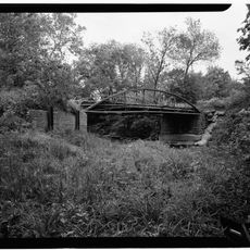
Jackson County is an administrative county in northeastern Kansas covering an area of approximately 658 square miles in a flat, rural landscape. The city of Holton serves as its administrative center and houses the primary government offices.

History

The county was founded in 1859 and renamed to honor President Andrew Jackson, having originally been called Calhoun County at its establishment. This change marked an important moment in the area's early development.

Culture

The Prairie Band Potawatomi Reservation occupies a substantial portion of the county and maintains Native American cultural traditions and ways of life in the region. Visitors can experience this community's presence through local gatherings and places that reflect the nation's heritage.

Practical

The Jackson County Courthouse in Holton is the main location for administrative matters including property records and licenses. Most government services operate during standard business hours, which visitors should plan accordingly.

Did you know?

The county is served by three separate school districts that each cover different areas and shape the local education system. This division reflects the geographic layout and settlement patterns across the region.

Location
Inception
February 11, 1859
Capital city
Holton
Shares border with
Nemaha County, Jefferson County, Shawnee County, Brown County, Atchison County, Pottawatomie County
GPS coordinates
39.40000,-95.83330
Latest update
December 10, 2025 15:54

AroundUs brings together thousands of curated places, local tips, and hidden gems, enriched daily by 60,000 contributors worldwide. Discover all places nearby (Kansas).

Around this place
Equality House
United States of America

Equality House

40.6 km
Cedar Crest
United States of America

Cedar Crest

37.9 km
United States of America

Prairie Band of Potawatomi Nation

6.6 km
Gage Park
United States of America

Gage Park

39.3 km
Topeka Zoo
United States of America

Topeka Zoo

39.3 km
Topeka & Shawnee County Public Library
United States of America

Topeka & Shawnee County Public Library

40.6 km
Kansas Museum of History
United States of America

Kansas Museum of History

38.6 km
Great Overland Station
United States of America

Great Overland Station

39.8 km
United States of America

St. Mary's Mission

30.4 km
Reinisch Rose Garden and Doran Rock Garden
United States of America

Reinisch Rose Garden and Doran Rock Garden

39.5 km
Constitution Hall
United States of America

Constitution Hall

40.9 km
Truckhenge
United States of America

Truckhenge

41.2 km
United States of America

Kanza Bowl

39.2 km
St. Joseph's Catholic Church
United States of America

St. Joseph's Catholic Church

40.6 km
Ward-Meade House
United States of America

Ward-Meade House

39.7 km
Church of the Assumption and Rectory
United States of America

Church of the Assumption and Rectory

41.1 km
Pottawatomie Indian Pay Station
United States of America

Pottawatomie Indian Pay Station

30.4 km
Pottawatomie Baptist Mission Building
United States of America

Pottawatomie Baptist Mission Building

38.6 km
Discovery Center of Kansas
United States of America

Discovery Center of Kansas

39.7 km
St. John's Lutheran School
United States of America

St. John's Lutheran School

40.7 km
St. John African Methodist Episcopal Church
United States of America

St. John African Methodist Episcopal Church

41 km
Hughes Conoco Service Station
United States of America

Hughes Conoco Service Station

40.4 km
McFadden House
United States of America

McFadden House

11 km
Holton Bath House
United States of America

Holton Bath House

10.7 km
United States of America

Lake Nemaha Dam Guardrail

44.2 km
North Topeka Baptist Church
United States of America

North Topeka Baptist Church

39.5 km
Crawford Building
United States of America

Crawford Building

41 km
Meriden Rock Creek Bridge
United States of America

Meriden Rock Creek Bridge

33.6 km
Show the full map
Administrative divisions
« Jackson County - Administrative county in Kansas, United States » is provided by Around Us (aroundus.com). Images and texts are derived from Wikimedia project under a Creative Commons license. You are allowed to copy, distribute, and modify copies of this page, under the conditions set by the license, as long as this note is clearly visible.

Discover hidden gems everywhere you go!

From secret cafés to breathtaking viewpoints, skip the crowded tourist spots and find places that match your style. Our app makes it easy with voice search, smart filtering, route optimization, and insider tips from travelers worldwide. Download now for the complete mobile experience.

Around Us App Screenshot

A unique approach to discovering new places

Le Figaro

All the places worth exploring

France Info

A tailor-made excursion in just a few clicks

20 Minutes

Around Us
Travel Guide & Maps
Download

Send to your phone

QR Code
1

Open the camera app on your mobile.

2

Point at the QR code with your camera. A notification will appear.

3

Tap the notification to open the link.