Medina County, Administrative division in northeastern Ohio, United States
Medina County is an administrative division in northeastern Ohio situated between Cleveland and Akron. It encompasses both developed communities and open areas with multiple parks throughout its territory.
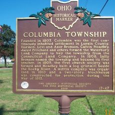
The territory was established as a county in 1812 following land acquisition and initially formed part of the Connecticut Western Reserve. This early settlement shaped the development of communities throughout the region.
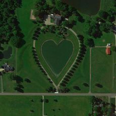
The Medina County Park District maintains over 6,000 acres of public spaces where residents participate in outdoor activities throughout all seasons.
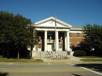
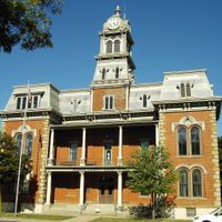
The county's main administrative center is located in Medina city, where residents and visitors can access various services. Public parks throughout the area are accessible year-round and provide free opportunities for outdoor recreation.
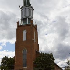
A religious experiment known as the Black River Colony emerged in 1852 as a community following German Baptist Brethren traditions. This settlement remains an important chapter in the region's ethnic and religious heritage.
Location: Ohio
Inception: 1812
Capital city: Medina
Shares border with: Ashland County, Lorain County, Cuyahoga County, Summit County, Wayne County
Website: http://co.medina.oh.us
GPS coordinates: 41.12000,-81.90000
Latest update: December 6, 2025 22:10
Mosher House
26.9 km
Northern Ohio Railway Museum
8.2 km
Akron Fossils & Science Center
21.9 km
Grand Pacific Junction
28.3 km
John and Maria Adams House
29.3 km
Gardenview Horticultural Park
22.2 km
John Wheeler House
26.8 km
Baldwin–Wallace College South Campus Historic District
27.9 km
St. Martin's Catholic Church
12.6 km
Old St. Patrick's Church
27.2 km
Ezekiel B. Zimmerman Octagon House
24.8 km
Burrell Memorial Observatory
28.7 km
Baldwin-Wallace College North Campus Historic District
28.6 km
Buehl House
27.7 km
United Church of Huntington
26.9 km
Carlos Avery House
28.6 km
Darlon Allen House
26.8 km
Huntington Grange
26.9 km
Walter F. Ehrnfelt Bridge
25.4 km
Olmsted Falls Depot and Model Railroad Museum
28.4 km
The Berea Triangle
27.7 km
Wordens Ledges
18.1 km
The Ark
29.1 km
West Salem City Hall
24.1 km
Woodvale Union Cemetery historical marker
27.4 km
Harding Memorial Bridge
28.7 km
Columbia Township
21.6 km
Baldwin University
28.5 kmVisited this place? Tap the stars to rate it and share your experience / photos with the community! Try now! You can cancel it anytime.
Discover hidden gems everywhere you go!
From secret cafés to breathtaking viewpoints, skip the crowded tourist spots and find places that match your style. Our app makes it easy with voice search, smart filtering, route optimization, and insider tips from travelers worldwide. Download now for the complete mobile experience.
A unique approach to discovering new places❞
— Le Figaro
All the places worth exploring❞
— France Info
A tailor-made excursion in just a few clicks❞
— 20 Minutes