Enable Location

We need your location to show you interesting places around you

Discover nearby places

Find interesting locations and hidden gems around you

Precise directions

Get accurate directions and distances to places

Your location is never shared with other users. It's only used when you tap the location button.

Jasper County

Log in to your account

Start exploring — it's free

Trusted by travelers worldwide

Continue with Google
Continue with Apple
or

We will send you a code to connect

By continuing, you accept our Terms and Conditions and our Privacy Policy

Check your inbox

We've sent a pincode in your inbox. Please enter the code below.

Jasper County, Administrative division in central Iowa, United States

Description

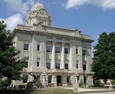
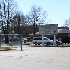
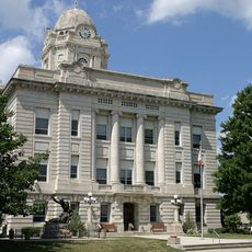
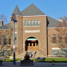
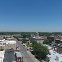
The area covers rolling farmland dotted with towns and villages, with Newton as its main administrative hub. A county courthouse in Newton houses the Board of Supervisors and serves as the focal point for government operations and public services.

History

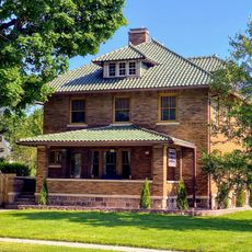
The area was established in 1846 shortly after Iowa joined the Union, receiving its name from Revolutionary War hero Sergeant William Jasper. Early settlement shaped how communities developed across this central Iowa region.

Culture

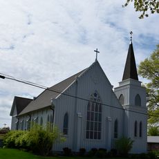
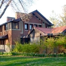
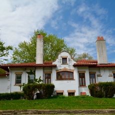
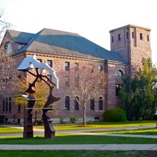
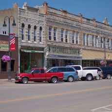
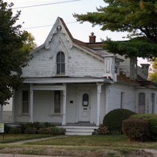
Community life centers on local gatherings and seasonal celebrations that bring neighbors together throughout the year. These events reflect how residents share traditions and maintain connections across the different towns within the county.

Practical

The county courthouse in Newton opens on weekdays for visitors interested in seeing the main government building and understanding local administration. Exploring the area works best by car since towns are spread across rural roads.

Did you know?

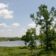
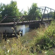
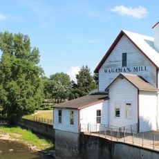
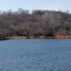
Two branches of the Skunk River cut through the landscape, creating diverse habitats for fish and wildlife that residents have relied on for generations. These waterways have become defining features that shape how people interact with the land.

Location
Inception
1846
Capital city
Newton
Shares border with
Marshall County, Marion County, Mahaska County, Poweshiek County, Tama County, Story County, Polk County
GPS coordinates
41.68806,-93.06139
Latest update
December 7, 2025 20:26

AroundUs brings together thousands of curated places, local tips, and hidden gems, enriched daily by 60,000 contributors worldwide. Discover all places nearby (Iowa).

Around this place
Iowa Speedway
United States of America

Iowa Speedway

4.1 km
Neal Smith National Wildlife Refuge
United States of America

Neal Smith National Wildlife Refuge

21.7 km
Merchants' National Bank
United States of America

Merchants' National Bank

28.6 km
Iowa Correctional Institution for Women
United States of America

Iowa Correctional Institution for Women

25.4 km
Rock Creek State Park
United States of America

Rock Creek State Park

19.4 km
Universalist Church
United States of America

Universalist Church

25 km
Ashton Observatory
United States of America

Ashton Observatory

23.4 km
St. Stephen's Episcopal Church
United States of America

St. Stephen's Episcopal Church

1.7 km
B.J. Ricker House
United States of America

B.J. Ricker House

29 km
Jasper County Courthouse
United States of America

Jasper County Courthouse

1.5 km
August H. Bergman House
United States of America

August H. Bergman House

1.8 km
Interior Telephone Company Building
United States of America

Interior Telephone Company Building

28.7 km
Goodnow Hall
United States of America

Goodnow Hall

29 km
Grinnell Historic Commercial District
United States of America

Grinnell Historic Commercial District

28.6 km
James Norman Hall House
United States of America

James Norman Hall House

14.8 km
First Avenue East Historic District
United States of America

First Avenue East Historic District

1.7 km
Stewart Library
United States of America

Stewart Library

28.7 km
Red Bridge
United States of America

Red Bridge

16.7 km
Bowers and McDonald Office Building
United States of America

Bowers and McDonald Office Building

28.6 km
Lynnville Mill and Dam
United States of America

Lynnville Mill and Dam

26.1 km
Farmers Mutual Reinsurance Company Building
United States of America

Farmers Mutual Reinsurance Company Building

28.7 km
Emerson Hough Elementary School
United States of America

Emerson Hough Elementary School

2.2 km
Thomas Arthur House
United States of America

Thomas Arthur House

2.3 km
Grinnell Herald Building
United States of America

Grinnell Herald Building

28.7 km
North Grinnell Historic District
United States of America

North Grinnell Historic District

29 km
Levi P. Grinnell House
United States of America

Levi P. Grinnell House

28.9 km
Christian Science Society
United States of America

Christian Science Society

28.3 km
Jacob Krumm Ahrens Access
United States of America

Jacob Krumm Ahrens Access

22.9 km
Show the full map
Administrative divisions
« Jasper County - Administrative division in central Iowa, United States » is provided by Around Us (aroundus.com). Images and texts are derived from Wikimedia project under a Creative Commons license. You are allowed to copy, distribute, and modify copies of this page, under the conditions set by the license, as long as this note is clearly visible.

Discover hidden gems everywhere you go!

From secret cafés to breathtaking viewpoints, skip the crowded tourist spots and find places that match your style. Our app makes it easy with voice search, smart filtering, route optimization, and insider tips from travelers worldwide. Download now for the complete mobile experience.

Around Us App Screenshot

A unique approach to discovering new places

Le Figaro

All the places worth exploring

France Info

A tailor-made excursion in just a few clicks

20 Minutes

Around Us
Travel Guide & Maps
Download

Send to your phone

QR Code
1

Open the camera app on your mobile.

2

Point at the QR code with your camera. A notification will appear.

3

Tap the notification to open the link.