Enable Location

We need your location to show you interesting places around you

Discover nearby places

Find interesting locations and hidden gems around you

Precise directions

Get accurate directions and distances to places

Your location is never shared with other users. It's only used when you tap the location button.

Bourbon County

Log in to your account

Start exploring — it's free

Trusted by 62,994 travelers worldwide

Continue with Google
Continue with Apple
or

We will send you a code to connect

By continuing, you accept our Terms and Conditions and our Privacy Policy

Check your inbox

We've sent a pincode in your inbox. Please enter the code below.

Discussion Reviews 1 Photos
37.7k Popularity

Bourbon County, Administrative county in Kentucky, United States

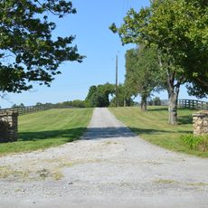
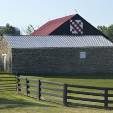
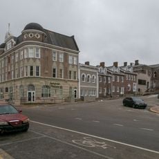
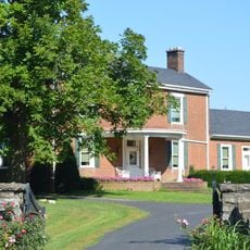
Bourbon County is an administrative county in Kentucky located within the Bluegrass Region, characterized by rolling terrain and fertile land devoted mainly to agricultural and equestrian pursuits. The county seat of Paris serves as the administrative center with courthouse and public services.

The county was established in 1786 from Fayette County and named after the French House of Bourbon to honor King Louis XVI's support during the American Revolution. The county seat's courthouse has been rebuilt twice after destructive fires in the 1800s.

The county remains deeply connected to thoroughbred horse breeding, with farms and training facilities woven into the landscape as a way of life. Equestrian traditions shape how people here spend their time and invest their resources.

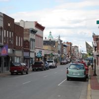
Visitors should head to Paris to find government offices, the courthouse, and local services concentrated in the county seat. The surrounding rural areas spread across rolling landscapes and are best explored by car.

Early distillers shipped whiskey barrels marked 'Old Bourbon' from local ports, a practice that helped shape the eventual bourbon industry. The county's role in whiskey production became so linked to its name that bourbon itself became the spirit's defining brand.

The community of curious travelers

AroundUs brings together thousands of curated places, local tips, and hidden gems, enriched daily by 60,000 contributors worldwide.

Start exploring
Location
Inception
1786
Capital city
Paris
Shares border with
Harrison County, Nicholas County, Bath County, Montgomery County, Clark County, Fayette County, Scott County
GPS coordinates
38.20000,-84.21000
Latest update
December 17, 2025 10:09
Around this place
Paris Cemetery
United States of America

Paris Cemetery

4.8 km
The Grange
United States of America

The Grange

6.1 km
Colville Covered Bridge
United States of America

Colville Covered Bridge

13.9 km
United States of America

Oakwood Estate

16.2 km
Mound Hill Archaeological Site
United States of America

Mound Hill Archaeological Site

13.3 km
Forest Retreat
United States of America

Forest Retreat

19.8 km
Owen-Gay Farm
United States of America

Owen-Gay Farm

13.3 km
United States of America

Bourbon County Courthouse

3.8 km
Walker Buckner House
United States of America

Walker Buckner House

6.8 km
United States of America

Cooper's Run Baptist Church

8.2 km
United States of America

Stoner Creek Rural Historic District

4.4 km
Snow Hill
United States of America

Snow Hill

13.5 km
United States of America

John Lair House

17.1 km
Stone Barn on Brushy Creek
United States of America

Stone Barn on Brushy Creek

19.1 km
Paris Courthouse Square Historic District
United States of America

Paris Courthouse Square Historic District

3.8 km
United States of America

Dr. Henry Clay House

7.1 km
United States of America

Kimbrough-Hehr House

19.5 km
United States of America

Thomas Kennedy House

3.9 km
United States of America

John Hinkson House

18.1 km
William Mathers House
United States of America

William Mathers House

19.2 km
United States of America

Buenna Hill

17.3 km
Erasmus Riggs House
United States of America

Erasmus Riggs House

15.5 km
Thomas A. Dorsey Farmhouse
United States of America

Thomas A. Dorsey Farmhouse

20.5 km
McKee-Vimont Row Houses
United States of America

McKee-Vimont Row Houses

12.2 km
Covered Bridge over the South Fork of Licking River
United States of America

Covered Bridge over the South Fork of Licking River

22.3 km
United States of America

Stoner Creek

3.2 km
United States of America

Houston Oaks Golf Course

8 km
United States of America

County Quad Point

20.3 km
Show the full map
Reviews
Share your experience

No review yet

Discussions
Start a discussion...

No discussion yet

Administrative divisions
« Bourbon County - Administrative county in Kentucky, United States » is provided by Around Us (aroundus.com). Images and texts are derived from Wikimedia project under a Creative Commons license. You are allowed to copy, distribute, and modify copies of this page, under the conditions set by the license, as long as this note is clearly visible.

Discover hidden gems everywhere you go!

From secret cafés to breathtaking viewpoints, skip the crowded tourist spots and find places that match your style. Our app makes it easy with voice search, smart filtering, route optimization, and insider tips from travelers worldwide. Download now for the complete mobile experience.

Around Us App Screenshot

A unique approach to discovering new places

Le Figaro

All the places worth exploring

France Info

A tailor-made excursion in just a few clicks

20 Minutes

Around Us
Travel Guide & Maps
Download

Send to your phone

QR Code
1

Open the camera app on your mobile.

2

Point at the QR code with your camera. A notification will appear.

3

Tap the notification to open the link.